Here is the chronicle of a road trip taken by Andrew, Luc, Caroline, Ewart, Peter and myself in the summer of 2003. The trip was, as always, capably organized by Andrew. Usually we fly to the destination area and then rent vehicles. This time we set out directly from Ottawa, in a rental van and my car. I agreed to this because I wanted, finally, to experience the vast size of this continent by driving a good deal of the way across it.
This is my perspective on the whole thing. You can also read Andrew's writeup.
The drive goes well - 600km in one sitting with no gas or bathroom stops - except that the air conditioning fails in my car. I assume I can get it fixed under warranty in the Soo tomorrow, but at the expense of my "slack day" at the camp. It does ruin my enjoyment of my freshly washed and serviced car a bit, I mean this was supposed to be reliable, that's why we took it!
Apart from that there are no issues, and we get to the camp at 8:30pm, with a total trip time of 8:15h for 720km.
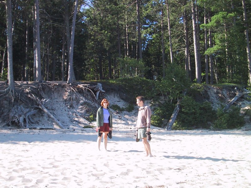
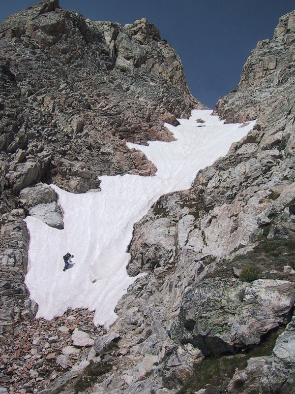
In the evening, I quickly go up the cliff with Luc, to show him the crack that I hurt myself falling out of two years ago. He climbs it with no difficulty, in sandals, and rates it as maybe a 5.6 or so. Well, I have climbed it before, I just can't do it reliably (and after hurting myself I'm not so courageous about it any more).
I make some phone calls to Acura's 24 hour customer service hotline. They say there is no Acura dealer in the Soo, and they don't know if a Honda dealer will fix it. Best to call in the morning.
Soon the north wind picks up and becomes very stiff with whitecaps on the waves right up to the beach. Kurt gives up trying to keep the boat on the lake under these conditions and comes in.
After the car dealerships open in the Soo, I telephone the Honda dealer, and then the Acura customer service hotline. It turns out that no one in the Soo can help me before Saturday, and no Acura dealer in the States would fix my air conditioning under warranty - only stuff that would prevent me from continuing the trip altogether would be covered this way. So we're screwed. The customer service lady calls back later and it is concluded that maybe in Calgary -- thousands of kilometres of sun-parched highway from here. I worry now that I'll be driving all by my lonesome, with the windows open, while everyone else is in the van ahead.
It is time to butcher the two fish from yesterday. Barbara is an expert at this, and shows the kids how it's done. "This is the gall bladder, don't stab that because the whole fish will taste bad if you break it" and so on.
|
|
|
Luc on the slackline
|
Later I help Luc find the paddles for the canoe and he goes off on the lake, where the wind has calmed down again, whereas Matthias and I eat some lunch and then take Barbara and the two older kids -- Tamara, age 3 and Sam, age 5 - up the cliff on the steep way up the front. Sam has no trouble and does almost all of it unassisted (while I hover close behind just in case) and Barbara and Matthias take care of Tamara.
Up at the viewpoint, we want to wave to Kurt, but our shouts -- and a telephone call from Matthias's RIM device -- produce no results and of course I've forgotten the walkie talkies. So I dash down again and find Kurt upstairs in the guest house watching over the sleeping baby. I take over the watch for a moment, while he goes out and does the wave and shout thing. I then go out and take many tries at getting a picture of the others up there through binoculars. A couple of them come out reasonably well.
I try a swim in the lake. It seems cold at first, but it's actually a comfortable temperature for swimming (barely). However I don't swim very far because the waves are a bit too big for my taste -- I'm not a very strong swimmer.
I help Kurt and Barbara and family set up the old raccoon trap that Matthias built 22 years ago and that still rests, in fully functional condition, in the back of the shed. We bait it with a fish head left over from the morning.
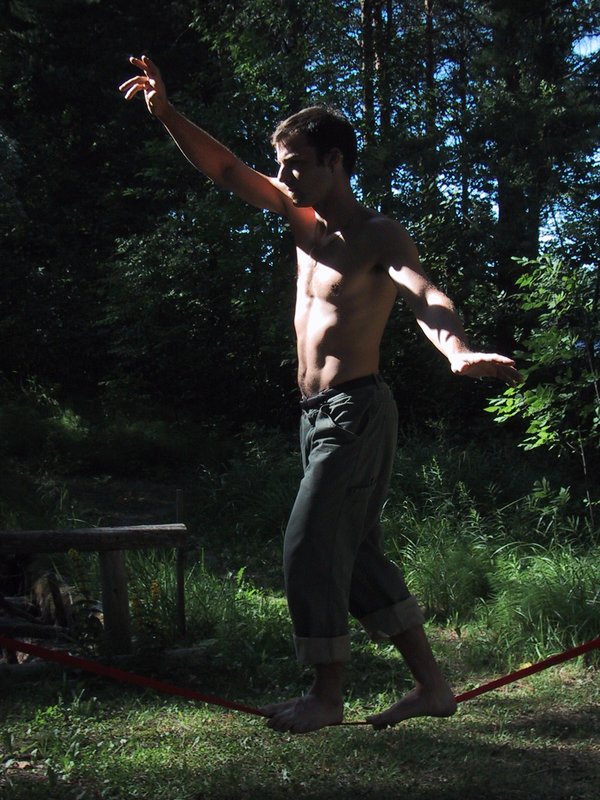
Luc spends a lot of time sleeping and reading - he doesn't feel up to climbing on the cliff today. Eventually he sets up a longer slackline down by the lake, where the whole camp can see. It doesn't take long before an audience gathers. "Are you in the circus?" is the first question. One lady in particular is very taken with Luc's "rippling abs" (true) and wants him to teach her. She doesn't try very hard though.
I am sitting by and taking more pictures - there's bound to be some good ones eventually - until Luc packs it in. Soon after we go back up to the cottage, at about 8:45pm, Andrew and the others arrive. The van is a Dodge Caravan. Hmmm. Maybe he should have asked for a Caravan, with the Pontiac as second choice, and then he'd have gotten the Odyssey? At least I have never gotten the vehicle I asked for, even when given the choice at the time I reserved.

|
|
Ewart on the cliff
|
Ewart says he snores, so we encourage him to set up his tent outside. I sleep passably well for the first few hours, then not so well.
|
|
Dinner
|
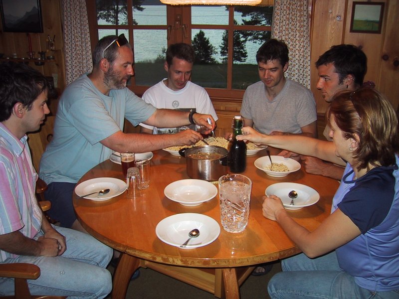
By the time we reach our destination, we have been on the road for near on 9 hours, so a nice hot meal in charming company, not to mention being surrounded by the beautiful interior woodwork of the log cabin, is much appreciated. After supper, we all promptly retire for the night - we will be getting up very early, and there is much driving to be done.
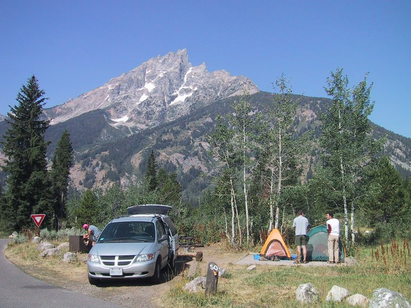
Peter: Starting out in Ottawa at noon time we headed for our first road stop at Amogla camp owned by Markus's parents. Along the way we passed through Sudbury and snapped some shots of the Giant Nickel. The Amogla camp area itself was beautiful, on the shores of a lake not far from the Sault Ste Marie border crossing. There was a nice little cliff to scramble up and the house itself was amazing inside. The work of a master wood worker, the entire interior was beautifully done in wood, right down to the door latches and hinges.
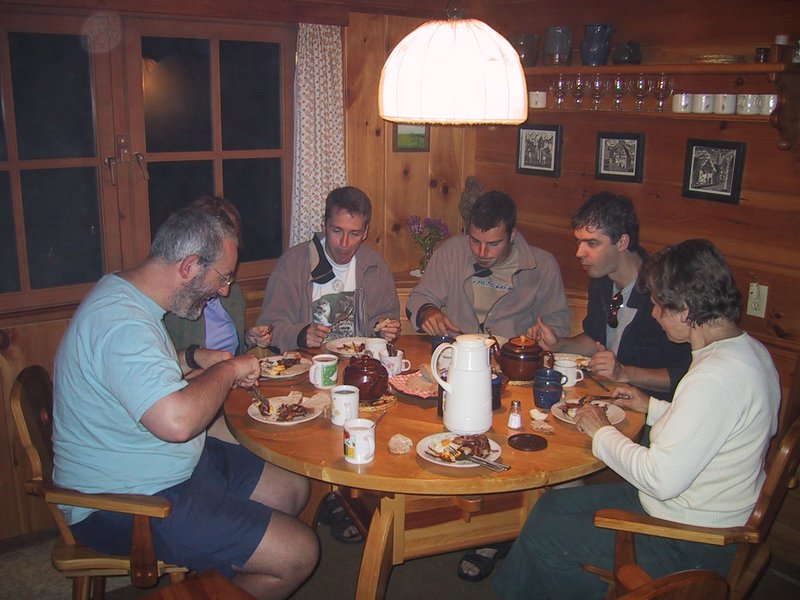
As I'm standing downstairs waiting for my turn in the shower, I look at the clock and it slowly registers - it says 3:50. What's happening here? Ooops! A "convenient" oversight. Gradually everyone is roused and showered, and mom gets up too and starts making breakfast - with bacon and eggs! for us. Even Barbara shows up to say hello to everyone.
|
|
Predawn breakfast
|
I unwind by driving very fast on the curvy Gordon Lake Road. Ewart, who is riding with me, is not worried, and Andrew with the others in the minivan is keeping up effortlessly. By the time we're on the 638, I've already had my fill of speeding and reasonable driving resumes. When we get to highway 17, Andrew takes the lead in the van.
The others remark on the "big loonie" sculpture by the highway -- just yesterday they stopped by the big nickel in Sudbury to take pictures. I explain that it is here because the loon design on the coin was done by an artist who lives right here in Dunns Valley, which we just drove through.
Ewart is riding with me so the two non-Canadian Citizens are in the same car. A non-citizen often triggers a request for everyone's papers at the border, and Luc, in his travels, has been to "the whole Axis of Evil" (in his words - primarily Iran and Afghanistan) and if they check his passport they might give everyone trouble. It's to no avail, I see everyone's papers being handed over anyway. It takes several minutes for the van to be cleared. Ewart's and my papers are in order - meaning our I94Ws are current - so we get through with no trouble.
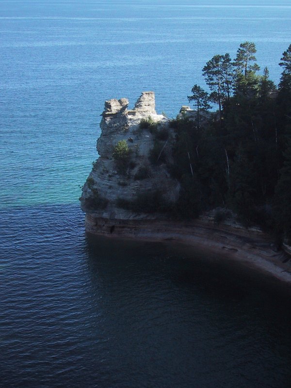
After an all too brief interval of speeding down a smooth freeway, we turn off to take a bit of a tour of the south shore of Lake Superior, which Marlene recommended most strenuously. It takes a long time before we turn north onto a highway that follows the shore, but we are foiled! A detour sign directs us onto a dirt road. And down this dirt road we speed, for 40 kilometres or so, which seems absolutely endless when you're in the rear vehicle without map or navigator. The road is bumpy, full of rocks, and is being graded so often there are big ridges of sand running along it. Just as I'm despairing of it (I'm thinking of taking a picture of these conditions to caption "the great drive out west") we finally get on pavement again and on we go, with no lake in sight.
|
|
Miner's Castle
|
|
|
Caroline and Peter on Miner's Beach
|
After we leave this area, the drive is unremarkable other than being a good impression of life before Interstate highways. We need to get west to Duluth, MN and that's hundreds of kilometres away as the crow flies and it's all non-freeway travel. It varies from relatively empty two-lanes where we easily make 120km/h to urban corridor where one town, with its fast food joints, gas stations and car dealerships, seems to abut the next.
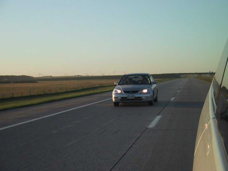
We eventually end up on a quiet two-lane road with virtually no traffic and manage a very good speed on it. Eventually we join Highway 2 at a town called Wakefield. After we fill up on Kentucky Fried Chicken and pizza, a car shuffle is done, and I am assigned to drive the van. Ewart takes the lead in my car. This is not a good arrangement. Traffic on the highway is very heavy and generally moving at 90km/h (the speed limit). Ewart muscles his way ahead using the adequate passing power of my car, whereas I'm driving this minivan which seems to float through the scenery, with steering, accelerator and brake input just applying a general bias to where it floats. I can't believe Andrew can make it keep up with my car when I drive it at the hardest, but such is the difference in our skill levels. I get very stressed and cranky, as Luc attempts to feed jazz music into the car's stereo using a little radio transmitter we have brought, but the tuning continually drifts so it's mostly hiss, plus I'm trying to eat pizza, plus I'm trying to keep up with Ewart's passing maneuvers and I'm getting ribbed about it all by everyone.
Fortunately Luc gives up on the music, the food is eaten and a quieter stretch of highway reached. Also I'm introduced to what remains of Caroline's unbelievably good white chocolate fudge! I am shameless and eat up most of what's left. Yum-my! This after Andrew and I already demolished a good portion of her equally delicious hard toffee.
After a long drive, we reach Duluth. This is the western end of the Great Lakes system and thus has extensive harbour and rail facilities. We find a scenic overlook on a hillside and take in the panorama.
Andrew now drives, and we head south on Interstate 35 at a good clip. We get off soon, to go diagonally across country to I94 on country roads. These aren't too bad. Stopped for gas and munchies, we go into a Radio Shack to see about a cassette adapter to better feed audio from the laptop computer into the van's stereo. Instead we find a better radio transmitter gadget! This one has fixed frequencies instead of analog tuning, and thus doesn't drift, and works perfectly. I immediately go in and buy a second one to keep for myself, as I'm not sure the Canadian Radio Shack would have them (I later check, and they don't).
Regaled by a recorded CBC Ideas episode about famous impostors, we motor on. The idea is to go northwest on I94 and then west, eventually to cross country south to I90. But seeing how slowly the little arrow creeps along the interstate when zoomed out, we change our minds, and head off cross-country again -- incidentally at exactly the bearing toward Yellowstone National Park (253 degrees) until we intersect I29 which goes south to I90.
We stop at the edge of a flat river valley but not for long, as we get attacked with such ferocity by mosquitoes that I immediately understand what it is the Winnipegers always talk about.
Ewart and Caroline are in my car, and happy to continue driving it even though its air conditioning has conked out again and it is quite hot.
|
|
Speeding down I29
|
The land is obviously all farmed, with lots of corn, some grazing and some haying. But you can go for 10 minutes or more at freeway speed and not see a building. This is big country. I still can't believe this perfect, smooth, quiet concrete freeway (it doesn't even have bumps between sections of concrete) - we're just gliding along at a great (and legal) speed and we can see (once we go up a sort of escarpment to a higher level of land) as far as the haze allows over flat country. There's no point trying to get this in a picture though. Luc, having put up with CBC Ideas, and two CDs from Peter (one Peter Gabriel, and one Led Zeppelin) now plays some jazz, but picks some that even Peter and I find quite relaxing and listenable so there is harmony in the car. Especially since we stopped at a store and stocked up on chocolate milk and edibles.
|
|
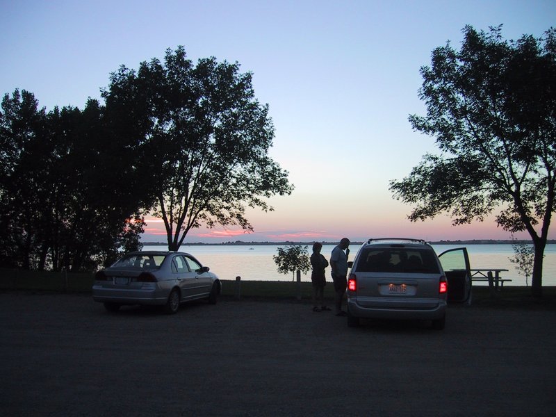
Looking for camping
|
The spot is quite nice, on the edge of the lake. After we set up, I go for a short swim, and the water temperature is wonderful.
My trip odometer shows 40,114km, so in a day and a half of driving we have covered 2,113km. Not bad really. Tomorrow we should reach the first of our actual trip destinations.
I've half convinced him to give us an extra half hour, but then Ewart's alarm goes off and we're up.
Luc: Bloody mosquitoes!!
We make a fairly good pack-up and getaway, and it starts to get light about the time we're getting gas and drinkables at the Cowboy Convenience Store out on the main street.
|
|
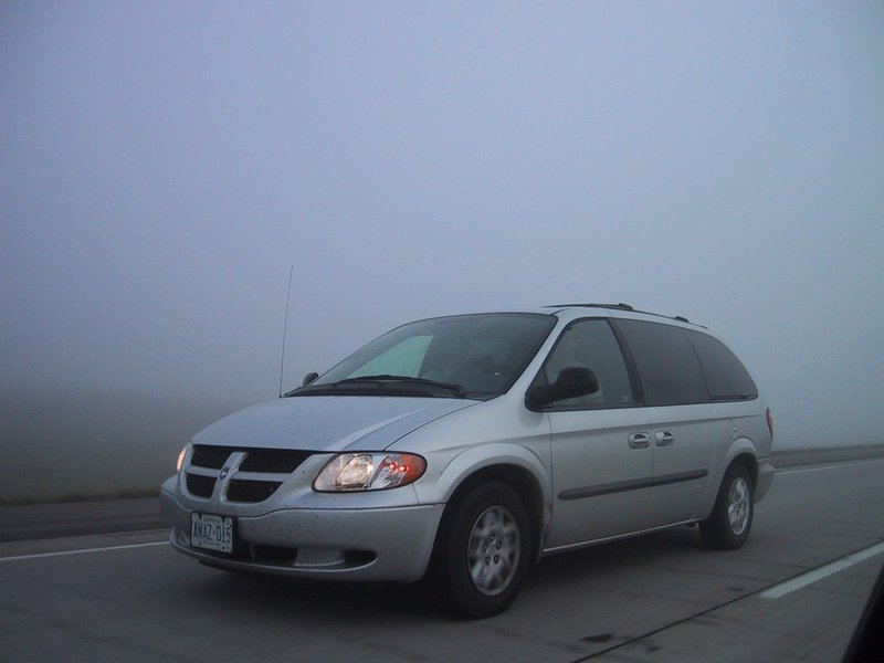
Driving in the fog on I29
|
Luc: Thousand clicks to go, McDonald's not going down so smoothly. Bloody fog!!
We reach the Missouri River, which is wide and stately, crossed by a very nice railway bridge and the twin strips of concrete of the interstate. Its valley marks an abrupt change in the landscape - you drive off a fairly flat plateau on one side, and then emerge into rolling hills on the other. We do not get a picture of this, unfortunately. At this point the trees also mostly vanish - the rolling hills are covered with just grass as far as the eye can see.
The rolling hills eventually become less pronounced, so you can see for maybe 10-20km in most directions. We drive and drive. The trip odometer indicates 400, 500, 600 kilometres since the morning's fillup and we are buzzing along at a steady 135-140km/h (almost legal, as the speed limit is 75mph) and the landscape changes little if at all, and you look at the navigation screen on the laptop, zoomed out to continent scale, and my God, how little of the way "across" we've gone. The freeway goes ever on, often arrow straight, like a gleaming twin ribbon laid down over the rolling landscape, heading always exactly West, 270 degrees. No police, no towns, no forests, no lakes, just the occasional homestead with its electrical power line coming in from somewhere far, far away.
Luc: "Help manage wildlife, wear fur!!" (billboard, South Dakota)
The air conditioning in my car seems dead for good. The outside temperature climbs to a desert-like 35°C (estimated). We (Luc and I) blast along the freeway, sweating, with the windows partly open. When radio communications are required the alert signal is needed so I can hold the radio to my ear to listen.
|
|
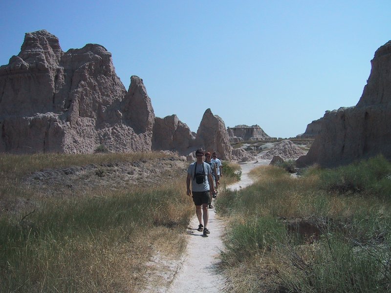
On the Trail in Badlands
|
We stop for gas, then soon enter Badlands National Park. Technically, Badlands are a particular type of clay formation; you can also find them in Death Valley and in Alberta. We go for a short walk. The heat is stupefying. Luc, who has the upper body for it, goes shirtless with his t-shirt wrapped around his head as a bandanna. Ewart says he looks like a proper Arab (that's Ay-Rab). All this reminds me exactly of wandering around in the Golden Canyon area of Death Valley.
We return to the hot car, put all the windows down and go for the scenic loop through the park. The heat actually becomes manageable this way, plus Luc puts on some electronic music that I've never heard before and really like, and which goes quite well with the heat and the parched but spectacular scenery all around.
At another stop, Andrew summarily moves us to the van, and takes over the car with Caroline. I aim all available air conditioner nozzles at myself, full blast, and bask in the cold. Later we exchange electronic gear so we can get fully settled in, and I can work on the log. To my considerable disappointment, we skip Wall Drug after seeing at least a hundred imaginative billboards for it over the last several hundred kilometres. Ewart drives, continuing west on I90. A hazy blue ridge appears on the horizon. We are informed that these are the Black Hills, home of Mount Rushmore, which is our next stop.
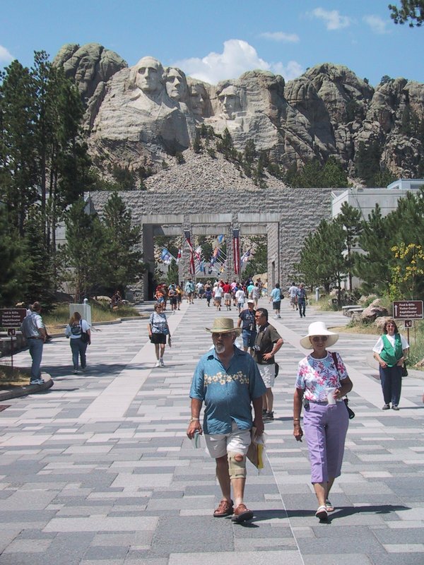
We drive through Rapid City and emerge on Mt. Rushmore Road. Gee, I wonder where that goes? A four-lane divided highway heads into the hills. There are crystal caverns, museums, hotels with the best view of the faces, authentic gold mine experiences and KOA campgrounds everywhere. The clutter gets thicker and thicker until it abruptly stops at the park boundary, where there are still two miles to go to ground zero. A Humvee labours past, towing a camper and a plume of black smoke. All the world seems to be pouring into this place (actually, the highway continues past it).
We stop a few times where the famous faces are visible over the trees. I had envisioned them as large, in the sense that they occupy most of the height of a small mountain. Well large they may be, but relative to the pinnacle into which they are carved, they are small, only perhaps the top 10% of the height. As a result they look small. Somehow they always seem to miss this fact in the postcard views.
|
|
Tourists at the foot of Mount Rushmore
|
I am let out and dash around, snapping off pictures where I can. On the way out, we stop a few more times and photograph such angles as we can get. Andrew assures me that this is as good as it gets, and a view of a poster later confirms it, so we haven't missed anything (like for example hiking to the top of a pinnacle for a better view or something like that, not allowed anyway).
We stop in the tourist clutter of "Hill City" on the way out and indulge ourselves at Dairy Queen (Peter only after finding the tablets for his lactose intolerance). A conference is held on what we should do now, should we do a similar touch-and-go at Devil's Tower (our next stop) or skip it altogether? We are running late, and still many hundreds of kilometres from Jelly- oh, make that Yellowstone National Park (the tourist clutter on the way in included a motel/campground named Jellystone Park).
After another glitch (a fried FRS radio) we reestablish communications between the cars, and thread our way onward through the Black Hills (on an ordinary two-lane road now). The hills are very nice, although mostly unviewed by me as I am typing this log on my lap.
We go down a long, engine-braking descent of at least 2000 feet, threading our way downward through hills that are not nearly as high as that (meaning we are passing from higher hills through lower ones). In a hollow at the bottom is the town of Deadwood, apparently connected to "Wild Bill" Hickock or something like that (billboards all over South Dakota). Certainly it seems to get enough tourist traffic. We just drive through.
Soon after that we rejoin I90 and continue westward until it is time to go on the backroads to Devil's Tower. Ewart and I are now the designated crew for the sweatmobile. Somehow I've been relegated to the passenger role, Ewart quite enjoying driving my vehicle and saying so. I do a coup d'etat and regain the driver's seat after a photo stop when the tower first comes into spectacular view complete with many square miles of surrounding cow country. Speaking of cow country, this part of Wyoming is just lovely, rolling grassy hills with stands of trees, rustic barns and fences, you name it. And, we drove by Sundance, you remember of course Butch Cassidy and the Sundance Kid, as well as the Sundance Film festival (though Andrew tells me that is held in Park City, Utah).
|
|
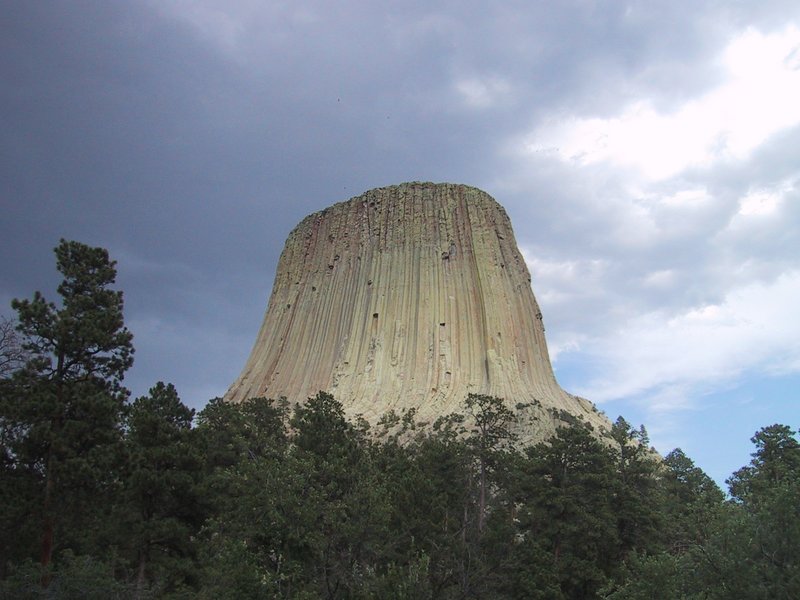
Devil's Tower
|
Everyone's seen pictures of Devil's Tower, but it's still pretty spectacular up close. We arrive in the parking lot at the base. We stare at the structure towering over the trees, take a couple of snaps and... time to leave. What? We just got here! We detoured for probably at least an hour and now we're going to stand here for five minutes next to the idling tour bus and do the idiot tourist thing and leave? I make a minor scene. It doesn't look like I convince anyone, but while I'm in the washroom a plan is apparently hatched and, OK, we will do the 2km paved loop trail around the thing. A thunderstorm is coming in, with the sharp uptake of wind that usually precedes the first few droplets of the deluge. But Andrew casts an expert eye at the clouds and prophesies that we'll definitely miss the worst of it because it's on the way through with clear blue sky behind. To be safe, we all grab our waterproof jackets.
Off we march. Andrew's weather prediction is correct. The trail and the views from it are beautiful. We watch some climbers climbing. I do have to pay for every photo stop with a run as I catch up to the others who just keep walking.
The trail goes along the bottom of a talus slope on one side, further into the woods on another, and along the "base wall" of the tower elsewhere. It passes by a broken-off chunk of column lying in the trees. The chunk is huge, probably 5m in diameter. Considering how small the columns look, you get the idea how big this spire is. I photograph a famously broken but not fallen column through a telescope that is provided trailside for watching the climbers (no climber activity visible from this angle, other than one guy belaying his buddy).
|
|
Sunset over I90 approaching Sheridan, WY
|
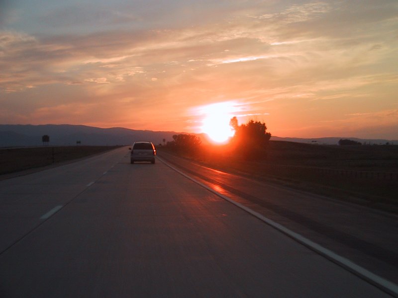
Later, as we continue west on I90, the sun sets over a high hazy ridge on the horizon - the Big Horn Mountains. We have arrived at the Rockies.
Because of the scenic stuff we did today, going all the way to Cody, WY is not practical. So we find a motel instead in Sheridan, which is several hundred kilometres short. This does mean getting up early again tomorrow.
I effect a vehicular rearrangement: Andrew gets to drive my car, with me as passenger -- Luc also comes along -- so that Andrew can use its modest performance to have some fun ahead, because we're going straight over those Big Horn Mountains we saw yesterday, a climb and descent of about 4500 feet vertical.
On the high plateau on top, we are stopped by first a herd of cows, then a very large one of sheep crossing the road. Funny, no yellow diamond "cow crossing" sign to be seen anywhere. I'm always joking about the crazy places you see those signs, like at the edge of a cliff on California's coast highway or in the middle of the most parched desert (honestly). Maybe this is some sort of inside joke by the road authorities.
The descent is very mountainous, with sharp switchbacks and rugged scenery. After some very spirited driving, we want to make a photo stop, but the intense smell of the front brakes convinces Andrew not to do it -- you can warp brake rotors by just stopping when they are this hot due to uneven cooling. The brake pedal also pulsates slightly. After taking it much easier for a while, all returns to normal.
Now we are cruising gently and levelly through a basin of some sort, elevation about 4000ft. We have another mountain range (the Absaroka Range) to cross eventually before we reach Yellowstone.
|
|
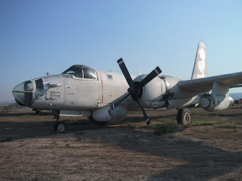
Old Aircraft
|
The basin expands. I understand about "Big Sky Country" even though this is not Montana - the highway converges to a dot in the distance, the ground is flat, though rising toward hills in the distance on either side. Andrew is driving at 160-180km/h on the perfect highway, slowing go a civilized 140km/h or so when other traffic is near. Hard to believe this vast flat openness is enclosed by mountains on virtually all sides.
After many miles we arrive in Cody WY, doubtless to do with "Buffalo Bill" Cody, since there is a Buffalo Bill Dam and many other Buffalo Bill things. We grab a drive-through McBreakfast here.
Ewart: This is the first time I have ever been through a MacDonalds, or MacMuckYucks as I prefer to call it, drive-thru. I refuse to order anything from this establishment myself, but take the orders for the others in the van. I have real difficulty understanding Caroline's pronunciation of "hash browns", with her heavy French accent, and not having heard of "hash browns" before/not being familiar with MacTalk. After 3 unsuccessful attempts at trying to understand what she wants, we mutually decide that it is probably better for Caroline to place the order herself. The MacGal on the other end of the microphone is a few slices short of a loaf. As Caroline speaks "Sausage and egg MacMuffin with cheese, and hash browns" into the microphone, she is asked whether she wants cheese, and to repeat the last portion of her order. At this point, Peter and I are in laughter. On repeating, Caroline is not sure that she has included the "hash browns" as the price for the order has not changed. We drive through to the hatch to pick up the order, at which point the MacGal asks her to repeat the last part of her order again. So I am not the only one that does not understand Caroline's MacParlez. I begrudgingly accept the brown bag through the hatch, and pass on to the occupants to consume.
The road goes up into a pass and threads its way gently through a mountain valley next to a wide river. It is very beautiful here, and still the highway is very suitable for fast, efficient driving. This is definitely a good place to drive.
We reach the Yellowstone National Park entrance. Our drive out west is officially complete! We will of course go further west later. Fairly heavy traffic at this point, slow campers and RVs. Many people stop at the Yellowstone sign to take each others' pictures in front of it.
We gain admission. Inside the park the road again rises, quite spectacularly hugging mountainsides in places. We reach Yellowstone Lake. It is vast, and blue, and glittering, and has snow-capped mountains on the far side. We do not stop to gaze though, as our focus is on getting to the area where we want to go hiking. We need a permit. The first ranger station we go to is closed, so we go to another at a marina. The odometer shows that my car has driven 3,774 kilometres since the Nortel parking lot back home in Ottawa.
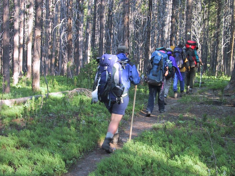
It turns out that to get the backcountry permit, the whole group must watch a "how to" video on preserving nature and not getting hurt by bears. We watch it intently, then we go out and get our packs ready right there in the sun-baked parking lot.
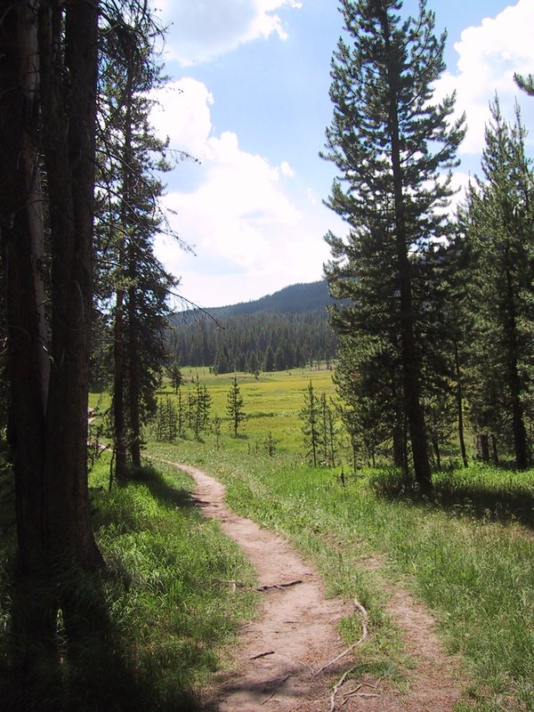
Peter: We plan a backpack into Yellowstone, but before we can get started we have to watch the bear video. Bears are a serious issue in yellowstone. So are mosquitoes we soon discover. The trail in is smooth and picturesque, but the mosquitoes are unrelenting. Many pictures will show people in Gortex jackets, even though it is warm and dry.
|
|
Typical scenery on the hike in
|
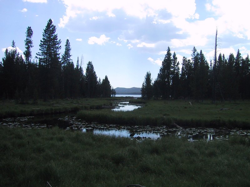
The hike in to Shoshone Lake takes us through a wide, flat valley with lush swamp grass and a creek meandering down the middle. With forested hillsides bracketing it and the lake in the distance, it is very pretty.
|
|
Approaching Shoshone Lake
|
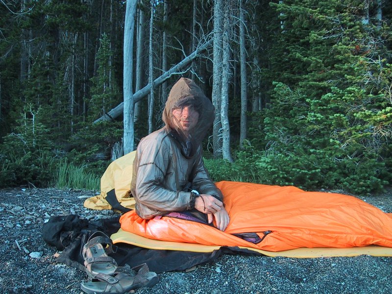
The mosquito density increases and we all apply bug repellent. But even with that, it is best to keep walking, surrounded even then by a cloud of mosquitoes. If you stop, they start biting immediately, through t-shirt and even rad pants. I am not wearing enough bug repellent, and with Andrew's constant assurances that the hike is almost done, I figure I'll just slog it through to the end, where I will go into the water anyway. But the hike drags on and on, and we have to stop frequently to keep the group together, and eventually the bugs get to me so much that I explosively empty the top pocket of my pack (wallet, passport, car keys, snacks scattered all over) to get to the bug repellent as the mosquitoes are even biting the hands doing the digging. Finally, liberal quantities of the blessed 95% pure Muskol and relief. On we march, as ever banging sticks together and making other noise, as instructed to avoid surprising any bears.
After many small uphills and downhills, accompanied by much hard breathing since none of us are acclimatized to the 8200ft elevation, we finally reach the blessed camp site. It is very nice. The waves lap the shore, a nice breeze comes in off the lake and keeps the bugs under control as long as you stay close to the water's edge. Everyone goes for a dip. I have a problem: I desperately need to get caught up on sleep tonight, and no level tent sites are to be found. Andrew wants to camp on the beach (and

|
|
Camping on the beach
|
|
|
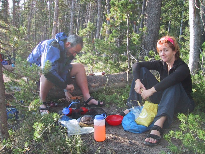
Ewart and Caroline cooking
|
Ewart: Ewart jokingly suggests to Andrew that he document his proposed design in a DD (Detailed Design) document, and have it reviewed prior to implementation. Andrew decides to over-ride due process.
|
|
Luc preparing to brave the mosquitoes without a tent (he changed his mind) |
Ewart, as ever in shorts, has waded into the lake until the waters cover his bare legs, and is grimly enjoying killing mosquitoes that land on the remaining exposed flesh.
Ewart: There are very few things more satisfying in this world than being in a zipped-up tent, hearing literally hundreds of mosquitoes outside trying to find a way in and knowing that they cannot, and through one's actions earlier on knowing that many of them have lost relatives! They will of course try and take revenge in the morning, but that is still many hours of sound sleep away.
Finally, bedtime. I am so tired, the very act of stretching out on my air mattress is a pleasure.
Alas, sleep does not come easily and I just can't get fully comfortable and wake up several times in the night. By morning, my objective of catching up on lost sleep is not achieved, in fact I think I'm further in the hole now.
Peter: We eat our meals and set up camp for the night. Somewhere during the night I discover my food had too much lactose in it. So I creep into the night lit by my bluish LED headlamp in a very "blair witch" like setting. My imagination is running wild with all the bear info that we had recently, as I creep around looking for the pit toilet. I was WIDE awake with adrenaline, but saw no bears, just more damn mosquitoes as I wandered about in my search.
|
|
Hiking to Shoshone Geyser Basin
|
We reach the geothermal area. There are pools of boiling water, burbling geysers ringed by solidified mineral matter, steaming holes in the ground and so on. The smell of hydrogen sulfide wafts everywhere. A structure that at first looks like an extinct geyser comes to life,
|
|
Backcountry geyser
|
Without even leaving the smelly area, we sit down and have food and drink, since it is plain that this hike is turning out longer than expected. Then we march off on the 6.3 mile leg to the Lone Star Geyser. After a few uphills, I run out of energy and fall behind. I settle into a slow, manageable pace. The others periodically wait up. I ask to be relieved of some weight, and Peter takes my tent and Andrew takes my air mattress, which he wears on his head. At a later break I eat a salty pepperoni and drink more water, and this actually helps, I feel better, and can keep up with the group again.
The scenery is pretty. Coniferous trees in green grassy meadows. Meandering rivers of crystal clear water. Swamp flowers. Open glades with campsites (unoccupied, one guesses because of the heat and the bugs). I remark that every time I tell someone how awesome Yosemite is, they immediately come back with "but have you seen Yellowstone?" Well now I have, and it sure is pretty, but Yosemite is that plus spectacular as well. Andrew says I haven't really seen much of Yellowstone so I can't pass judgment.
We cross the Continental Divide. It's not much. The trail goes slightly uphill in the woods, then there is a steel signpost with no sign, then it goes slightly downhill from there. I get a picture of Ewart straddling the continental divide, one leg (theoretically) in each of the Atlantic and Pacific drainage basins.
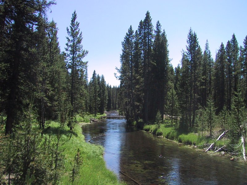
It is very hot. We run out of water, and stop at the river and purify more using Ewart's filter pump. At this point, the Firehole River is still upstream of most of the geothermal stuff further down and the water does not taste of sulfur at all, it is perfect.
It takes a long time to get to the Lone Star Geyser. This is a big geyser, but it only goes off every 3 hours or so, and from the slight steam arising from its impressive cone, it is apparent that it has gone recently and won't again for at least two hours.
|
|
Firehole River
|
We load up the cars, and immediately drive off to Grand Teton National Park, which is just south of Yellowstone. We skip Old Faithful - Andrew says if we really have to see it we can do it on the way back north. The other famous features of Yellowstone would take too long to get to - this is a big park.
On the way, we drive through a vast area of dead trees. A huge forest fire raged here in 1988.
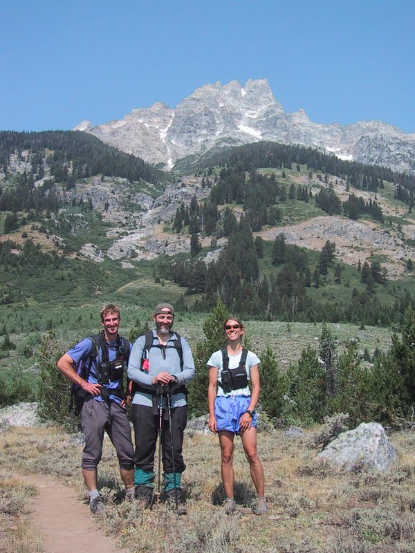
Snow-capped mountains are visible ahead. Andrew radios back "there's a major view coming up" and so it is - the majestic Grand Tetons visible across a glittering blue lake. We all pile out of the cars, and I take a panorama photo. From this perspective, our goal, Teewinot Mountain, is still way off to the south.
We make camp at the Colter Bay campground, where there are showers.
I have a problem. I have missed so much sleep now that tiredness comes in waves - I am alert for a while, then too tired to function for a while, repeat ad infinitum. Packing up tonight for the tough Teewinot ascent, and then doing it starting at 2AM tomorrow, is inconceivable in my state. The others accommodate me by agreeing that we should have a rest day tomorrow. This gives me one more chance to catch up on sleep.

|
|
Evening view across the Snake River in Jackson Hole
|
I take three of the pills (normal adult dose: 2) and hit the sack. To believe the others, three such pills should knock me out cold. They don't. I still take forever to get to sleep, and I still wake up every hour or two. But perhaps the pills make it easier to fall asleep again. At least, in the morning I am simply able to go back to sleep for another hour and a half, and awake again with the sun high in the sky.
Peter: Next morning we get camp sites at Jenny Lake, right under a glorious view of Teewinot. We took many pictures while going to get the new camp site. We then spent the rest of the day getting ready for our climb of Teewinot. This included a trip into town looking for gear, where I snapped pictures of old gear on the wall of the outdoor gear store.
The others return, having successfully secured campsites. We break camp and load up and drive down there.
Approaching the city of Jackson, WY from the north, you go through a large flat valley called Jackson Hole. Most of it is in the national park and thus pristine (the rest is occupied by the town, which is a trendy, fancy ski town, and the two ski resorts of Jackson Hole and Snow King).

|
|
Tourist stagecoach ride in Jackson
|
|
|
Campsite with Teewinot in the background
|
We go to eat a late breakfast and pop into a few stores in Jackson. Then we go to the campground and spend a really lazy day packing up our packs for tomorrow, discussing the ascent (the entire route is clearly visible from where we sit at the picnic table), looking at Andrew's digital camera pictures, eating sweets and (Luc and I) going for a swim in the lake. It is very beautiful; directly from the opposite shore, Teewinot Mountain rises about 6000ft into the air, obscuring the higher Grand Teton and Owen mountains. It is hot. A coyote wanders through the campground. Even if you've never seen one in the flesh before, and don't know dogs very well, you can tell right away this is a wild animal. Wolf? Nah, too small. Other campers confirm it's a coyote.
According to the car's odometer, we've traveled 3,978km.
Having prepared our packs the day before, we manage to eat breakfast and drive to the trailhead and get started by 3AM. As we rumble on the dirt road in the darkness, everyone sitting up straight and a pile of packs (as well as two hikers) in the back, it feels like the start of a proper adventure.
Like a little torchlight procession, we wind our way upward on the zigzag trail, first through open meadow, then through forest glades, as the first glow of dawn slowly appears.
We reach 10,000 feet altitude, and pretty much the end of the trees, by sunrise. Because of the clouds, the sunrise is spectacular.
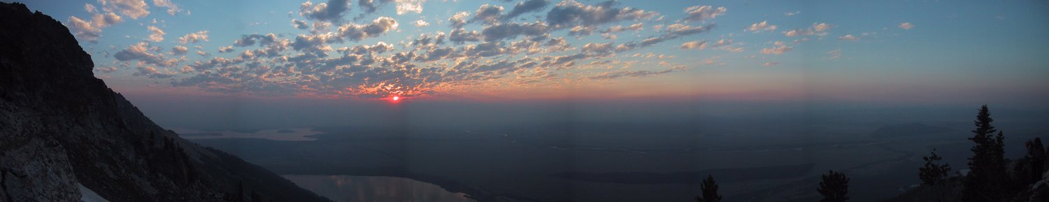
|
|
Sunrise from about 10000ft altitude on Teewinot Mountain
|
We continue upward until the trail ends just below the pinnacle known as the Worshipper (located as it is next to a larger pinnacle called the Idol). Here it is time to don gaiters and helmets, and take the ice
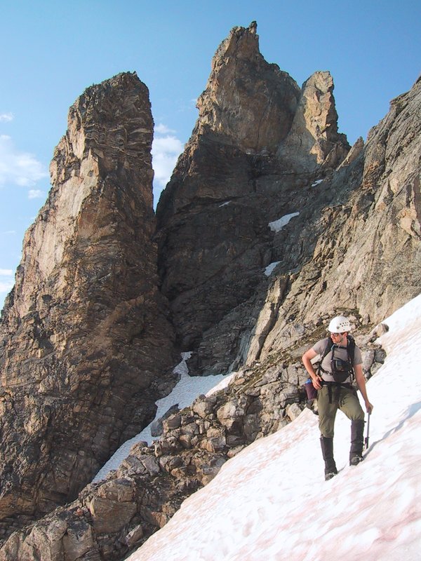
|
|
Andrew on the snow slope in front of Worshipper and Idol
|
After we cross the snowfield, we work our way upward over steep rock, which requires class 4 scrambling in some places (i.e. you have to use your hands, but there is nothing difficult about it). We find bits and pieces of zigzag trail, and use it where convenient.
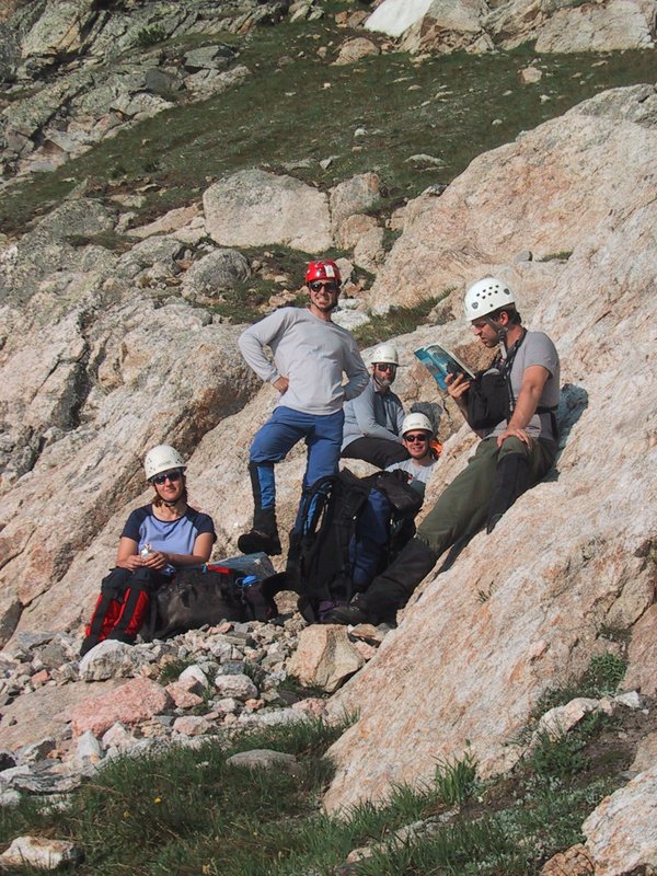
|
|
The climbing party (except Markus)
|
We must find a particular gully that is our route to the summit. After some erroneous poking around, we gain the correct one and work our way up it, until stopped by a steep and apparently unclimbable section, which by this time has plentiful water gushing down it. To continue, we experimentally kickstep our way up a small steep snowfield to the left, and climb from the top of that. The climb is not easy for an inexperienced climber, and I almost fall off at one point, after committing to some inadequate handholds. I make it however, and so does Peter. We both strenuously advise that a belay (i.e. rope protection) be set up for the others. Andrew climbs up and does the belay for Caroline and Ewart. It takes a long time to set up, but they do the actual climb very quickly.
While all this is going on, I have climbed a nearby plateau where I can watch the proceedings from a bird's eye perspective. I also form a strong opinion of the route from here, partly correct (i.e. cross back over to the gully and go up it) and partly incorrect (from such a high angle it's hard to tell what's steep and what is not).
I get an empty feeling in my stomach, which means I have not eaten for too long. I reach for my food bag in my pack, and, this is not good, it is not there! I must have forgotten to pack it again when stopped for food somewhere earlier. Now my bagel, two power bars and a bunch of granola bars are gone, and I'm feeling hungry, which is very bad on a climb like this (it turns out later that the food was not wasted, as we meet the rangers who found it and ate it!)
|
|
Luc kicking steps into the final snow slope
|
We are now close to the summit, but the air is thin and the empty feeling in my stomach has spread to my muscles. In other words, I'm close to bonked. I beg some food from the others and gain about 300 calories (nobody has a serious excess of food). Some salty chips from Andrew really help.
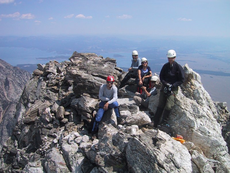
The summit itself takes some exposed scrambling to get to, and is a narrow pointed pinnacle with abysses on three sides. To slip while up there means death. Luc confidently stands straight up and is photographed. The rest of us show varyingly less courage.
|
|
On the summit (almost)
|
But in the back of our minds (at least in the back of mine) is that we're 6000 feet above our trailhead, of that 1500 feet off trail, and we have to get back down. It took us nine and a half hours to get up, so it is now 12:30, so there is no time pressure.
Peter: We got up at 2AM ate some breakfast (noodles + oatmeal for me) and made our final preparation, we were at the trailhead by 3:15 AM. We made great initial progress. It was turning into an interesting scrambly climb. Sometime after it got scrambly, I started to bonk badly (despite breakfast and constant calorie intake) and had to stop to eat a most of my remaining food and some of Andrews.
The rest of the climb was beautiful and challenging. With a lot of easy rock climbing/scrambling and some snowfield crossing. One rock section was fairly challenging and quite a bit beyond my comfort zone, but once I committed going back seemed worse. I put everything into getting around that section. Once the Adrenaline wore off I was bonking again (no energy + the shakes). We still had to get Caroline and Ewart around this section, so they put on harnesses while Andrew set up a belay. I just tossed them the rope which is all I could manage at this time. Soon we were back together and scrambling onward. The rest of the way up I had periods of normalcy mixed with blood sugar crashes. On attaining the summit area, I was pretty weak and light headed and the summit was very exposed so I made no attempt to do anything demanding. I simply put my hand on the true summit and returned to less exposed place to sit.
The summit area views were Spectacular! Jagged craggy rock surrounded us, an alpine feast for the eyes. This was the best summit view that had ever awaited me. I shot pictures with abandon. After soaking in the scenery and a Dare cookie or two we began to descend.
Though I feel weak from so little food (and too little hydration as well) it doesn't take much strength to descend. I am too careless on the snow, descending the steps that Luc made on the way up, and fall. Oh boy, this is steep! It takes a couple of moments to remember my self-arrest position and execute the maneuver, by which time I have slid about 10 metres. I'm proud to have managed it and not ignominiously crashed into the rocks below, but I don't think the others saw. Other than that there is no problem until the part where we had to do the difficult bit of climbing up. I chat with another person coming up, and he says that yes, this route is all class 4 (nontechnical scrambling) but you have to be an experienced Teton climber to find the class 4 stuff! Later a ranger explains to me that the easy route up this part is on the other side of the gully, and looks impossible at first sight. That's why we missed it.
We set up a rappel using the entire 70m length of Andrew's rope. This allows us to descend not only the tough bit (I tried to downclimb it, nearly fell, and gave up) but some more stuff below it. The rappel goes quickly. Luc collects the anchor webbing and brings the rope down by downclimbing it all, which is no problem for him, though he slips off the steep bit of snow slope and has a hard landing.
The descent seems endless, probably due to my weakened state. Finally back at the big snowfield. We only need to cross this, and we're on trail for the remaining 4500 feet down. Instead of going down on rock to reach the standard boot track traversing it (which another hiker does) we start at the top and kickstep our way straight down. I fall again, and once again execute the self-arrest maneuver, as inelegantly as before. Then I am more careful, and cross with no further trouble.
Peter: I was quite depleted after reaching the summit and pretty much out of food. Also food didn't seem to help much. I am very wary of descents, as I usually out of gas completely and mistakes come much easier. I was hoping for a swift safe decent out of any areas of potential danger. Unfortunately this was not to be.
The trip down was going fine. We did a cool single rope rappel (with Luc gathering the gear and downclimbing). This got us past any of the tricky down climbing. I was feeling much less anxious as we only really had a last snowfield to descend before it turned into a hike out.
Andrew and I are standing there, looking back at the others making their way across, when we see Caroline fall and slide. She nearly manages to stop, but then speeds up again and crashes into some rocks. Her ice axe is still stuck in the snow near where she fell, and one of the others carefully makes his way down to retrieve it, while Caroline picks herself up and announces that she is unhurt.

|
|
The fateful snow slope
|
It takes quite a while to get things sorted out. It is plain that Ewart is in no shape to walk anywhere today, and he repeatedly offers to spend the night right here, until he is well enough to hike down the mountain. Eventually he is helped across the loose talus slope to a place where a shelter can be improvised, a couple of rangers are dispatched by radio to come up with supplies and bivouac equipment, and all of us and three of the rescuers hike down as night falls. By the time we reach the cars, it is as dark as it was when we left in the morning.
I am so exhausted now from the lack of food that I go right into my tent and crash, while the others drive into town to have burgers.
Ewart: Whilst descending the snowfield, I was purposefully ensuring that my ice axe was as firmly embedded within the snow as possible at all times - I weigh a lot! The next thing I know is that I have slipped, and am starting to descend the mountain at an increasing rate of knots. There is no time to grab the bottom of the ice axe - it has already popped out of the snow. I grab the ice axe and try to get into the self-arrest position, only to hit some rocks, be thrown into the air, hit the snow again, followed by some more rocks. Fully conscious the whole time, I am aware that had it not been for my helmet and backpack, I would surely have been dead, my head having bashed into rocks on two occasions. When I finally come to a rest, I know that nothing major is broken - I still have movement in all my arms and legs. But I am dazed, and very grateful to still be alive.
I try to get up, but no sooner than I try to do so, Caroline arrives on the scene and tells me not to move. I have no problems obeying her orders! She immediately starts to attend to a gash above my right buttock. As she does this, rangers Mikal and Andy are on the scene - they were descending at the same time, and saw the whole incident. They soon take charge, checking me out very thoroughly. They ask if I can walk, but it is hopeless - I am getting continual muscle spasms in my arms and legs, and I cannot put any pressure on my left leg (during my descent, it was the left side of my body, as well as my backside, that took the brunt of the knocks). I ask how my Nikon FM2 fared - it was in my backpack wrapped in my fleece and goretex jackets, and otherwise unprotected (I find out the following day that the lens was damaged, but the main body appears to be OK).
I am quite happy to stay up here overnight right where I am - after living in the Ottawa region for the past 30 months or so in a tent, spending a night 4,000ft up on a mountainside with a wonderful view and ice-cold melt-water to drink is no hardship, but a real treat. I know that what I am suffering from is trauma, and there is no way that I will be able to make it down the mountain under my own steam today. Everybody is being really helpful - from getting me water, to giving me remaining energy bars/food stuffs, to distributing the contents of my pack so that it can be taken down to the trail head. The decision is finally taken to have me camp out in a sheltered spot a short distance diagonally across the slope, although "short" in my condition seemed like infinity (it took about 3 hours from the time the incident occurred to me reaching my spot for the night).
I can tell that Andrew is visibly upset by what has happened, so ask Andy to leave me for a while so that I can have a quiet chat with Andrew alone.
Andy/Mikal have arranged for two wardens, Brandon & Helen, to come and stay with me overnight, and to escort me out in the morning if at all possible. Andrew wants to stay behind with me overnight, but I decline the offer and request that he descend with Andy and the others, get some decent food inside of him, not to mention a good night's sleep - I will be in my element up here, and I know that I will be in good hands.
My friends leave me with a pile of fleece and goretex gear to keep me warm/use as bedding, as well as a communicator. I arrange to give Andrew a call around 8.00am the following morning to let him know what is happening. Mikal stays with me until Brandon & Helen arrive, and the necessary medical information has been exchanged. They have brought up for me some food, a foam pad, a sleeping bag and a bivy sack, not to mention a more complete first aid kit.
The first question Brandon asks is why I think I will be able to walk out in the morning, as there is a helicopter on standby ready to air-lift me out now. I tell him that during the past three hours there had been visible mobility improvements, and that I would prefer to defer any air-lift decision until the morning - I also could not claim to have climbed Teewinot if I were unceremoniously helicoptered off. We decide to see how I am in the morning - provided that I can limp/hobble then we'll walk out. The helicopter is stood down, and Helen takes to performing a further medical assessment.
By this stage, I really want to go for a pee, not having done one since 3.00am (the body was in water conservation mode during the ascent), but the rest of my body just wants to shut down - I manage to hold off until the morning. Brandon supplies me with some anti-inflammatory drugs before I finally nod off, and again in the morning.
Peter: While descending the snow slope near Worshipper and Idol, I was second last in line and Ewart was last and far behind, he was having trouble with the snow all day, and clearly didn't like being on it. It half entered my mind to go see if I could help, but I was spent at this point and figured he would be ok, if he was going slow, he was probably going safely.
Moments later looking downslope, I could see Caroline falling. People were yelling instructions "Use your ice axe...", but from my vantage point I could see that she had lost her axe, but she was controlling her descent somewhat. When she plowed into the rocks it seemed in slow motion. By the amount of rocks moved, I thought the impact might have been greater than the speed first appeared. But she was up and saying she was ok quite soon. Luc started heading over to retrieve her axe which wasn't far from him. I was still wondering if she was really ok, when I heard a shout that Ewart was falling. Glancing up, it looked like he was heading right at me. Instinctively I dove for cover and wrenched my knee in a moat near some rocks. I then witnessed Ewart fly by me in a spray of snow, flailing and tumbling out of control, I instantly had a sinking feeling in the pit of my stomach watching him fly by and then be tossed into the air like a rag doll when he hit the first outcropping of rocks and then crashing hard in a heap, into the rocks below, not far from Caroline. I had once witnessed a fall of similar violence and that person just barely survived. At this point I was very shaken. I could see people converging on Ewart. All I could manage was to slowly make my way down the mountain. Driving my axe in deeply and holding onto it with a death grip at each step.
When I arrived, much to my relief Ewart was speaking. He was soon talking about resting for the night where he was was and walking out in the morning. I thought this was nonsense. I expected several fractures and he was not near any level ground to rest on. Painstakingly over the next hours Ewart crawled, walked, was belayed across snow, supported and dragged to a place where he could really rest for the night.
Climbing rangers were bringing additional supplies to spend the night with Ewart, and we were ushered off the mountain. On the way down, I spent much of the time by myself as my knee needed support of an ice axe and would still occasionally collapse painfully on me (this slowed me down). Reunited at the vehicle we headed into town for a very somber meal about 10:30pm. A fitful nights sleep awaited most of us.
Oh, the whole thing made the NPS bulletin (PDF file) too.
|
|
Brandon, Ewart and Helen after descent from Teewinot
|
Ewart arrives with the whole entourage (including the two rangers who spent the night with him). He receives further checking out at the rescue station. While he never utters a word of complaint, it's obvious that he's been through a lot, and anyone who saw the accident yesterday can't help but be hugely impressed by the fact that he made it off the mountain. 4500ft of elevation over rough switchback trail is no picnic.
Ewart: Morning rise is at 5.30am, forced by my need to have a pee more than anything else. I no longer have any muscle spasms, and am in a position to walk, albeit slowly. Yet more 'bar' food is all that is on the menu for breakfast, which I am starting to get rather tired of, but beggers cannot be choosers. Brandon has brought up a pair of hiking poles, which really helps. I tell him that I have a hiking pole of my own which I hid amongst some rocks just a short way down the trail on the ascent, as I knew that it would be of limited use for the rest of the climb. When we get to it, the webbing and foam gripping has been completely mauled by marmots - I don't particularly care, as I never had much affinity for "hi-tech" hiking poles that either collapse unexpectedly at the most inopportune times, or fail to collapse when you want them to.
As 8.00am approaches, I radio Andrew to let him know that we are heading down, and that we have just entered the tree line - I estimate that we will be down by 10.00am. About 1,500ft above the trail-head, we meet up with Andrew, Luc, Caroline & Peter who have hiked up the trail to meet us - this was a much appreciated gesture! We arrive at the trail head around 11.00am, at which point there are some poses for photographs with Brandon & Helen before we are escorted to the ranger station at Jenny Lake to be cleaned up before I go and see the doctor at Jackson Lake Lodge.
Peter: Fairly early in the morning, we had word that Ewart was walking out! We were overjoyed. We quickly made plans to meet him on the trail. Somehow Ewart had escaped more serious injury, through the foresight of wearing a helmet and the luck of taking most of the impact on his Butt. Overall he was VERY Lucky.
After we were re-united we stopped at the ranger rescue station where the rangers further checked him out and then we went to a local clinic for further checks.
Because the rangers have been so helpful after Ewart's accident, it's decided to get them a few cases of beer as a thank you. We buy these at the Colter Bay grocery store, where I also fill up on lots of stuff from the deli counter to restore my calorie balance. At the ranger station, we intercept the first ranger we see, the very prototype of a square-jawed lawman type, and deliver the goodies, which we understand go into the pool for everyone to enjoy. "We don't normally accept this kind of thing" says the lawman type with a wink.
Ewart: All of us had been really bowled over by the support provided by the Grand Teton climbing rangers - I for one was very humbled by the whole experience. Brandon & Helen were not open to receiving any money. However, they indicated that beer would be acceptable, so we popped in at Colter Bay, bought three large boxes (at some extortionate price), and dropped them off at the ranger station in Colter Bay requesting that they be forwarded to Jenny Lake. Then followed a visit to the medical centre at Jackson Lake Lodge, our last stop before proceeding North to Glacier National Park via Old Faithful in Yellowstone.
Dr. Chuck Harris:
It is now around 1.00pm, and time to start heading north. Fortunately I am still able to travel sitting upright in the van.
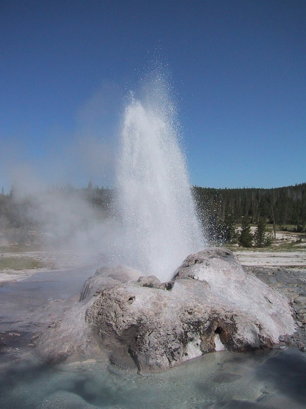
The trip north commences. This takes us through Yellowstone again, right by Old Faithful, which we now stop to see.
There is an enormous parking lot, a rustic looking hotel, a restaurant with picture-window view of the geyser, gift shops, you name it, a regular tourist city. I walk around and take it all in and quite enjoy the spectacle. A huge circular seating area runs around the geyser itself at a respectful distance. The geyser at this point is just emitting wisps of steam. There are clock displays all over the area showing 4:19, which is the next predicted eruption time, plus or minus 10 minutes.
At T minus 15 minutes or so, the seating area fills up, with almost everyone toting a camera. The geyser emits a few teaser spurts of water. At pretty much the scheduled time, the eruption starts, and it is an impressive show, though it only lasts about a minute or so at full height (it continues for a couple of minutes more at lesser height).

|
|
Ye Olde Faithful
|
We get back on the highway amid the traffic burst of everyone else leaving the geyser show, and blocked by RVs, rubberneckers watching wildlife and a construction zone, we slowly inch or way to the west entrance. As often the case, the instant you leave the national park you are in touristville central, but only briefly before we're back in the open heading north on highway 287.
The weather now turns cloudy with occasional droplets of rain. How fortuitous! Perfect weather until the exact moment we decide to go north hundreds of kilometres and overnight in a motel anyway.
We drive north until we get to Interstate 90, the highway on which we came a lot of the way west. We continue on it through rolling grassy hills, in Montana, where there is a posted 75mph speed limit but Andrew radios back not to worry about it.
We cross the Missouri River - again - which seems odd at first glance. Then the topography gets interesting as the highway drops abruptly into the valley containing the Jefferson River, and later even more so as we pass a pullout labeled "Chain Up Area" and then start to climb to a peak altitude of 6393 feet (the height of Mount Washington, approximately) and a sign saying "Continental Divide". This is certainly a more scenic and rugged part of the Continental Divide than the barely perceptible hilltop back in Yellowstone. After this the highway drops precipitously into a wide open valley, very scenically. Down there is the city of Butte MT, and also the start of Interstate 15 to the north, which is where we're going. But first a food stop at Perkins Family Restaurant, where there is much happiness, because we're all together again in good health.
Ewart: One must understand that by this stage I have not had a proper meal in 48hrs. After limping into the restaurant and gingerly parking my arse on a chair, I realise that I am a bit far from the table. Pulling my chair up to the table would be too painful, but thankfully lateral thinking Caroline comes to the rescue and nudges the table up to me instead. The feasting can now start!
We spend some time looking for an acceptable motel, reject the Motel 6 because it is not a motel here and we need outside ground floor access to the rooms because of all the junk in our cars that we want to organize. So we end up at an older, partly renovated, non-franchise motel which is actually fine, everyone sleeps well and in the morning we completely clean out the vehicles and organize all our stuff, which at least to me is therapeutic.
|
|
Organizing our stuff
|
We amuse ourselves by testing out the range of the radio transmitter thingy that Luc is using to play CDs in the van (which does not have a CD player). I walk Luc through turning on the laptop's microphone so we can actually hear sounds from the van too.
We turn off the interstate on highway 287 and head northwest. A sign says Glacier National Park is 155 miles away. The landscape gradually changes - the hills become less pronounced, then just rolling, the vegetation changes to prairie grass, and eventually it becomes mostly flat. We blast along the two-lane at typical speeds of 120-140km/h, seeing almost no other traffic, the pavement perfect for mile after mile, even though the population density is so low that often you can see no dwellings at all. Once we reach 190km/h but once again the straight stretch is a bit too short to see what speed my car actually tops out at - probably about 200km/h or just below.
We've been driving first in drizzle, then under solid grey cloud, but as we near Glacier National Park, the clouds stay behind us and we have clear blue sky again.
It is evident right away that there is some major spectacular scenery here, but it is very hazy, due to several forest fires burning in the park. For this reason the main highway trough it, the "Going to the Sun Road" is closed at the pass. There is still plenty of nice potential hiking on the open east side, and even in the low evening light with all the haze the scenery is beautiful.
|
|
Hazy but nice scenery in Glacier National Park
|
We sit around at the campground, where we got the last two spots, which aren't very good but at least we got them (a few minutes later they would have been gone too). Someone has bought a pack of 1.5 pint beer cans and I am peer pressured into drinking a whole one ("at least this means you have peers" quips Peter). It does give a pleasing mellowness for a normally high-strung nondrinker like me, even though I hate the taste (that's why I don't drink). Luc regales us with tales of his incredible adventures all over the world, with some suspecting that such stories could only be made up, but we question him aggressively and all the facts cross-check, and besides he has beautiful photos to show.
Finally we go up the road to the pass and take lots of pictures up there and on the way back. Many nice mountains here, not hard to climb and with spectacular views. I could imagine spending at least a week in this place and not getting bored.
|
|
Goose Island Overlook
|
Later, as we're getting dinner ready - and I just have to record this - we're looking at the dehydrated bits of chicken in Andrew's Alpine Aire dinner, and Luc wants to taste one. "Can I hydrate one of your chunks?" he asks. I think this is the pickup line of the century - can you just imagine walking up to someone in a bar and asking "Baby, can I hydrate your chunks?" Heh heh.
Peter: The first hike was Mt. Reynolds. Which I did get ready for, but when at the store to get food, I realized how crappy I felt and decided the day would be better spent near a bathroom (beer or illness?). Luc was in the same situation and Ewart was not yet ready for any serious hike, so this day only Andrew, Caroline and Markus went for a hike, while the rest of took it easy.
We're in my car, having moved all the stuff from it to the van, so that the non-hikers have the use of it and all the stuff in it. To this end, I've also lent Ewart my driver's licence and National Parks pass, so they can get in and out of the park unimpeded.
We drive up to the pass in gloomy but fairly clear weather - it seems some drizzly rain in the morning has knocked the smoke out of the atmosphere. No sooner up there, than Caroline finds she's forgotten her waterproof jacket, so Andrew and she drive back down to get it, while I hang around the visitor center up there, admiring its open, airy 1960s architecture, and how it all runs without external electricity supply (thus huge windows giving views of the mountains, and no lights).

|
|
Mt. Reynolds
|

|
|
On the boardwalk
|
We turn off the main trail towards the mountain. There are a few snowfields to cross, so, mindful of the experience on Teewinot, we unstrap our ice axes for each one.
|
|
Caroline climbing the scree slope
|
|
|
The scary traverse
|
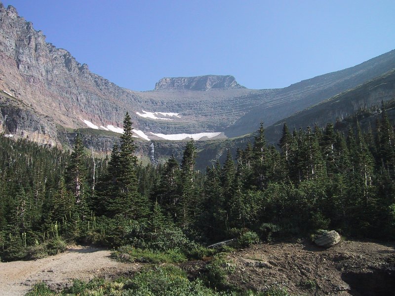
Eventually we reach a higher plateau. Andrew consults the route description in his guidebook. It is now time to go across the slanting traverse along the steep north face of the mountain. From a distance, it looks like a regular shelf that won't be hard to walk on. Up close, it is narrow and precipitous, and covered in loose rock. There is a well-established path there, along which we very carefully pick our way. Lose your balance toward the left, or misstep in a serious way, and you're done for. At the start of the traverse, I'm unafraid and think, this would be a good cure for people uneasy with traverse paths on steep/loose slopes. By the end of the traverse, I'm uneasy myself. Imagine panicking in the middle of this thing if the height and exposure get to you. You'd be stuck. We later find out that the leading cause of death among mountain goats is falling off places just like this.
In somewhat less scary but still precarious conditions we make our way along another face of the mountain, and eventually reach a scree slope going further up. This we ascend. Andrew's guidebook is much consulted, and then we find a series of cairns showing the way, as we clamber up stratum after stratum of this mountain, eventually traverse again until we've done a full circuit of the mountain from where we started, and finally see the well-marked way to the summit.
The total elevation gain is only about 2400ft to the 9100ft summit. We took about the hardest route up there, and took five and a half hours from the parking lot at the visitor center. The view is spectacular, despite the growing haze from the forest fires, and the weather is once again sunny, hot and windy.
There is a summit cache. We pass the time reading the log entries, adding one of our own, eating the summit cookies that Andrew has brought, and listening to some other hikers on our FRS walkie-talkies. We eventually, by trial and error, find out that they are using squelch code 5, so we dial that in and transmit to them. A conversation results. They are on Siyeh pass, about 6 kilometres away, line of sight, which far exceeds the FRS radios' advertised maximum range of 3.2km.
The way down goes quickly, since we skip the circuit of the mountain and just take the "normal" way down. Scree slopes that are tough on the way up are trivial on the way down, just slide with each plunging step, but wear gloves in case you lose your balance and fall. We find a series of cairns clearly marking the way down, and the hike back to the car takes just over two hours.
|
|
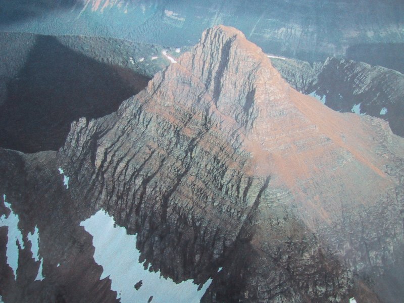
Aerial view of Mt. Reynolds (photographed off a display at the visitor center) |
A very pleasant and satisfying hike, and our second summit of this trip, and spectacular like the first one. Too bad only half the group could make it.
When we get back to the campground, Andrew and Caroline buy hot dogs, buns and fixin's and offer the cooked dogs around. I score two. Other than that I mostly just sit around listless and mellow, since it has been such a satisfying day and I am now dead tired, since I didn't sleep well the night before.
|
|
Our ascent route up Pollock Mountain
|
The ascent is very steep - 50% slope (3000 feet in 2 kilometres) with no switchbacks. Quite a bit is over talus. We encounter a group of big-horn sheep who let us approach fairly closely before lumbering off.
When we reach the saddle between Pollock and Piegan Mountain, we establish radio contact with Ewart, but can't see him on the trail.
To overcome the upper cliffs on the mountain, we have to follow some directions in Andrew's guidebook precisely - go around this side until you see such a pinnacle, then count off 112 steps... eventually we arrive at a narrow "chimney" that is readily climbable, though I don't feel completely comfortable about being able to downclimb it again.

|
|
Bishop's Cap from Pollock Mountain
|
On the way back down the chimney, first I dislodge a rock that crashes down and narrowly misses the others, then I have a tough time downclimbing it. Not good.
Peter: During the decent, I verbally lost my temper when Markus loosed a large boulder down the chimney and only luck prevented injury. With recent events my nerves were getting more and more frayed. The rest of the decent to the saddle was uneventful. Eventually it was decided that the rest of use would go down to Ewart (who was hiking the meadow trails), while Andrew and Luc would go for a quick ascent of Piegan.
We go back to the saddle. Andrew and Luc (who isn't feeling sick any more) want to go up the adjacent Piegan Mountain. From this angle it doesn't look very interesting, and I'm a bit tired, so I join Caroline and Peter in going down the enormous slope down to the pass where Ewart is, while Andrew and Luc go up to the summit.
Ewart indicates his position with flashes from a signaling mirror. It takes surprisingly long to get down there even though it all looks like a flat, easy slope.
Soon after we reach Ewart, we start the 7km hike out. We are well along when Andrew and Luc leave the summit. We stay in radio contact with them from then on, monitoring the closing gap between them, who are going very fast to catch up, and us.

|
|
Trail from Piegan Pass, Pollock Mtn. in the background
|
I radio various waypoints to Andrew - a creek crossing, a bridge, an avalanche scar, a big rock by the trailside - and it takes progressively less long for them to reach them behind us. 2.5km from the trailhead they overtake us. I have been walking at less than my natural pace, and want to unwind, so I go with them, but only for a few minutes, as they are walking at about 6.5km/h which for me is not sustainable, so I soon toss them the car keys and fall behind again.
At this point, we are directly below the steep side of Piegan Mountain, which looks extremely spectacular and rugged from here and has a glacier on it besides. I have mixed feelings about not having done it now - it would have been a nice summit (better than Pollock Mountain) but the fast hike out would have really hurt.
Ewart: After two full days of complete rest following the accident, I felt capable of doing some walking, but nothing steep. Andrew suggests a hike up to Piegan pass, returning via the same route. The contour lines on the map show a gentle slope, and the path goes substantially through Alpine meadows. I decide to give it a go - if it is too much, I can always return back to the trailhead and wait in the car for the others to return. The hike up the path is indeed very beautiful, with all the flowers in full bloom. I take numerous photos (Luc also has a Nikon camera, and so lent me one of his spare lenses for the remainder of the trip - thanks Luc!). Unfortunately, the roll of film with these photos is still in my camera and will probably not be developed for some weeks yet, too late to be included in this trip log.
When I get to the pass, I ascend some ways up to the saddle between Piegan and Pollock with a view to getting some photos of the valley running due north. It is here that I make visual and audio contact with Andrew & Markus atop Pollock mountain. I then descend down to the pass, where I have left my backpack, as there are marmots about and I don't want them to gnaw at it. Once at the pass, I head toward a nearby snowfield so that I can rest and tank up with melt-water. Whilst doing so, high above I see a group of mountain goats descending from Piegan onto the snowfield, frolicking their way down like little kids - even the parents! As the others make their descent to the saddle, I get up and work my way to a place where I can be seen. However, something is afoot - I have a pain right at the bottom of my spine, and walking is not comfortable.
Once Markus, Peter and Caroline have reached the pass, we gingerly start our descent back to the trailhead - we leave Andrew and Luc to catch up in due course, which should not be too difficult given the slow pace I am setting. The last 2 miles of the hike are a killer, and I am concerned that there is something seriously wrong with my back. On reaching the trailhead, I inform Andrew that I need to go to the nearest A & E centre once we cross over into Canada. I am sat in the van, but as we proceed to exit the park enroute to Canada, the pain is too great and I request to lie on my stomach in the back so as to get all the pressure off my back. This, embarrassingly, becomes my mode of transit for pretty much the remainder of the trip, the Dodge caravan effectively turned into a semi-hygienic ambulance with F1 drivers! I also know that there will be no more hiking for me this trip.
Peter: We met up with Ewart on the trail below and took a few pictures and then began our slow hike out. We made our way through lovely alpine meadows covered in multi-coloured flowers, to the tree line with strong pine scents, to babbling stream crossings. When Luc and Andrew caught us they continued on to get the cars with Markus, while Caroline and myself paced Ewart out. It was clear he had over-exerted himself in his condition and he was moving slower as time passed. He was in much worse shape than on his hike out of Teewinot after his injuries. We took his gear, but this seemed to make little difference, we settled in for the slow grind out.
This hike also seemed to be an over-exertion for my knee, what had previously been painful only in certain situations turned into a constant ache regardless of activity. This was my last planned hike before my plane out, so the timing of my exit worked out very well.
Andrew and Luc have nearly finished fetching the van from the hike start point when I arrive at Siyeh Bend. We then wait for the others, who take a while to get there, because the 14km hike was still too much for Ewart and he is walking along in visible pain.
Ewart needs to get checked out by a doctor, so we drive straight to Lethbridge, Alberta (over the smallest, most rural border crossing I've seen yet). To make it easier on his bruised behind, the van has been rearranged with my air mattress on top of a bed of duffel bags, so Ewart can lie on his stomach. This arrangement will continue for the next four thousand kilometres or so.
At the hospital we find no one waiting in admissions, so he is seen right away. No serious harm done, the hike was just too much for his present condition.
Ewart: On crossing over into Canada, we make for Lethbridge which is a nice university town with a hospital. On entering the A & E facility, I am led to a receptionist who starts to take some details. She offers me a seat - "I'd rather not thanks - it is one of the reasons I am here". I get checked out - the doctor confirms nothing broken, and no back damage, just very bad bruising that will take 2-3 weeks to subside. He issues me with a prescription for more powerful pain killers, but I decide not to take them.
We eat dinner at a Montana's, and then find a very reasonably priced hotel to spend the night. We also telephone with Renato's brother Tony, who lives in Calgary and offers to put us up for the next night.
Lethbridge is a classic western prairie town - wide, straight streets in an X-Y grid, flat, modern, prosperous looking.
With no breakfast (this causes me concern since I am hungry) we hit the road to Calgary. I grab a chicken club sandwich and a liter of chocolate milk (breakfast of champions!!) at a convenience store later.
We motor through the flat farm landscape, and remark on the efficient simplicity of the highways - 110km/h speed limit, four lane divided highway, but not limited access.
We get into Calgary, and note that it is just after 12 - lunch hour. The traffic is heavy. I try to call Tony but have no success. We decide to just go to Mountain Equipment Co-op and hang out there until I get a hold of Tony. While there I try on some hiking boots but can't decide (if I bought them here, I would save the sales tax). Finally I get through to Tony, and he gives me the address of where he works. We go there and pick up the key, and two pages of helpful instructions he has written out. Thus armed we proceed to his condo building, where we can park in an underground visitor parking area.
Tony has had this condo for years, but I've never been here. We're all impressed by how nice and convenient everything is! To top it all off, Tony has left food and instructions for its preparation!
|
|
Dinner
|
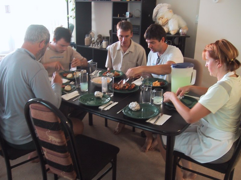
Caroline, who is not having a lazy afternoon, takes over the kitchen and prepares dinner. It is very good - grilled chicken breast, potatoes, peas, cauliflower in cheese sauce, all supplied by Tony.
After dinner, Andrew, Caroline and Peter want to go out to a movie and check movie listings on the internet. They decide on "Pirates of the Caribbean". I want to ride the bike, but Tony mentions that one of the inner tubes is punctured. But I don't give up so easily, so I drive down to MEC to buy bike repair supplies. Luc and Ewart also come, to shop for breakfast supplies at an adjacent grocery store.
It takes me a while to get the bike going, because the old pump does not work too well. Eventually it is OK, except for excessive play in the rear wheel bearings, which I can't fix because I don't have any cone wrenches.

|
|
Downtown Calgary from near Tony's place
|
Tony has suggested a nearby hillside across the river as having a good view of downtown, so I go there first. From there, I ride along the ridge, and then I spy some radio towers in the distance on another ridge and decide to go there. Unfamiliar with the area, I mostly miss the bike paths and ride on major highways.
I ride as far as the Calgary Olympic Park. I want to get up on top of the ridge along whose slope the Olympic Park is constructed, but the only way up is a road through the park itself, and that is private. I ask nicely at the booth, and the girl looks up and down the road, then shrugs and waves me through.
It is a tough climb to the top even though the road has switchbacks - harder than Pink Lake back home. I constantly see downhill mountain bikers, transported up by the ski lift, ride down on dirt trails. By the time I'm at the top, the sun is setting and I'm a long way from downtown now. I ask some people I see how to get back downtown. "Oh, just along this street and left on Bow Trail". So I do this. I was hoping to get a sunset lit view of the downtown skyline, but it is too late, the sun has set.
Bow Trail is a very busy highway, limited access in places, but I'm out of time so that's how I ride. I find my way back to Tony's place just as it is getting dark.
In the evening I show Tony some pictures from the trip, and then we soon hit the sack - literally - spread out all over Tony's place in sleeping bags.
We hit the Trans Canada Highway westward, stop in Canmore for donuts, groceries and a topo map, then drive up to the appealingly named Mosquito Creek campground (doesn't sound so scary after the Yellowstone experience), which is close to Mount Hector.

|
|
Mosquito Creek Campground
|
Thus there is practice in the "Z system" glacier crevasse rescue system, which takes us a few tries till we get it right again. The campground's name, unfortunately, proves justified - we are pestered by mosquitoes here for the first significant time since Yellowstone. Other than that, it's nice here, a lovely rushing creek, pretty scenery and good campsites. And the Yellowstone experience has left me, who is normally terrified of mosquitoes, remarkably blase about them buzzing around and occasionally biting me except when they get me somewhere irksome, like through the socks.
After not really enough practice, we prepare our packs and then I go to bed while it is still light and there is still activity all around - having taken three of those sleeping pills again. I guess they work - I sleep intermittently as usual but with no great difficulty going back to sleep each time I wake up, and I even sleep for some of the time the others are still noisily doing things around the tent.
We find the unmarked trailhead in the darkness and go up by headlamp. First we take a wrong turn and go almost all the way back to the highway before discovering our mistake, then Caroline's headlamp battery fails. Not good omens. Luc plays tunes (I remember "O Tannenbaum") on the harmonica, and I bang on a picket (glacier rescue snow anchor) with a piece of wood, so we can't surprise any bears, because at night by a rushing stream (which masks your normal walking noises) is a high encounter risk environment.
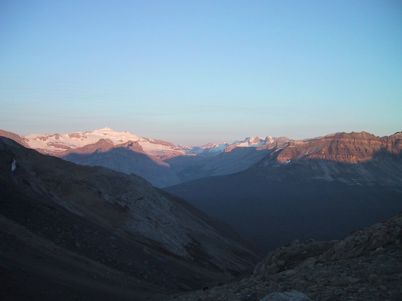
|
|
Sunrise seen from the slope of Mount Hector
|
The trail climbs steeply up a glacial valley, climbing past occasional waterfalls and up scree slopes, as it gradually gets light. Andrew and Luc are ahead, walking effortlessly, whereas Caroline and I are behind. Caroline's back is bothering her (an aftereffect of her accident on Teewinot) and I'm just feeling off, not enough sleep and somewhat dehydrated I suspect.
A sizable climbing team approaches from behind, and catches up when we sit down for a rest. From the look of their gear, they are a serious group, possibly professionally guided or on a course (we don't ask). They go ahead of us and disappear up the mountain.
At this point we discover that neither Andrew nor I have our sunglasses. This is an aftereffect of going to bed in the daytime, and getting up in the dead of night. A bad omen. Caroline has a spare pair, and I can improvise with my ski goggles (you can't just tough it out without on a glacier approach, as these are typically on north slopes, so you have the sun in your face and a highly reflective environment below, as go up - you could quite literally be blinded).
We find a suitable snow slope, and do some self-arrest practice. After Teewinot, Andrew is taking no chances on safety. I do my usual inelegant but workable self-arrests, Luc does his with textbook perfection after hardly any practice. Caroline seems unsure, and says the self-arrest maneuvers hurt her back, and so after the self-arrest practice she leaves us to hike back down to the road and thence to the campsite.

|
|
Little Hector, with Mount Hector in the background
|
Now it's just Andrew, Luc and me, and I'm struggling way behind as they occasionally wait up. We get to the glacier tongue and gear up. While we do this, two large teams come down, having already summited.
The summit is clear in sight. We start up. Almost immediately I run out of breath and have to call for stops or slower pace. Then I start to sweat and my goggles fog up. That, plus I should really go to the bathroom (not a possibility while in layers of clothing and a climbing harness in the middle of a wide open glacier) and I'm dehydrated and hungry (but when I try to eat, the food doesn't taste right and it takes me 5 minutes just to eat a bagel). And my mountaineering boots, which never did fit very well, are giving me pain today. All in all not an enjoyable walk in the great outdoors, just a grim slog with a goal at the end.
We start crossing crevasses. At first, no problem, just an indentation in the snow you walk across. Then, dangerously soft snow, then we see an actual hole where someone has gone through with one leg. Then snow that looks so dicey that you think twice before putting your weight on it at all (while calling for your teammates to keep the rope good and tight). And upward we slog, but this crevasse crossing stuff is getting worrisome, and a warm wind is blowing (I'm in a t-shirt) and the sun is beating down relentlessly. At our slow Markus-limited pace, we would take at least another hour and a half to do the last 1200ft of our 4500ft climb. I'm having such a bad time, I'm just hoping Andrew will call off the summit as being too risky, but don't want to be the spoilsport who suggests it. Finally, the decision is made without me, and we turn back, without having even gained the summit ridge (from which a view to the other side would be possible; already a sea of summits is visible behind us).
On the way down we have to be even more careful and it takes a long time to get off the glacier, and an even longer time to stumble over scree slope after scree slope (rough stuff that makes for really unsafe footing) until we finally get back to the van. I'm miserable because of the blown summit attempt (if you don't enjoy the actual ascent that much, it's the summit that makes the whole thing worthwhile) and announce that this is the end of my glacier mountaineering career (total: 2 summits gained and one not gained).
I collapse in the van and don't budge even after we get back to the campsite - the combined physical and emotional exhaustion taking effect. Meanwhile a discussion occurs about what we should do next, the conclusion of which is that we will drive up the rest of the Icefields Parkway to Jasper, then east from there.
While I pack up and organize (listlessly) I eat food and feel a bit better. Even so I've had my fill of snow-covered mountains and don't bother taking any pictures even as we gaze at Mount Athabasca (ascended two years ago) and a spectacular isolated peak that may or may not be Mount Edith Cavell (unfamiliar with the area we don't know, and the park map is not much help).
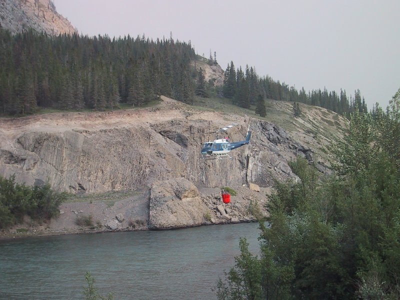
|
|
Fire fighting helicopter near Jasper
|
And so we motor eastward, in the process hitting the most northerly point of our whole trip (above the 53rd parallel) and watching the Rockies turn into minor hills and then flat landscape, though not desiccated prairie like further south, but typical northern vegetation with lots of bush land and green grass.
The sun begins to set. Luc and Ewart announce that they want to just squat camp by a side road somewhere. I am badly short on sleep and don't want this, so Andrew says no problem, we'll just find a motel. Alas, by the time we get there it is close to 10pm, and because the squatters want to be gone at sunup, we have to get up again at 5, and guess what, after a shower I don't feel sleepy any more.
We motor on. I have resigned myself to the relentless driving at this point and am just looking forward to getting it over with and still having the long weekend to spend at my parents' camp. The landscape and vegetation look just like Ontario for most of the Alberta leg of the journey. At Lloydminster, we eat some Albertan donuts, get an oil change about 10m from the provincial border, and then eat some Saskatchewan McBreakfast. After that, to my dismay, the divided highway ends, and we are on a two-lane, complete with slow campers.
The scenery flattens out and the rolling hill cow pastures turn into flat land with grain elevators. Also we see a lot of black oil tanks in the fields as we cross two patches of oil country.
At North Battleford we cross the North Saskatchewan River, which has an impressive (especially for this terrain) valley. I think I even spotted a vineyard but I'm not sure. After North Battleford, the divided highway resumes until Saskatoon, then it is two-lane again, but with less traffic so it isn't so bad.
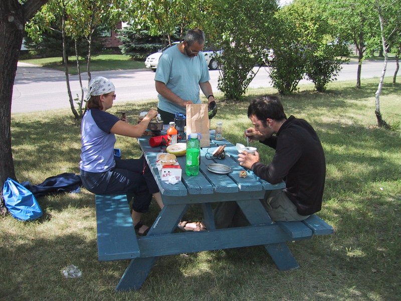
|
|
Cookout
|
When we hit the road again, the air conditioning in my car conks out again for the first time in many days.
We cross a few more nice river valleys in the otherwise flat landscape, and into Manitoba. The highway quality deteriorates: Alberta 110km/h divided, Saskatchewan 100km/h two-lane with paved shoulders, Manitoba 100km/h two-lane with gravel shoulders, and of course we know what awaits in Ontario.
Munching on junk food and listening to the radio, I'm starting to fade out due to tiredness again as Andrew drives (as he has the whole way) when a harmless looking piece of debris on the road turns out to be something hard that smashes into the bottom of the car with a loud bang. So much for feeling sleepy. It turns out that the exhaust pipe is bashed in and punctured behind the catalytic converter, making the car annoyingly loud but otherwise fine to drive (Andrew says he does not notice a reduction in power). And so, onward we roar, sounding like one of those gimmicked up Honda Civics with the coffee can sized exhaust tips.
|
|
Not really a thunderhead
|
We stop in the outskirts of Winnipeg for gas (our third fillup today) and consumables and try to call my sister Marlene in Thunder Bay but she's not home. Hopefully she's left the key for us, because it is decided to continue driving, deer collision and sleepiness risk notwithstanding, to do a 2200km day and arrive in Thunder Bay some time around morning (keep in mind we are losing two hours in going from Mountain to Eastern time zone).
To minimize the collision risk we hang off the end of a convoy of three transport trucks. Several other vehicles accumulate behind us, and nobody passes even when the trucks lumber up hills at 80km/h. With all their noise and lights and bulk, hopefully they will scare off / clear up any animals that jump in the way, and since such a big truck can't do anything too sudden, you can follow with 20m of separation pretty safely.
The Trans-Canada Highway is a 4-lane divided highway with 110km/h speed limit in Manitoba. As soon as you cross the Ontario border, it narrows to a two-lane, the speed limit goes to 90km/h, the signs with the table of fines for various speeds appear, even the pavement seems to get bumpier. The paved shoulders persist for a while, then they too turn to gravel. Welcome to Canada's most populous and prosperous province, eh?
We drive to Dryden, where we have to gas up for the fourth time in 24 hours for the long empty stretch to Thunder Bay. About 20km before, the trucks all pull off so we're alone, and then we're enveloped by fog. We creep along at 70km/h, both driver and passenger intently peering into the murk for deer or moose. Waves of drowsiness overcome me. This is pretty nuts, and 360km more to Thunder Bay seem impossible to me.
Dryden is quite a little centre of nighttime activity - open gas station, Tim Horton's, a Greyhound bus (with parcel trailer) stopping in, trucks idling, sandwiches being made in the convenience store, etc. We pull into a quiet side lot for a 20 minute nap break. I don't get much of a nap, but Andrew apparently does, returning all chipper and ready for more, also eagerly ingesting the bottle of Jolt cola I've bought him.
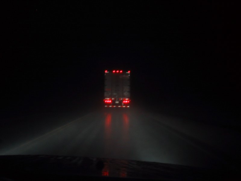
|
|
Driving in the night
|
It eventually gets light, so we can separate from the truck and drive at our own pace. Luc is sounding pretty tired on the radio, and mentions that he is now alone, his passengers having gone to sleep. This does not sound good, so I summon every molecule of wakefulness I have and announce that I will take over. First I take a run of a few hundred metres along the side of the road to really get woken up. Driving the van, I am safe, but I have to carefully avoid road hypnosis, where everything around the taillights of the car ahead goes blurry and you get woozy. I pinch myself, tension my arm muscles against the steering wheel, hold my breath and so on, to maintain alertness. For the 150km that remain, it will do.
Getting closer to Thunder Bay, all this clears up and I feel fine. We find Marlene's place with no problems. No car in the driveway, and the side door is locked and there is no key stashed where it should be. But the back door is open, so I go in, yell hello and am just about to go around to let the others in the front, when Marlene comes downstairs - she's home after all! Finally I can introduce my mystery sister to Andrew and some of the other people I know in Ottawa, not one of whom had ever met her up to that point.
Andrew, Luc and Caroline say hello and then immediately proceed to lie down somewhere and go to sleep. Ewart, who slept soundly on the way here, is quite chipper. So we sit around and make conversation, then Marlene has some errands to run on foot and I come along. We walk all over one of the two downtowny areas of Thunder Bay (which is really two amalgamated cities, with separate downtowns about 5km apart). It is really nice here. A somewhat old-fashioned town, with lots of neat old houses, hotels and stores, which still functions as originally designed - not just some old disused buildings. For example, the old waterfront hotel is still in use. Apparently there is an artistic community here, with a symphony orchestra and a theatre. Marlene likes it here and I can see why. It's really too far from anywhere else for much tourism, and the local natural attractions (tall cliffs etc) are so uncharted that you pretty much have to ask the locals about them.
Speaking of the locals, Marlene says the population is aging because all the young people move away, and hardly anyone young moves in from elsewhere. And the town is economically in decline.
But I still like what I see. We drop into a grocery store and it is full of yummy delicacies, such as many kinds of cheese and great bread, that you would never find in Kanata where I live, or for that matter in many towns the size of this one. There are significant Finnish and Italian communities here.
I can't believe how energetic I feel. I'm practically jumping up and down with excitement at being here after 26 hours awake in the car. The tiredness in the muscles is gone, my mind feels alert. But it's psychological; as we walk up a hill in town I feel the emptiness in my stomach and could imagine collapsing in a faint any moment.
Later we go out for breakfast at a good local restaurant. I love it the moment I see it. Booths with Formica tables, bustle and noise, lively and homey atmosphere. The sort of restaurant the locals go to, not the tourists.
Ewart : After breakfast, we all cross the street to a corner Italian shop to get some provisions for the remainder of our journey. Whilst we are talking outside, who should pass by, heading for the same shop, but Dan Fossum and his wife Anne. Dan is an old friend of mine, who lives in Ottawa, who I have not visited since my arrival back in Canada some 2.5 years ago, and was my Adirondak hiking guardian between 1993-1996, the longest anyone has held this prestigious position. Dan's family is from Thunder Bay. I'll pop in on you soon Dan, promise!
Andrew has bought exhaust sealing tape and crawls under my car to try to tape up the gaping hole in the exhaust pipe. At first this seems successful, but when we set out, it burns through within a minute, and the noise is back as loud as ever.
So anyway, it was lovely to finally visit my sister in Thunder Bay and even to be able to bring a bunch of friends along.
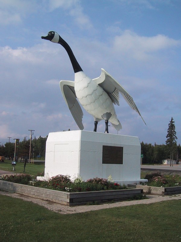
|
|
The Wawa Goose commemorates the completion of the Trans-Canada Highway
|
It is still a long way home. We drive through totally variable weather, sometimes sunny and pretty clear, usually hazy and sometimes raining cats and dogs. The highway threads its way through elevation changes, rock cuts and along the shore. I want to stop at Wawa and see the famous Wawa goose, but the others don't care and anyway the goose doesn't look that imposing, so we don't stay long.
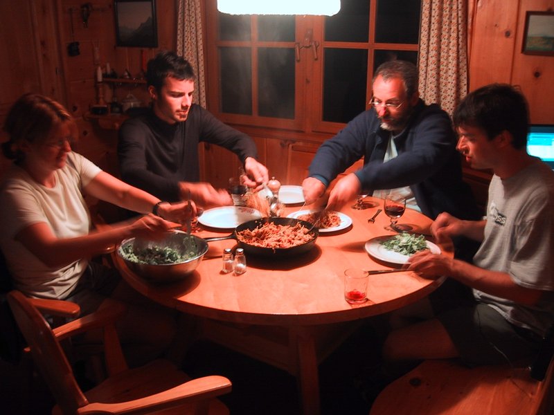
|
|
Digging into dinner at Amogla Camp
|
I still feel energetic and not sleepy, so I take a couple of those sleeping pills, because if I don't catch up on sleep soon the whole weekend could be ruined. With their help I manage to sleep until 8AM or so, when the noise in the cottage makes it impossible to sleep any longer.

|
|
Packing Up
|
We have a very good lunch and I eat three helpings of ice cream afterward. This finally releases the latent tiredness and I spend most of the afternoon just lying about dozing.
[Two days later]
Driving the 700km back to my place in Ottawa doesn't seem such a big deal after so much time on the road. I arrive, unload and get right to work on stuff without any of the usual "wow, back from a big trip" feeling.
My car's odometer has accumulated 9,854 kilometres on this trip.
Ewart: Many thanks Andrew for having organised the trip - I am certainly game for another such trip, but in the Autumn next time so as to cut down on the bug menace. Hopefully my case of bad butt did not spoil the vacation for others - I tried to ensure that the vacation proceeded to plan as much as possible given the circumstances. Finally, thanks to all for having being there for me on Teewinot - I know I make a lousy patient.