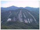
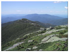
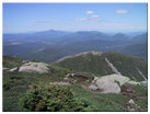
Allen Mtn 9.0km distant Cliff Mtn 4.7km distant Cheney Cobble 11.2km distant Rist Mtn 13.0km distant Flowed Lands 3.5km distant
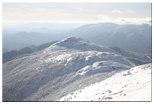
Looking south from Algonquin Peak. Photo by Markus Wandel, taken on 2005/02/13 at 14:36:15.
Visible in this picture: Allen Mtn Cliff Mtn Cheney Cobble Rist Mtn Flowed Lands

Other views from this location (go to next / previous or click on any thumbnail)
Looking north at Whiteface Mtn, Heart Lake, Mt. Jo Looking southwest at Iroquois Mtn, Santanoni Peak, Panther Peak Looking southeast at Mt. Marcy, Mt. Colden, , Gray Peak, Mt. Skylight Looking southwest at Iroquois Mtn, , Santanoni Peak, Panther Peak Looking north at Wright Peak, Mt. Jo, Whiteface Mtn, Pitchoff Mtn, Heart Lake Looking southeast at Pitchoff Mtn, Cascade Mtn, Porter Mtn, Big Slide Mtn, Hurricane Mtn, Mt. Phelps, Giant Mtn, Rocky Peak, Lower Wolfjaw Mtn, Upper Wolfjaw Mtn, Tabletop Mtn, Indian Falls, Armstrong Mtn, Gothics Mtn, Saddleback Mtn, Basin Mtn, Mt. Dix, Nippletop Mtn, Mt. Marcy, Gray Peak, Mt. Colden, Mt. Skylight, Mt. Redfield, Allen Mtn, Cliff Mtn, Cheney Cobble, Rist Mtn, Calamity Mtn, Mt. Adams, Yard Mtn, Hough Peak

Index of all locations All pictures of this location

Hike logs for this location: 2000/08/05, 2002/07/20, 2005/02/13
External map links: Topozone, Mapquest, Yahoo Maps, Nearest Geocaches
Site links: Adirondack Summit Log, Outdoor & Travel page, Home Page