We find the unmarked trailhead in the darkness and go up by headlamp. First we take a wrong turn and go almost all the way back to the highway before discovering our mistake, then Caroline's headlamp battery fails. Not good omens. Luc plays tunes (I remember "O Tannenbaum") on the harmonica, and I bang on a picket (glacier rescue snow anchor) with a piece of wood, so we can't surprise any bears, because at night by a rushing stream (which masks your normal walking noises) is a high encounter risk environment.
|
|
|
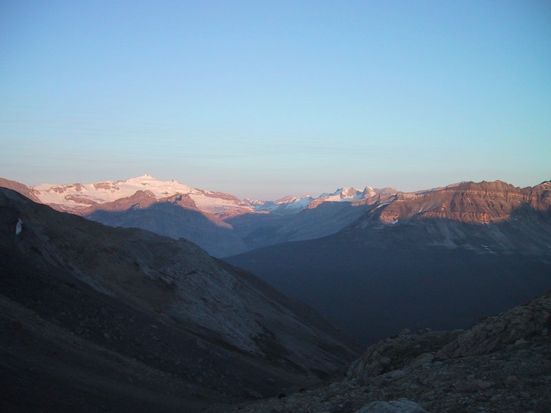
Sunrise seen from the slope of Mount Hector
|
The trail climbs steeply up a glacial valley, climbing past occasional waterfalls and up scree slopes, as it gradually gets light. Andrew and Luc are ahead, walking effortlessly, whereas Caroline and I are behind. Caroline's back is bothering her (an aftereffect of her accident on Teewinot) and I'm just feeling off, not enough sleep and somewhat dehydrated I suspect.
A sizable climbing team approaches from behind, and catches up when we sit down for a rest. From the look of their gear, they are a serious group, possibly professionally guided or on a course (we don't ask). They go ahead of us and disappear up the mountain.
At this point we discover that neither Andrew nor I have our sunglasses. This is an aftereffect of going to bed in the daytime, and getting up in the dead of night. A bad omen. Caroline has a spare pair, and I can improvise with my ski goggles (you can't just tough it out without on a glacier approach, as these are typically on north slopes, so you have the sun in your face and a highly reflective environment below, as go up - you could quite literally be blinded).
We find a suitable snow slope, and do some self-arrest practice. After Teewinot, Andrew is taking no chances on safety. I do my usual inelegant but workable self-arrests, Luc does his with textbook perfection after hardly any practice. Caroline seems unsure, and says the self-arrest maneuvers hurt her back, and so after the self-arrest practice she leaves us to hike back down to the road and thence to the campsite.

|
|
Little Hector, with Mount Hector in the background
|
Now it's just Andrew, Luc and me, and I'm struggling way behind as they occasionally wait up. We get to the glacier tongue and gear up. While we do this, two large teams come down, having already summited.
The summit is clear in sight. We start up. Almost immediately I run out of breath and have to call for stops or slower pace. Then I start to sweat and my goggles fog up. That, plus I should really go to the bathroom (not a possibility while in layers of clothing and a climbing harness in the middle of a wide open glacier) and I'm dehydrated and hungry (but when I try to eat, the food doesn't taste right and it takes me 5 minutes just to eat a bagel). And my mountaineering boots, which never did fit very well, are giving me pain today. All in all not an enjoyable walk in the great outdoors, just a grim slog with a goal at the end.
We start crossing crevasses. At first, no problem, just an indentation in the snow you walk across. Then, dangerously soft snow, then we see an actual hole where someone has gone through with one leg. Then snow that looks so dicey that you think twice before putting your weight on it at all (while calling for your teammates to keep the rope good and tight). And upward we slog, but this crevasse crossing stuff is getting worrisome, and a warm wind is blowing (I'm in a t-shirt) and the sun is beating down relentlessly. At our slow Markus-limited pace, we would take at least another hour and a half to do the last 1200ft of our 4500ft climb. I'm having such a bad time, I'm just hoping Andrew will call off the summit as being too risky, but don't want to be the spoilsport who suggests it. Finally, the decision is made without me, and we turn back, without having even gained the summit ridge (from which a view to the other side would be possible; already a sea of summits is visible behind us).
On the way down we have to be even more careful and it takes a long time to get off the glacier, and an even longer time to stumble over scree slope after scree slope (rough stuff that makes for really unsafe footing) until we finally get back to the van. I'm miserable because of the blown summit attempt (if you don't enjoy the actual ascent that much, it's the summit that makes the whole thing worthwhile) and announce that this is the end of my glacier mountaineering career (total: 2 summits gained and one not gained).
I collapse in the van and don't budge even after we get back to the campsite - the combined physical and emotional exhaustion taking effect. Meanwhile a discussion occurs about what we should do next, the conclusion of which is that we will drive up the rest of the Icefields Parkway to Jasper, then east from there.
While I pack up and organize (listlessly) I eat food and feel a bit better. Even so I've had my fill of snow-covered mountains and don't bother taking any pictures even as we gaze at Mount Athabasca (ascended two years ago) and a spectacular isolated peak that may or may not be Mount Edith Cavell (unfamiliar with the area we don't know, and the park map is not much help).
|
|
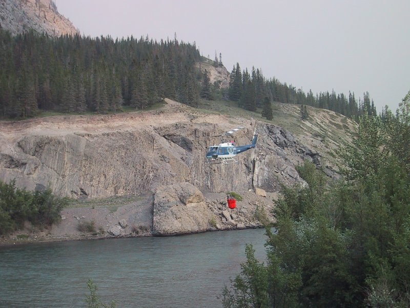
Fire fighting helicopter near Jasper
|
And so we motor eastward, in the process hitting the most northerly point of our whole trip (above the 53rd parallel) and watching the Rockies turn into minor hills and then flat landscape, though not desiccated prairie like further south, but typical northern vegetation with lots of bush land and green grass.
The sun begins to set. Luc and Ewart announce that they want to just squat camp by a side road somewhere. I am badly short on sleep and don't want this, so Andrew says no problem, we'll just find a motel. Alas, by the time we get there it is close to 10pm, and because the squatters want to be gone at sunup, we have to get up again at 5, and guess what, after a shower I don't feel sleepy any more.