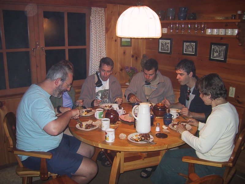
As I'm standing downstairs waiting for my turn in the shower, I look at the clock and it slowly registers - it says 3:50. What's happening here? Ooops! A "convenient" oversight. Gradually everyone is roused and showered, and mom gets up too and starts making breakfast - with bacon and eggs! for us. Even Barbara shows up to say hello to everyone.
|
|
|
Predawn breakfast
|
I unwind by driving very fast on the curvy Gordon Lake Road. Ewart, who is riding with me, is not worried, and Andrew with the others in the minivan is keeping up effortlessly. By the time we're on the 638, I've already had my fill of speeding and reasonable driving resumes. When we get to highway 17, Andrew takes the lead in the van.
The others remark on the "big loonie" sculpture by the highway -- just yesterday they stopped by the big nickel in Sudbury to take pictures. I explain that it is here because the loon design on the coin was done by an artist who lives right here in Dunns Valley, which we just drove through.
Ewart is riding with me so the two non-Canadian Citizens are in the same car. A non-citizen often triggers a request for everyone's papers at the border, and Luc, in his travels, has been to "the whole Axis of Evil" (in his words - primarily Iran and Afghanistan) and if they check his passport they might give everyone trouble. It's to no avail, I see everyone's papers being handed over anyway. It takes several minutes for the van to be cleared. Ewart's and my papers are in order - meaning our I94Ws are current - so we get through with no trouble.
After an all too brief interval of speeding down a smooth freeway, we turn off to take a bit of a tour of the south shore of Lake Superior, which Marlene recommended most strenuously. It takes a long time before we turn north onto a highway that follows the shore, but we are foiled! A detour sign directs us onto a dirt road. And down this dirt road we speed, for 40 kilometres or so, which seems absolutely endless when you're in the rear vehicle without map or navigator. The road is bumpy, full of rocks, and is being graded so often there are big ridges of sand running along it. Just as I'm despairing of it (I'm thinking of taking a picture of these conditions to caption "the great drive out west") we finally get on pavement again and on we go, with no lake in sight.
|
|
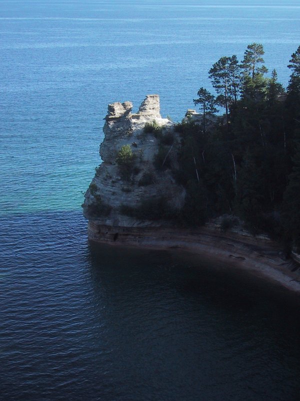
Miner's Castle
|
|
|
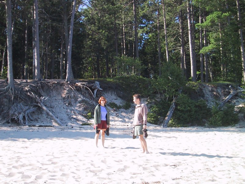
Caroline and Peter on Miner's Beach
|
After we leave this area, the drive is unremarkable other than being a good impression of life before Interstate highways. We need to get west to Duluth, MN and that's hundreds of kilometres away as the crow flies and it's all non-freeway travel. It varies from relatively empty two-lanes where we easily make 120km/h to urban corridor where one town, with its fast food joints, gas stations and car dealerships, seems to abut the next.
We eventually end up on a quiet two-lane road with virtually no traffic and manage a very good speed on it. Eventually we join Highway 2 at a town called Wakefield. After we fill up on Kentucky Fried Chicken and pizza, a car shuffle is done, and I am assigned to drive the van. Ewart takes the lead in my car. This is not a good arrangement. Traffic on the highway is very heavy and generally moving at 90km/h (the speed limit). Ewart muscles his way ahead using the adequate passing power of my car, whereas I'm driving this minivan which seems to float through the scenery, with steering, accelerator and brake input just applying a general bias to where it floats. I can't believe Andrew can make it keep up with my car when I drive it at the hardest, but such is the difference in our skill levels. I get very stressed and cranky, as Luc attempts to feed jazz music into the car's stereo using a little radio transmitter we have brought, but the tuning continually drifts so it's mostly hiss, plus I'm trying to eat pizza, plus I'm trying to keep up with Ewart's passing maneuvers and I'm getting ribbed about it all by everyone.
Fortunately Luc gives up on the music, the food is eaten and a quieter stretch of highway reached. Also I'm introduced to what remains of Caroline's unbelievably good white chocolate fudge! I am shameless and eat up most of what's left. Yum-my! This after Andrew and I already demolished a good portion of her equally delicious hard toffee.
After a long drive, we reach Duluth. This is the western end of the Great Lakes system and thus has extensive harbour and rail facilities. We find a scenic overlook on a hillside and take in the panorama.
Andrew now drives, and we head south on Interstate 35 at a good clip. We get off soon, to go diagonally across country to I94 on country roads. These aren't too bad. Stopped for gas and munchies, we go into a Radio Shack to see about a cassette adapter to better feed audio from the laptop computer into the van's stereo. Instead we find a better radio transmitter gadget! This one has fixed frequencies instead of analog tuning, and thus doesn't drift, and works perfectly. I immediately go in and buy a second one to keep for myself, as I'm not sure the Canadian Radio Shack would have them (I later check, and they don't).
Regaled by a recorded CBC Ideas episode about famous impostors, we motor on. The idea is to go northwest on I94 and then west, eventually to cross country south to I90. But seeing how slowly the little arrow creeps along the interstate when zoomed out, we change our minds, and head off cross-country again -- incidentally at exactly the bearing toward Yellowstone National Park (253 degrees) until we intersect I29 which goes south to I90.
We stop at the edge of a flat river valley but not for long, as we get attacked with such ferocity by mosquitoes that I immediately understand what it is the Winnipegers always talk about.
Ewart and Caroline are in my car, and happy to continue driving it even though its air conditioning has conked out again and it is quite hot.
|
|
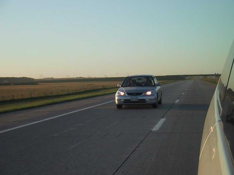
Speeding down I29
|
The land is obviously all farmed, with lots of corn, some grazing and some haying. But you can go for 10 minutes or more at freeway speed and not see a building. This is big country. I still can't believe this perfect, smooth, quiet concrete freeway (it doesn't even have bumps between sections of concrete) - we're just gliding along at a great (and legal) speed and we can see (once we go up a sort of escarpment to a higher level of land) as far as the haze allows over flat country. There's no point trying to get this in a picture though. Luc, having put up with CBC Ideas, and two CDs from Peter (one Peter Gabriel, and one Led Zeppelin) now plays some jazz, but picks some that even Peter and I find quite relaxing and listenable so there is harmony in the car. Especially since we stopped at a store and stocked up on chocolate milk and edibles.
|
|
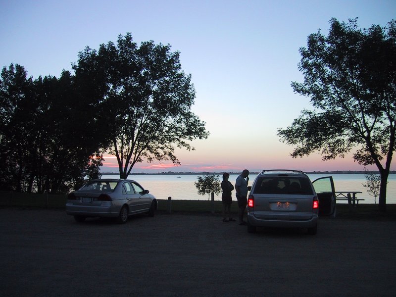
Looking for camping
|
The spot is quite nice, on the edge of the lake. After we set up, I go for a short swim, and the water temperature is wonderful.
My trip odometer shows 40,114km, so in a day and a half of driving we have covered 2,113km. Not bad really. Tomorrow we should reach the first of our actual trip destinations.