I've half convinced him to give us an extra half hour, but then Ewart's alarm goes off and we're up.
Luc: Bloody mosquitoes!!
We make a fairly good pack-up and getaway, and it starts to get light about the time we're getting gas and drinkables at the Cowboy Convenience Store out on the main street.
|
|
|
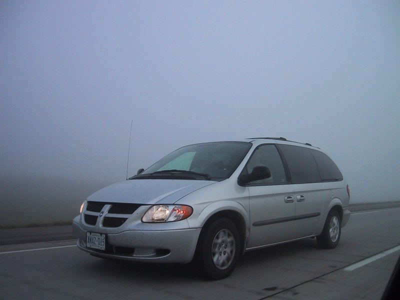
Driving in the fog on I29
|
Luc: Thousand clicks to go, McDonald's not going down so smoothly. Bloody fog!!
We reach the Missouri River, which is wide and stately, crossed by a very nice railway bridge and the twin strips of concrete of the interstate. Its valley marks an abrupt change in the landscape - you drive off a fairly flat plateau on one side, and then emerge into rolling hills on the other. We do not get a picture of this, unfortunately. At this point the trees also mostly vanish - the rolling hills are covered with just grass as far as the eye can see.
The rolling hills eventually become less pronounced, so you can see for maybe 10-20km in most directions. We drive and drive. The trip odometer indicates 400, 500, 600 kilometres since the morning's fillup and we are buzzing along at a steady 135-140km/h (almost legal, as the speed limit is 75mph) and the landscape changes little if at all, and you look at the navigation screen on the laptop, zoomed out to continent scale, and my God, how little of the way "across" we've gone. The freeway goes ever on, often arrow straight, like a gleaming twin ribbon laid down over the rolling landscape, heading always exactly West, 270 degrees. No police, no towns, no forests, no lakes, just the occasional homestead with its electrical power line coming in from somewhere far, far away.
Luc: "Help manage wildlife, wear fur!!" (billboard, South Dakota)
The air conditioning in my car seems dead for good. The outside temperature climbs to a desert-like 35°C (estimated). We (Luc and I) blast along the freeway, sweating, with the windows partly open. When radio communications are required the alert signal is needed so I can hold the radio to my ear to listen.
|
|
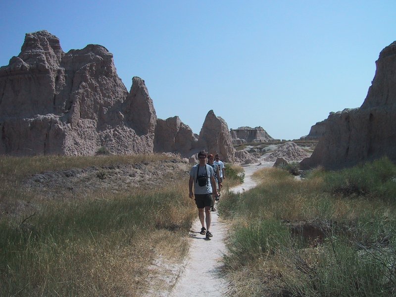
On the Trail in Badlands
|
We stop for gas, then soon enter Badlands National Park. Technically, Badlands are a particular type of clay formation; you can also find them in Death Valley and in Alberta. We go for a short walk. The heat is stupefying. Luc, who has the upper body for it, goes shirtless with his t-shirt wrapped around his head as a bandanna. Ewart says he looks like a proper Arab (that's Ay-Rab). All this reminds me exactly of wandering around in the Golden Canyon area of Death Valley.
We return to the hot car, put all the windows down and go for the scenic loop through the park. The heat actually becomes manageable this way, plus Luc puts on some electronic music that I've never heard before and really like, and which goes quite well with the heat and the parched but spectacular scenery all around.
At another stop, Andrew summarily moves us to the van, and takes over the car with Caroline. I aim all available air conditioner nozzles at myself, full blast, and bask in the cold. Later we exchange electronic gear so we can get fully settled in, and I can work on the log. To my considerable disappointment, we skip Wall Drug after seeing at least a hundred imaginative billboards for it over the last several hundred kilometres. Ewart drives, continuing west on I90. A hazy blue ridge appears on the horizon. We are informed that these are the Black Hills, home of Mount Rushmore, which is our next stop.
We drive through Rapid City and emerge on Mt. Rushmore Road. Gee, I wonder where that goes? A four-lane divided highway heads into the hills. There are crystal caverns, museums, hotels with the best view of the faces, authentic gold mine experiences and KOA campgrounds everywhere. The clutter gets thicker and thicker until it abruptly stops at the park boundary, where there are still two miles to go to ground zero. A Humvee labours past, towing a camper and a plume of black smoke. All the world seems to be pouring into this place (actually, the highway continues past it).
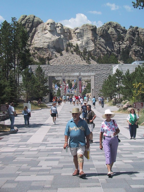
We stop a few times where the famous faces are visible over the trees. I had envisioned them as large, in the sense that they occupy most of the height of a small mountain. Well large they may be, but relative to the pinnacle into which they are carved, they are small, only perhaps the top 10% of the height. As a result they look small. Somehow they always seem to miss this fact in the postcard views.
|
|
Tourists at the foot of Mount Rushmore
|
I am let out and dash around, snapping off pictures where I can. On the way out, we stop a few more times and photograph such angles as we can get. Andrew assures me that this is as good as it gets, and a view of a poster later confirms it, so we haven't missed anything (like for example hiking to the top of a pinnacle for a better view or something like that, not allowed anyway).
We stop in the tourist clutter of "Hill City" on the way out and indulge ourselves at Dairy Queen (Peter only after finding the tablets for his lactose intolerance). A conference is held on what we should do now, should we do a similar touch-and-go at Devil's Tower (our next stop) or skip it altogether? We are running late, and still many hundreds of kilometres from Jelly- oh, make that Yellowstone National Park (the tourist clutter on the way in included a motel/campground named Jellystone Park).
After another glitch (a fried FRS radio) we reestablish communications between the cars, and thread our way onward through the Black Hills (on an ordinary two-lane road now). The hills are very nice, although mostly unviewed by me as I am typing this log on my lap.
We go down a long, engine-braking descent of at least 2000 feet, threading our way downward through hills that are not nearly as high as that (meaning we are passing from higher hills through lower ones). In a hollow at the bottom is the town of Deadwood, apparently connected to "Wild Bill" Hickock or something like that (billboards all over South Dakota). Certainly it seems to get enough tourist traffic. We just drive through.
Soon after that we rejoin I90 and continue westward until it is time to go on the backroads to Devil's Tower. Ewart and I are now the designated crew for the sweatmobile. Somehow I've been relegated to the passenger role, Ewart quite enjoying driving my vehicle and saying so. I do a coup d'etat and regain the driver's seat after a photo stop when the tower first comes into spectacular view complete with many square miles of surrounding cow country. Speaking of cow country, this part of Wyoming is just lovely, rolling grassy hills with stands of trees, rustic barns and fences, you name it. And, we drove by Sundance, you remember of course Butch Cassidy and the Sundance Kid, as well as the Sundance Film festival (though Andrew tells me that is held in Park City, Utah).
|
|
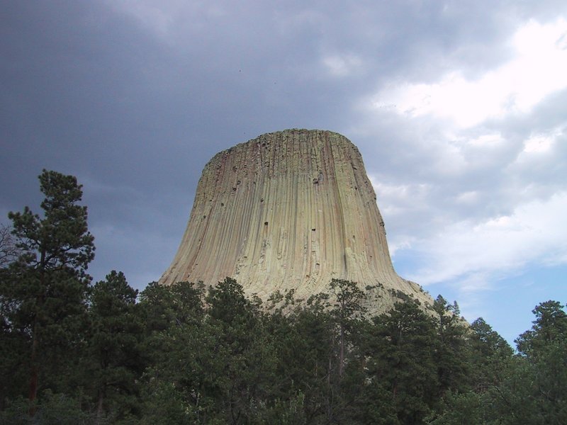
Devil's Tower
|
Everyone's seen pictures of Devil's Tower, but it's still pretty spectacular up close. We arrive in the parking lot at the base. We stare at the structure towering over the trees, take a couple of snaps and... time to leave. What? We just got here! We detoured for probably at least an hour and now we're going to stand here for five minutes next to the idling tour bus and do the idiot tourist thing and leave? I make a minor scene. It doesn't look like I convince anyone, but while I'm in the washroom a plan is apparently hatched and, OK, we will do the 2km paved loop trail around the thing. A thunderstorm is coming in, with the sharp uptake of wind that usually precedes the first few droplets of the deluge. But Andrew casts an expert eye at the clouds and prophesies that we'll definitely miss the worst of it because it's on the way through with clear blue sky behind. To be safe, we all grab our waterproof jackets.
Off we march. Andrew's weather prediction is correct. The trail and the views from it are beautiful. We watch some climbers climbing. I do have to pay for every photo stop with a run as I catch up to the others who just keep walking.
The trail goes along the bottom of a talus slope on one side, further into the woods on another, and along the "base wall" of the tower elsewhere. It passes by a broken-off chunk of column lying in the trees. The chunk is huge, probably 5m in diameter. Considering how small the columns look, you get the idea how big this spire is. I photograph a famously broken but not fallen column through a telescope that is provided trailside for watching the climbers (no climber activity visible from this angle, other than one guy belaying his buddy).
|
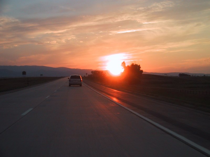
|
Sunset over I90 approaching Sheridan, WY
|
Later, as we continue west on I90, the sun sets over a high hazy ridge on the horizon - the Big Horn Mountains. We have arrived at the Rockies.
Because of the scenic stuff we did today, going all the way to Cody, WY is not practical. So we find a motel instead in Sheridan, which is several hundred kilometres short. This does mean getting up early again tomorrow.