
|
|
Hiking to Shoshone Geyser Basin
|
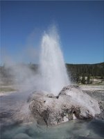
We reach the geothermal area. There are pools of boiling water, burbling geysers ringed by solidified mineral matter, steaming holes in the ground and so on. The smell of hydrogen sulfide wafts everywhere. A structure that at first looks like an extinct geyser comes to life,

|
|
Backcountry geyser
|
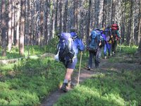
Without even leaving the smelly area, we sit down and have food and drink, since it is plain that this hike is turning out longer than expected. Then we march off on the 6.3 mile leg to the Lone Star Geyser. After a few uphills, I run out of energy and fall behind. I settle into a slow, manageable pace. The others periodically wait up. I ask to be relieved of some weight, and Peter takes my tent and Andrew takes my air mattress, which he wears on his head. At a later break I eat a salty pepperoni and drink more water, and this actually helps, I feel better, and can keep up with the group again.
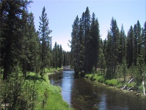
The scenery is pretty. Coniferous trees in green grassy meadows. Meandering rivers of crystal clear water. Swamp flowers. Open glades with campsites (unoccupied, one guesses because of the heat and the bugs). I remark that every time I tell someone how awesome Yosemite is, they immediately come back with "but have you seen Yellowstone?" Well now I have, and it sure is pretty, but Yosemite is that plus spectacular as well. Andrew says I haven't really seen much of Yellowstone so I can't pass judgment.
We cross the Continental Divide. It's not much. The trail goes slightly uphill in the woods, then there is a steel signpost with no sign, then it goes slightly downhill from there. I get a picture of Ewart straddling the continental divide, one leg (theoretically) in each of the Atlantic and Pacific drainage basins.
It is very hot. We run out of water, and stop at the river and purify more using Ewart's filter pump. At this point, the Firehole River is still upstream of most of the geothermal stuff further down and the water does not taste of sulfur at all, it is perfect.
It takes a long time to get to the Lone Star Geyser. This is a big geyser, but it only goes off every 3 hours or so, and from the slight steam arising from its impressive cone, it is apparent that it has gone recently and won't again for at least two hours.

|
|
Firehole River
|
We load up the cars, and immediately drive off to Grand Teton National Park, which is just south of Yellowstone. We skip Old Faithful - Andrew says if we really have to see it we can do it on the way back north. The other famous features of Yellowstone would take too long to get to - this is a big park.
On the way, we drive through a vast area of dead trees. A huge forest fire raged here in 1988.
Snow-capped mountains are visible ahead. Andrew radios back "there's a major view coming up" and so it is - the majestic Grand Tetons visible across a glittering blue lake. We all pile out of the cars, and I take a panorama photo. From this perspective, our goal, Teewinot Mountain, is still way off to the south.
We make camp at the Colter Bay campground, where there are showers.
I have a problem. I have missed so much sleep now that tiredness comes in waves - I am alert for a while, then too tired to function for a while, repeat ad infinitum. Packing up tonight for the tough Teewinot ascent, and then doing it starting at 2AM tomorrow, is inconceivable in my state. The others accommodate me by agreeing that we should have a rest day tomorrow. This gives me one more chance to catch up on sleep.

|
|
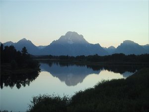
Evening view across the Snake River in Jackson Hole
|
I take three of the pills (normal adult dose: 2) and hit the sack. To believe the others, three such pills should knock me out cold. They don't. I still take forever to get to sleep, and I still wake up every hour or two. But perhaps the pills make it easier to fall asleep again. At least, in the morning I am simply able to go back to sleep for another hour and a half, and awake again with the sun high in the sky.