

As of October 3, 2004, Andrew and I are 46ers with our final ascent of Gray Peak. This hike log was started to document our 46er quest, but it includes lesser (but still nice) peaks and repeat ascents, and I will continue to add Adirondack hikes to it.
I'm not trying to become a winter 46er, but my winter count so far is 9.
I don't get to the Adirondacks much any more, but I had gotten some negative feedback about
having a geocache on
this mountain (planted exactly six years earlier). As a fellow hiker drily remarked, the Adirondacks are a "designated no-fun zone".
Seriously though, when an area is this popular, a "take only pictures, leave only footprints"
policy is justified, but the geocache had brought a number of people to this mountain
who would otherwise not have climbed one, so I don't feel all that guilty.
Anyway, this hike was to remove the cache. In Ottawa, they were still mowing green lawns,
but Ewart warned that we would need at least Yaktrax, so we bought some just for the
occasion, and they certainly came in useful. There was a lot of snow near the summit,
and it was pure luck that I found my cache again.
Pictures.
Previous hike of this mountain.
 This is the time of year for "spring to winter" hikes. At home in Ottawa,
the lawns are already greening, and by the time you reach the summit, you're walking on
four feet of snowpack, the top of it
freshly fallen.
This is the time of year for "spring to winter" hikes. At home in Ottawa,
the lawns are already greening, and by the time you reach the summit, you're walking on
four feet of snowpack, the top of it
freshly fallen.This was another of those less popular mountains that I trekked along with more experienced hikers on, years ago, without really paying attention to the map. Lisa had never seen Lower Ausable Lake. We hoped to ascend the trail that leaves from the lake's shore, but were advised against it at the entrance, so, even though we had brought crampons and ice axes for icy conditions, we ascended on the Alfred E. Weld Trail that goes up to Pyramid Peak. This was easy walking, first on dry ground, later on packed snow with snowshoes.
Nearing the Sawteeth Summit, we encountered some challenging steep sections which, on descent,
it was most practical to
slide down. At the summit, the track in the snow stopped, indicating
that nobody had gone up the other side (our original intended ascent route) in some time.
Pictures.
Previous hike of this mountain.
 This is how I like my Adirondack hikes: A super scenic ridge trail with views all the way up, and a full carload
so the ecological footprint of the 550km round trip is minimized.
This is how I like my Adirondack hikes: A super scenic ridge trail with views all the way up, and a full carload
so the ecological footprint of the 550km round trip is minimized.Daryl was getting married soon, and this was his stag weekend. Now why would a bunch of guys (and a girl) take you hiking in the wholesome fresh air of the Adirondacks on such an occasion? Would it not be more appropriate to take him to Montreal, get him drunk and leave him in an alley somewhere with a concrete ball chained to his leg and go back to Ottawa? It was precisely to avoid such a scenario that Daryl picked this particular crowd to entertain him on his stag weekend, he said.
Anyway, getting back to the hike. This is just a super trail. The views start almost immediately and continue all the way up, and there is a suitable bailout (the Giant's Nubble) for anyone who can't make the whole thing. And the top gives some (limited, because of tree coverage) views into Vermont as well as a 180 degree panorama of the high peaks.
The weather was glorious. On the top we met a couple of which the man had just climbed his 15th peak on his 46er quest and was posing for pictures with the number 15. I borrowed the digits to pose with them the other way around, because I had figured out that this was my 51st trip to the Adirondacks.
We finished by driving into the Ausable Club so certain parties could ooh and aah at the size of the
mountain we had just climbed. Pictures.
 Lisa decided late on Saturday that we had to do a mountain hike, and offered to
do all the driving. So I went along, and I'm glad I did because it was a wonderful
day and I finally got around to doing this neat little hike.
Lisa decided late on Saturday that we had to do a mountain hike, and offered to
do all the driving. So I went along, and I'm glad I did because it was a wonderful
day and I finally got around to doing this neat little hike.The Nun-da-ga-o ridge is rugged with many open rocky spots giving a spectacular panorama of the high peaks. At the start of the hike, a short side trip takes you to the top of Big Crow Mountain, and at the end, the trail goes over Weston Mountain. Also, you visit Lost Pond, though that was decidedly unimpressive at this time of year.
This was the day of the Lake Placid Ironman, and on the way home we ended up driving through there, which involved some delays, but allowed me to see a bit of this event for the first time. All the pictures
I just counted and this marks the 50th time I've been to the Adirondacks. That means
about 28,000 kilometres spent in automobiles. Are we a bunch of environmental
conservationionsts, or what. Note, one trip is not in this log because it rained
so hard that we ate breakfast at the Noonmark Diner and then drove straight back to Ottawa.
 My spring obsession, which is preparing for and riding the Rideau Lakes Cycle tour was
complete for another year. Pu's hiking group was going to Ampersand Mountain. Lisa wanted to go too, and this
caused Peter and Yi and me to go, and when Jenn heard about that, Andrew and she joined as well. So in the end there
was a totally unreasonable group size of
18 people. Awesome.
My spring obsession, which is preparing for and riding the Rideau Lakes Cycle tour was
complete for another year. Pu's hiking group was going to Ampersand Mountain. Lisa wanted to go too, and this
caused Peter and Yi and me to go, and when Jenn heard about that, Andrew and she joined as well. So in the end there
was a totally unreasonable group size of
18 people. Awesome.The weather forecast was reasonable but it was overcast most of the morning. With such an easy hike and so many people though, we started late: 7:30AM from Ottawa. So the hike ended up being in the afternoon and taking advantage of the clearing weather. Lisa was very happy to bag her second Adirondack summit, since her previous three hikes in this area were unsuccessful summit attempts.
When we were finished with the hike, the weather was so warm and lovely that we just had to go the extra mile
(literally) to visit the beach on Middle Saranac Lake that is accessible from the trailhead parking lot.
Some of us went swimming, but the photos of that are best kept private.
All the Pictures.
Andrew's writeup (with different photos).
Previous hike of Ampersand Mountain.
 The Forty-Sixer questionaire asks "Have you climbed MacNaughton?". I put "not yet"
as my answer. MacNaughton is high enough to qualify for Forty-Sixer status, but was missed because of
inaccurate measurements when the list was compiled. So it kind of belongs with the rest of the high
peaks and I resolved to do it eventually.
The Forty-Sixer questionaire asks "Have you climbed MacNaughton?". I put "not yet"
as my answer. MacNaughton is high enough to qualify for Forty-Sixer status, but was missed because of
inaccurate measurements when the list was compiled. So it kind of belongs with the rest of the high
peaks and I resolved to do it eventually.This is a long hike, 24km round trip from Adirondak Loj, and 3km of that is bushwhack. And the summit is treed with very limited views. But what the heck, I'd been told that the snow was gone from the mountains, and Jan also felt like a crazy hike, so off we went.
The trouble was that the mountains were not free of snow after all. Anything above 3000 feet elevation
was, in fact, mostly covered. And more than a quarter of this hike was above 3000 feet. Imagine breaking
through a snow crust every fifth step on average, banging the same spot on your leg every time you go
down, and wishing for the hundred thousandth time that you hadn't picked this one day to leave the
gaiters at home (and that you'd brought the snowshoes) and you get an idea how much fun this was. We
detoured through swamps and other terrain normally considered undesirable wherever possible. Occasionally
we would stop to wring out our socks. See the rest of the story with the pictures.
 While annotating hundreds of photos for my Adirondack View Browser,
I couldn't help but get intrigued by some minor mountains that aren't so frequently climbed but show up
prominently in landscape photos. One such is Avalanche Mountain, which is the bump between Mt. Colden and
Algonquin Peak. The vertical cliffs bypassed by the
Hitch Up Matildas on Avalanche Lake are
part of it. For something unusual to do, I proposed that we attempt a bushwhack climb of this trackless
peak on this last winter weekend. Having been defeated by such a bushwhack
before, I warned my compatriots that we might not reach the summit.
While annotating hundreds of photos for my Adirondack View Browser,
I couldn't help but get intrigued by some minor mountains that aren't so frequently climbed but show up
prominently in landscape photos. One such is Avalanche Mountain, which is the bump between Mt. Colden and
Algonquin Peak. The vertical cliffs bypassed by the
Hitch Up Matildas on Avalanche Lake are
part of it. For something unusual to do, I proposed that we attempt a bushwhack climb of this trackless
peak on this last winter weekend. Having been defeated by such a bushwhack
before, I warned my compatriots that we might not reach the summit.The weather was beautiful and we got going in Ottawa by 4:30AM. I had plotted a GPS route of the least steep way up the mountain, which goes up the spine of it from approximately Avalanche Lean-To. But a ranger we encountered there, who had climbed the mountain and knows the area well, advised against this, and told us we should go up the Avalanche Pass trail to a certain point and then cut across, which would cut 1/4 mile off our bushwhack. So we did that, but at the cost of crossing a deep ravine and then making a very steep ascent up the side of the mountain. Not far to the left of where we went up, there were sheer cliffs.
Nevertheless, we managed to reach the ridge and with it my originally planned route, as confirmed by the GPS. But the going did not get easier. The higher we went, the deeper the snow got, and by the time we were on top, the woods were dense and the snow so deep that there was no hope of avoiding the "spruce traps" but merely of treading gingerly and hoping not to break in too often.
When we first gained the ridge, we were 883 metres from the summit according to the GPS. A mighty struggle
brought us to 344 metres eventually, with the summit in sight and another 400 vertical feet to go. In another
hour and a half we might have reached it, but time and willpower were running out, so we turned around, and
reached the trailhead at South Meadow before dark. It was a noble failure.
All the pictures
 Three years ago this was the site of my first mountain snowshoe outing.
At that time, weather factors and the fact that most of our group gave up below the sub-summit caused
Andrew and me to turn around without summiting. So this mountain was always in the back of my mind
as one to re-do, especially as, once you've gained the sub-summit, you've gained virtually all the
vertical, and done all the steep scrambling.
Three years ago this was the site of my first mountain snowshoe outing.
At that time, weather factors and the fact that most of our group gave up below the sub-summit caused
Andrew and me to turn around without summiting. So this mountain was always in the back of my mind
as one to re-do, especially as, once you've gained the sub-summit, you've gained virtually all the
vertical, and done all the steep scrambling.Lisa and I got another perfect-weather day for this one. The hike did not start well, as we went up the wrong trail (not even noticing that we were on "No Trespassing" private property) and eventually had to bushwhack to look for the correct one. I blame this on a truck that was parked in front of the two red blazes that mark the proper trailhead, so I didn't see it. Anyway, the main trail was distinct enough to be followable until the faint snowshoe track turned toward the rocky steep section below the sub-summit. Having not been here in a while and knowing that the trail is not marked, I assumed this was the way up, and proceeded to climb it. Lisa was very uncomfortable with the steep and exposed rock, and decided to stay behind. A large group of hikers following behind us went to look for the proper way up.
Once on the sub-summit, I had to search for a while before I found the indistinct track in the snow heading toward the main summit. But I was then able to follow it and avoid serious bushwhacking. On the wind-blown upper part of the mountain, I lost the track again but by then it didn't matter.
Knowing that Lisa was waiting, I just took some quick pictures and went back down. The large group of hikers that was behind us had taken a long break on the sub-summit and despite my assurances that it was easy from here, decided to turn around. I followed their track to the proper descent route down the "chimney". Pictures. Previous (unsuccessful) climb of this mountain.
 Lisa is an experienced flatland hiker, but had little experience with snowshoes and none with hiking
up mountains. But when I suggested a winter stomp in the Adirondacks, where she had never been, she
went for it enthusiastically. Fortunately, we got a perfect weather day, with temperature about -5°C
at Adirondak Loj in the morning, and -14°C with only gentle wind on the summit. It's always nice
when you can wander around, eat sandwiches and take pictures without constantly fighting frostbite and
hypothermia.
Lisa is an experienced flatland hiker, but had little experience with snowshoes and none with hiking
up mountains. But when I suggested a winter stomp in the Adirondacks, where she had never been, she
went for it enthusiastically. Fortunately, we got a perfect weather day, with temperature about -5°C
at Adirondak Loj in the morning, and -14°C with only gentle wind on the summit. It's always nice
when you can wander around, eat sandwiches and take pictures without constantly fighting frostbite and
hypothermia.We went straight up and back down for a 12km distance with a bit over 3000 feet elevation gain. It had snowed heavily on the previous day, but the constant hiker traffic up this popular peak had compacted the trail again, so we had the best possible scenery with no additional effort. Lisa took a while to realize that if you slip on your snowshoes, you will not slide to your doom all the way down the mountain, and anyway to trust the traction of the things, especially on ice above the treeline.
The weather was perfectly clear, and the view was the best I've ever had from this mountain, and one of the best I've had in the Adirondacks. And with my new digital SLR, I got stunning 6 megapixel pictures. I assembled a stitched panorama of the southeast view (also available with the mountains labeled). Contrast this to the panorama looking the other way from Nippletop Mountain.
The descent is the best part of a snowshoe hike. Just march straight ahead, not having to worry about roots, rocks, slippery mud or water. And if it gets steep enough, sit down and slide. I had brought a couple of plastic bags to try Andrew's idea from last winter and boy, did it work. It was awesome, even if we did wipe out and land in deep snow a few times, and bump against some trees. All the Pictures.
 We wanted to hike as much as possible in order to keep our legs in shape for an upcoming
trek up Mt. Kilimanjaro in Africa.
It was, however, November, with the unsettled weather typical of that month. For this weekend,
it was at least not supposed to rain until later in the day on Saturday, so we picked a short hike. As it
happens, the Pitchoff Ridge (across the pass from Cascade Mountain) is a beautiful hike with probably the
most scenery-per-effort of any Adirondack hike I have ever done.
We wanted to hike as much as possible in order to keep our legs in shape for an upcoming
trek up Mt. Kilimanjaro in Africa.
It was, however, November, with the unsettled weather typical of that month. For this weekend,
it was at least not supposed to rain until later in the day on Saturday, so we picked a short hike. As it
happens, the Pitchoff Ridge (across the pass from Cascade Mountain) is a beautiful hike with probably the
most scenery-per-effort of any Adirondack hike I have ever done.While the weather doesn't look particularly pretty in the pictures, the high overcast blocks much of the ultraviolet light that causes the blue haze in distant views, the temperature was a relatively balmy 7°C and there was almost no wind.
I planted a geocache on the first subsummit you come to from the northeast. The views were first-rate in all directions and with three digital SLRs in operation, we took about 366 pictures between the lot of us, only the tiniest minority of which you can actually see here. The Pictures. Andrew's writeup and picture selection.
 Finally, it all came together! Andrew was back from his various trips, I felt in peak hiking shape,
and a good weather forecast beckoned for Sunday. We resolved to bag Gray Peak and complete our 46er
quest, and, because we are crazy, we decided to make a loop of it and also re-ascend Mts. Marcy and
Tabletop.
Finally, it all came together! Andrew was back from his various trips, I felt in peak hiking shape,
and a good weather forecast beckoned for Sunday. We resolved to bag Gray Peak and complete our 46er
quest, and, because we are crazy, we decided to make a loop of it and also re-ascend Mts. Marcy and
Tabletop.Because of the length of the hike (just under 33km) and the time of the year, we drove down on Saturday afternoon to camp out at South Meadow so we could start early. It started to rain right about the time we left Ottawa, and rained furiously throughout our 3 hour drive to Saranac Lake. At times the rain was so heavy that we had to slow down due to visibility, and lightning flashed all around, and in our minds, or mine at least was the thought, what are we doing here? How can we even think of setting up a tent in this? But we were there, so we stopped to eat at Pizza Hut, and by the time we were done, it had stopped raining, and when I got up in the middle of the night to look at the sky, it was clear.
We hit the trail just after 4AM. Since the first part (the truck road to Marcy Dam) is smooth and free of trip hazards, we walked it by moonlight without using our headlamps, which was great. We had to use lamps for the next segment to Avalanche Lake though because of the rougher trail.
The sun rose as we rounded Lake Colden. We ascended along the Opalescent River, whose normally spectacular cascades were looking unimpressive because of very low water flow, so we just kept marching instead of oohing and aahing and taking pictures, which is the normal procedure. In fairly short order, we had reached Lake Tear of the Clouds, where the herd path goes up to Gray Peak.
Gray Peak doesn't look like much, but the views from it are actually very good thanks to some open lookouts. And so we became 46ers. The day was now warming up, and beautifully clear and sunny, with views right into Vermont and little wind. Truly a fitting hike for this occasion.
The direct route from Gray to Marcy has a followable track, but it is pretty much a bushwhack since the vegetation is usually closed over the track. It took us a full hour to make our way to the open slope of Marcy above treeline.
We arrived on top of Mt. Marcy in t-shirts on an absolutely perfect October day. This was my third time on this summit, not counting one failed attempt, and by far the nicest. We thoroughly enjoyed and photographed the views. There was a summit steward here. We asked how late in the season they do this, and the guy said the next weekend would be the last.
After eating a leisurely lunch, we descended to Indian Falls and then up Tabletop Mountain, which was anticlimactic after Marcy and not as nice as in winter. I hated the steep descent, since I was getting tired, and my legs always get the sorest from that sort of downhill hiking. In the winter, we had simply sat down in the snow and slid down, which was much nicer.
The rest of the hike was mostly marked by the beautiful fall colours (which we had not seen in the morning because it was dark then). I've never managed to capture the vibrant colours with a camera, film or digital. You just have to go out there and see them firsthand. Pictures. Andrew's writeup. More interesting (winter) ascent of Tabletop.
 44 of the 46 peaks were in the bag and only Skylight and Gray remained. Andrew was also still
missing Gray to complete his 46, and currently away on a trip, so I thought I'd do just Skylight,
even though Gray is immediately adjacent and could be easily bagged at the same time, so that we
can finish together later. Peter and Yi felt up to the challenge and joined me.
44 of the 46 peaks were in the bag and only Skylight and Gray remained. Andrew was also still
missing Gray to complete his 46, and currently away on a trip, so I thought I'd do just Skylight,
even though Gray is immediately adjacent and could be easily bagged at the same time, so that we
can finish together later. Peter and Yi felt up to the challenge and joined me.Of course, Skylight is a very hard hike no matter how you approach it. We followed the route in the guidebook, which starts at Upper Works and is extremely scenic, with an open (logged) area with a view, many bridges over creeks, Calamity Pond, Flowed Lands, the Lake Colden dam, and the beautiful cascades of the Opalescent River.
We were slowed somewhat by the fact that the trails were very muddy, on account of the recent rains dumped here by the dying furies of Hurricane Frances. But the extra water made the thundering waterfalls along the Opalescent River all the more spectacular.
By the time we approached the 4000 foot level, Yi was getting tired and sent us on while she took a nap and then continued at her own slower pace. Peter and I were able to summit but only stayed 10 minutes before departing again. We took 13.5 hours for the 20 mile hike (my second-longest so far) and had to do the last three hours in darkness by headlamp. Doing Gray Peak too with the days this short would have been silly so it's just as well that it's saved for another hike. This was a beautiful hike with many great pictures.
 The Trap Dike is probably the most spectacular hike in all the Adirondacks.
I had climbed it twice before
but it's worth doing again and again. I also had a brand-new set of hiking boots that
I wanted to test thoroughly, and what better terrain for that than the steeply angled
slab rock on the side of Mt. Colden.
The Trap Dike is probably the most spectacular hike in all the Adirondacks.
I had climbed it twice before
but it's worth doing again and again. I also had a brand-new set of hiking boots that
I wanted to test thoroughly, and what better terrain for that than the steeply angled
slab rock on the side of Mt. Colden.I recruited six other people to go with me. Daryl in particular was eager to try this hike after hearing my enthusiastic stories about it in the past. Chris, Eduardo and Juan Carlos had never been in the Adirondacks at all so this would be quite an ambitious intro hike for them.
The weather had been miserable for most August so far, but a sunny day showed on the forecast for Sunday. At the last minute, the forecast shifted so the sunny day was Saturday (with rain on Friday and Sunday!) so that's when we went.
The weather was beautiful, and the hike uneventful until we got to the steep part of the Trap Dike. The rock was wet, I had difficulty climbing it and felt guilty at having brought six other people here without having climbing rope and harnesses to set up a belay if things got bad. Downclimbing the Trap Dike without such gear is out of the question at any rate. Fortunately most of my compadres were better climbers than I am, and we got up there in one piece.
The second glitch followed immediately, as precisely the three hikers who did not know the area, and had no map, went ahead without us. We could not find them again and went up the summit without them. This involves exiting the Trap Dike at the first opportunity, to get onto the band of open slab rock that goes up to the summit.
We had to wait quite a while while they had themselves a merry old bushwhack, ascending the mountain the hard way.
Apart from that, it was a great hike and everyone enjoyed themselves, though some announced that they would probably be sore the next day. We got back to Ottawa at midnight. Pictures. Chris's writeup. Same hike last year.
 Dix is a great looking mountain from all angles. I had never been in that part of the High Peaks before
(the closest had been looking across from Nippletop).
Dix is a great looking mountain from all angles. I had never been in that part of the High Peaks before
(the closest had been looking across from Nippletop).Dix is also close to four other so-called trailless peaks that were missing from my 46er count, and after the monster hike two weeks earlier, I certainly felt ready to do them in one go, and started casting about for others to go with me. Andrew and Ewart did. This was convenient since they are both old hands in this area, so I did not have to worry about navigation at all, and navigation is important when you're off the official trails.
The weather forecast was good, but when we got there it was cloudy. The hike up the open rocky slide on Macomb Mountain did not offer any distance views at all, but the clouds made a wooded hillside to the north look like tropical rainforest. The slide itself is very unusual for the Adirondacks, consisting of basically glacial till, as opposed to chunks of solid granite like most other places.
We didn't get much view from Macomb or South Dix (which was too bad, because there were some nice open rocky areas on the way) but we did get a good view eastward from East Dix, and the clouds lifted enough to allow us to see most of Hough Peak from there as well.
Once on Hough Peak, the clouds lifted enough to expose all of Mt. Dix, which is very impressive from this angle. The pointed subsummit you see from here is called the Beckhorn. It didn't take us long to get up there. The views from the top of Mt. Dix were spectactular. I tried to take a panorama, but was only partly successful due to digicam battery issues. At any rate, Dix is impressively steep on all sides, and amidst some very rugged scenery, and when the clouds are low above your head, it really feels like you are on top of something.
Just below the Beckhorn summit is a very interesting rock plateau where we stopped for more pictures. The rest of the hike was uneventful, but mostly sunny as the weather continued to improve. Pictures. Andrew's Writeup.
 We did it! The insane 34km, 8 summit, 8200ft elevation gain hike, the idea of which was first
given to us by the ladies we met on Noonmark in 2001.
We did it! The insane 34km, 8 summit, 8200ft elevation gain hike, the idea of which was first
given to us by the ladies we met on Noonmark in 2001.It took unselfish support by Ewart, an overnight campout, a 2AM start, unusual hydration measures and a lot of willpower. I walked farther than I ever had and gained more altitude in one day. I knew I would be sore, and indeed would spend the whole next week walking around stiffly. But was it ever worth it, if only for the sunrise on Marcy, and the glorious early morning light on Haystack.
We had Marcy, Haystack, Basin and Saddleback completely to ourselves, only encountering the usual crowds on Gothics and beyond. The hike took 15.5 hours. The rest of the story is with the pictures. Pictures and full story. Andrew's Writeup.
 I did not want to go into the mountains in May. Too much mud, and too many mosquitoes and blackflies.
But the others were going with or without me, and it would have been even less fun to do this hike
by myself, so I went along.
It turned out quite scenic, and due to a frost the night before, virtually bug free. There
was lots of mud though.
I did not want to go into the mountains in May. Too much mud, and too many mosquitoes and blackflies.
But the others were going with or without me, and it would have been even less fun to do this hike
by myself, so I went along.
It turned out quite scenic, and due to a frost the night before, virtually bug free. There
was lots of mud though.From the trailhead near Tupper Lake, we first ascended Mt. Donaldson by the direct trail that goes up there. Being an unmaintained "herd path" it is frequently blocked by blow-down.
On the summit of Donaldson, a pair of lookouts show much flatter country to the northeast, and rugged peaks in the west. From Donaldson, we went over to Emmons and back. This gave no particularly great views except of Long Lake.
Then we hiked back over Donaldson, and on to Seward. Seward did not give great views either, except this very good one of Ampersand Mountain and Lake. The descent from Seward was very steep but open, with views on the upper part.
Once we reached the main trail, the hike out was flat and uneventful. We finished the 24km hike in twelve hours. Pictures.
 Well, we almost made it. March 20 is the second day of spring this year, but still counts as a winter day
for the 46ers, so we would have bagged a winter ascent of Marcy. People who don't go into the mountains much
often wonder about this winter thing -- hasn't all the snow gone away by now in Ottawa, with temperatures
regularly above freezing?
Well, we almost made it. March 20 is the second day of spring this year, but still counts as a winter day
for the 46ers, so we would have bagged a winter ascent of Marcy. People who don't go into the mountains much
often wonder about this winter thing -- hasn't all the snow gone away by now in Ottawa, with temperatures
regularly above freezing?When Rick proposed this hike, with three Adirondack first-timers, I immediately made a nuisance of myself with emails on what to expect in terms of difficulty and conditions, what clothing and what gear to bring. It seems I nearly scared them off, and this without even mentioning the dicey weather forecast. Well, better that than go into the mountains unprepared in winter, that's my opinion. Anyway in the end all was well, we all had enough warm clothes and lights, and we did manage to finish the hike a half hour before total darkness.
We drove down the evening before and stayed at a motel. To my surprise, everyone was up at 6AM and an hour later found us in the Noonmark Diner eating breakfast. We got walking at 8:45AM. "I can't believe I'm going to be walking for the next ten hours" Elan was heard to say.
Rick and Paul were both wearing brand-new boots. In Paul's case this would prove to be an ordeal. He soon broke away from us and grimly, doggedly slogged his way almost to the summit and then back down as the stiff boots rubbed his heels raw. The rest of us took our merry old time, many times adjusting our clothing as we went into and out of windy areas, steep and not so steep slopes, and occasional rest stops.
Initially there were low-hanging clouds and falling snow, but these cleared out as we neared the summit, and once we got above tree line we actually had a pretty good distance view under the high overcast. But the weather continued unstable, and most of the group decided to turn around before tackling the last bit of climb to the summit. Marty and Elan seemed keen to go on, so the three of us slogged on. But the weather was changing. Clouds were enveloping nearby summits, and the fierce wind drove snow into our faces with such intensity that it stung. Tracks in the snow were obliterated within minutes. We were warm enough, fortunately, but I was worried that we would push on to the summit, where every way is downhill, and then get enveloped by whiteout and not know our way back down. The boys' enthusiasm was also waning. So we turned around, only 150m or so farther than the others had and still at least 200m from the summit proper.
The weather got worse and worse as we hiked out, with areas that had been calm and sheltered before now getting quite a bit of wind, and snow falling constantly. I was deprived of the usual winter pleasure of sliding down the steeper parts of trail, because the soft fresh snow proved not slippery enough.
It took us almost until nightfall to hike out. Paul had been waiting for two and a half hours.
The drive home was messy, but fortunately the roads were only slushy until we got out of the Adirondacks.
 Hurricane is one of the "easy" mountains below 4000 feet that nevertheless give a beautiful view.
I'd been wanting to do it for a while. Andrew wanted to introduce a couple of his colleagues to the
Adirondacks and also invite a couple of others who we had never hiked with.
Hurricane is one of the "easy" mountains below 4000 feet that nevertheless give a beautiful view.
I'd been wanting to do it for a while. Andrew wanted to introduce a couple of his colleagues to the
Adirondacks and also invite a couple of others who we had never hiked with.Because of the shortness of the hike, and because we wanted to finish it at about the right time to drive to Kingston and hit a bar there, we started very late: 8AM departure from Andrew's house. It felt strange driving down there practically in the middle of the day, but since the weather was gradually improving from overcast to clear, it was actually advantageous to do this short hike later in the day.
Everyone in the group was fit and hiked quickly, so we made the ascent in about two hours. There is little to say about it other than that there was virtually no snow on the ground until we got above 3000 feet or so, and even then there was not much.
When we emerged onto the summit ridge, we were hit by a gale-force wind which forced us to don all our winter clothing to stay warm, even though the temperature was a mild -4°C or so. The 360° view from the summit is one of the best in all the Adirondacks, with dozens of the high peaks visible. The only downside was that it was a bit hazy and the light was from the wrong direction.
I've always been intrigued by fire tower mountains, and this was my first one with a tower still standing. I had to climb it of course, carefully because of the wind, the snow on the steps and the fact that the two bottom flights of stairs had been removed to discourage climbing.
After soaking in the scenery and eating lunch - at one point the wind seized my bag of salty snacks and scattered some of the contents over the others sitting downwind, prompting Asmir to exclaim "Manna from heaven!" - we hiked out again, and finished the hike still in sunlight.
Pictures. Andrew's summit log entry. Andrew's annotated picture gallery.
 I had skipped several Adirondack outings because of the brutal cold (daytime highs of -25°C)
and just about given up winter hiking, when I found myself skating on the Rideau Canal with a friend
on Saturday, and, holy macro, it feels like spring. It was such a beautiful day that I immediately
decided to go along when I heard Andrew wanted to go hiking on Sunday.
I had skipped several Adirondack outings because of the brutal cold (daytime highs of -25°C)
and just about given up winter hiking, when I found myself skating on the Rideau Canal with a friend
on Saturday, and, holy macro, it feels like spring. It was such a beautiful day that I immediately
decided to go along when I heard Andrew wanted to go hiking on Sunday.The weather did not disappoint. It was barely below freezing when we started, and it hit a balmy high of around 8°C with sunshine and very little wind. All winter outings should be like this!
We started from the ghost town at the Upper Works trailhead (I will have to come back just to explore that thoroughly before the buildings collapse and it's all gone) and had an easy, gradually sloping hike up to Calamity Pond and then the Flowed Lands. Andrew's planned route was to go to the dam at Lake Colden, then up the Opalescent River, but when we followed the well-trod snowshoe track in the open area, it headed straight to Cliff Mountain and up it. We decided to follow.
The track was very good, totally firm and with very little bushwhacking, so the ascent was easy and pleasant. The summit is wooded, but with the heavy snow cover and the thinness of the trees, the magnificent mountain panorama all around (Iroquois, Algonquin, Colden, Marcy, Gray, Skylight, Redfield) was viewable. We could not find a summit marker of any kind.
The way out was easy as well, with occasional fun sliding. Andrew had brought a heavy plastic garbage bag, and this proved to slip better than plain snow pants, and he managed long stretches of sliding. We stopped at the well-preserved monument at Calamity Pond.
We finished the hike with plenty of sunlight remaining. A thoroughly pleasant outing, and another peak bagged for the 46er collection. Pictures. Andrew's log entry.
 Ah, Esther mountain, annoying little asterisk on any list of 46er peaks still to be conquered.
We'd meant to do it twice before and
were prevented both times by unforeseen circumstances.
Ah, Esther mountain, annoying little asterisk on any list of 46er peaks still to be conquered.
We'd meant to do it twice before and
were prevented both times by unforeseen circumstances.In this case, we were going out to dinner in the evening, so if a hike was going to be done it had to be a short one, so we drove down just to climb Esther. In the photos it might look like we did this very late in the day, but they are so orange-toned because Andrew mis-set the colour balance on his camera.
We'd had a blessed mild spell recently, after the record cold of January 2004, and also I had been down here skiing on Whiteface a week earlier in reasonable temperatures, so I had my hopes up for a less hardcore winter outing. It was not to be, since this ascent goes up the west side of a rather exposed mountain, and as a result it was very windy at an ambient temperature around -17°C.
This was truly trailless. Starting about 800m up the toll road, we ascended along a recognizable snowshoe track. This went through a band of very tangled woods before emerging on the ridge about 700m north of the summit. As soon as we crossed the top of the ridge, even a little bit, we were shielded from the wind and the conditions became much more enjoyable.
Considering that this is a fully wooded summit, the views are actually very good, perhaps because of the thickness of the snow cover which elevates you above the smaller trees. Neighbouring Whiteface Mountain looks beautiful from this as from all other angles (and here is the view back in the other direction from the Whiteface summit).
The way down was unproblematic, and we finished shortly after noon. I did finally shred my snow pants from sliding on my bum wherever possible, and wreck the elastic cord stuff on the back of my pack when it got tangled in the woods and I didn't notice until it was stretched out to several metres. Pictures. Andrew's Page.
 This route is rightfully called one of the most scenic, and considering the distance (about 18km)
one of the harder hikes in the Adirondacks. The reason it's so scenic is that it follows a
ridge that is mostly treeless because of a forest fire in 1913, and the reason it's so hard
is that the ridge is made up of many little bumps and bigger summits, amounting to a total
climb of 5300 feet by the time you top Giant Mountain.
This route is rightfully called one of the most scenic, and considering the distance (about 18km)
one of the harder hikes in the Adirondacks. The reason it's so scenic is that it follows a
ridge that is mostly treeless because of a forest fire in 1913, and the reason it's so hard
is that the ridge is made up of many little bumps and bigger summits, amounting to a total
climb of 5300 feet by the time you top Giant Mountain.We did a car shuttle and traversed the route from east to west. The weather was clear and down in the valley there was no wind. It was bitterly cold, a thermometer in Saranac Lake on the way in having read -26°F (-32°C). Disappointingly, there was very little snow which meant that snowshoes could not be used at lower elevations, and we had to contend with slippery rocks, frozen creeks and other hazards.
The views start right away as you reach the first lookout on Blueberry Cobble, and continue until the major climb up the first subsummit of Rocky Peak, which is wooded (then resume as you get to the top of that). This is one spectacular hike; as you walk along you eventually get jaded about the amount of openness even though it is so rare in the Adirondacks.
It would be nice if this was a delightful stroll through wintry woods, but the fact is, it is a strenuous hike, and with the extreme cold, a lot of stuff becomes difficult. Such as buckling up your pack straps when your arms can't bend far enough because of four layers of clothing, or hands that hurt from the cold almost the instant you take your gloves off, or precious core temperature being lost as you struggle to put them back on, or frost building up on your fleece jacket as water vapour from your sweat freezes the moment it hits the atmosphere (and the fleece, taken off during a hard climb in a wind sheltered area, freezes solid in your pack). Or the ice crystals in your sandwiches, or the crunchy chocolate, or the ice cold drinks starting to turn to slush which, combined with the fact that stopping to eat costs you body heat, cause you not to eat and drink enough which causes you to get even slower and colder. I nearly bonked with a third of the hike's climbing still left to go, and forced myself to eat a half-frozen sandwich, tasting about as good as cardboard at this point, and to drink three quarters of a liter of liquid which, thanks to insulation, was a little warmer than ice cold, as I started shivering because I'd taken off gloves and toque for the operation. It helped me make it through the hike. Fortunately everyone maintained good cheer as we did the last 700ft climb up Giant Mountain in total darkness, on the last of our strength.
We had been delayed at the border as US customs decided to search our vehicles after seeing the various visas and passport stamps (Afghanistan, Iran, ...) in Luc's passport, and we were running slow due to the tough trail conditions, so sunset caught up with us exactly as we summited Rocky Peak. All the rest of the hike was in darkness. We did the 300m side trail to the summit of Giant, to each stand on the summit rock for a few seconds, blasted by a wind which was now quite stiff with an ambient temperature around -30°C before scampering back into a sheltered area nearby.
I was only warm enough while moving, despite all the layers of clothing, in part, I guess because of the frozen sweat that had accumulated, in part because of a severe lack of hydration. But we were almost done, only about 4km to go to the car. But what a tough 4km it was. Just as soon as we were low enough for the snow to thin out and expose rock and ice, it got really steep and we had to pick our way down one icy patch at a time, extra slow because we only had three working headlamps among the five of us. We were all glad when we finally reached the blessed highway. The heat in the car was going full blast for most of the way back to Ottawa and we loved it. It was a 22.5 hour day by the time I got to bed. Pictures. Andrew's Page.
 My sister Johanna was visiting, and eager
to finally experience the Adirondacks for herself. The planned hike was modified
several times, lastly at the gas station in Saranac Lake. Andrew and I had both
done this hike before, but it is particularly scenic, and the weather was looking
promising. My last visit to Big Slide was fogged out and the one
before that was too long ago to really remember much from.
My sister Johanna was visiting, and eager
to finally experience the Adirondacks for herself. The planned hike was modified
several times, lastly at the gas station in Saranac Lake. Andrew and I had both
done this hike before, but it is particularly scenic, and the weather was looking
promising. My last visit to Big Slide was fogged out and the one
before that was too long ago to really remember much from.We had departed from Andrew's house in Ottawa at 4AM and thus it was not long after sunrise that we hit the trail from the Garden parking lot up the first of the Brothers. The trail gets steep right away, and it doesn't take long before you emerge from the trees into great views. Then it is a lovely open scramble over one little pinnacle after another, complicated at this time of year only by slippery snow and ice. My hiking boots are nearly worn out so I had to be particularly careful.
A bank of clouds was moving in by the time we went back into the woods from the last open spot on the Brothers, but more sunshine awaited us later when we got to the summit of Big Slide. All in all a very good day weatherwise.
We were all carrying crampons just in case, and on the steep trail up the Big Slide summit, I finally paused to put mine on. It was well worth it as I caught up to the others who had kept going, walking up the slope with the greatest ease (except for the huffing and puffing) whereas they carefully picked their steps while searching for handholds.
On the summit we enjoyed the spectacular 180° panorama that stretches from Hurricane and Giant Mountains in the east all the way to Algonquin and Wright in the west. The most jaggedly interesting summit from this vantage point is Basin.
Ewart wasn't feeling well, and had left us to hike on his own back over the Brothers. We could now do the direct trail down into the valley, or the detour over Yard Montain. I wanted to do the latter, and prevailed. The trail was not as good though, since it was untracked snow at first, and then muddy creek beds. This provided Johanna a thorough introduction to Adirondack hiking conditions, lest she think that smoothly trampled trail is the norm here.
We all had our fill of the mud when we reached Johns Brook Lodge, where we ate sandwiches and then trudged on the good "hiker highway" trail back to the car. All in all a very good 17km hike. Pictures. 2000 Hike. 1997 Hike. Andrew's Page. Johanna's page.
 Well, you win some and you lose some. As usual this fall, we headed down
to the Adirondacks with a marginal weather forecast, of cloud and possible rain
later in the day. As it turned out, it drizzled or outright rained most of the
day, and the 29km hike (from the Upper Works area) was extremely muddy. We got
soaked, and since the clouds started at about 2800ft, we never saw a thing from
the mountain itself.
Well, you win some and you lose some. As usual this fall, we headed down
to the Adirondacks with a marginal weather forecast, of cloud and possible rain
later in the day. As it turned out, it drizzled or outright rained most of the
day, and the 29km hike (from the Upper Works area) was extremely muddy. We got
soaked, and since the clouds started at about 2800ft, we never saw a thing from
the mountain itself.The hike was a mix of ATIS maintained trails, private roads, rough skidder tracks through butchered forest, unofficial but well-marked trail (with yellow disks made from a variety of materials), and bush trail so obscure that I could not follow it reliably. The actual ascent of the mountain was very steep and tricky on the wet slickrock, but that part of the "herd path" was easy to follow with lots of cairns and such. The snow we saw two weeks ago was all gone and the temperature was about 7°C at the base.
The best part of the whole day was getting back to the car after 12 hours on the trail, changing into dry clothes, and enjoying the full blast heat and leftover snacks on the drive home. Pictures. Andrew's Page.
 What an interesting and varied hike this was!
It didn't look too promising at first. We hiked in from South Meadow to Avalanche Lean-To in non-descript weather. The trail up to Lake Arnold is very rough, and the fresh dusting of snow on the rocks made the footing extra treacherous.
After Lake Arnold it got worse, especially going downhill, until we got into the flat swampy area with its plank bridges. We took a lunch break at one of the lean-tos in the Opalescent River area, and then started on the herd path up Redfield. Ewart said the herd path was terrible, with lots of blowdown. He had even brought a hatchet to avenge himself on the worst obstacles. But the path had been improved! The first half kilometer or so was marked with lots of trail marker tape and a way had been cut through the fallen trees with a chainsaw.
After the marked part, it was more difficult to follow the path as it went into and out of stream beds, but we got to the summit without any trouble. The higher we got, the more snow there was; on the summit there were at least six inches.
The view toward the south was clear, with Allen Mountain prominent in the foreground and very little haze due to the cold air and high cloud. On the other side, there was a very impressive view of Mt. Marcy.
The summit was quite busy, with two hikers awaiting three others who were coming up, so they could toast them on finishing their 46 peaks, another party of three just leaving, and one solo hiker who was underdressed in sweaty cotton and immediately left again after summiting. We put on our warm stuff and had a leisurely munchie and photo break.
The way down was unproblematic despite the snow. Back on the main trail, we decided to make a loop of it, and headed off to Lake Colden. This introduced me to all the beautiful waterfalls on the Opalescent River. I wished it was summer so I could strip to shorts and go play in the shimmering green pools below the falls. Some other time I guess.
Andrew said the trail on the southeast side of Lake Colden is absolutely terrible, but then the trail via Lake Arnold had been awful as well so we had nothing to lose. In the end, we went around the other side of Lake Colden, and the trail there was excellent.
We dropped in at the Interior Outpost, chatted with the ranger there, and got to see the inside of the cabin, which is very nice and an ideal place for a hermit to live!
We made it back to Avalanche Lean-To just as it got fully dark, and finished the rest of the hike by headlamp. Overall we had hiked 29.5km in just over 13 hours. A very satisfying hike. Pictures. Andrew's writeup.
 The weather forecast didn't look particularly good, but at least it probably wouldn't rain,
and we had been plagued by a lot of bad weather in Ottawa lately and wanted to get out there
and stretch our legs.
The weather forecast didn't look particularly good, but at least it probably wouldn't rain,
and we had been plagued by a lot of bad weather in Ottawa lately and wanted to get out there
and stretch our legs.Since it was just Andrew and myself this time, and you want to have lots of time margin on a "trailless" peak, we got going extra early: 4:30AM from my place. The drive down to the trailhead (near a small hamlet called Coreys, near Tupper Lake) was only 230km, considerably shorter than usual, so we arrived at just after 7AM.
The hike was uneventful: An easy 9km hike in the Ward's Brook Trail, until just after Ward's Brook Lean-To, a stone cairn marks a turnoff onto the "herd path" that goes up this "trail-less" peak.
The ascent was steep and muddy, and I was a bit slow because I had the beginnings of a cold. The path was easy to follow. The views from the available lookouts on the treed summit were good, considering the weather, exposing all the Seward Range, the Santanonis, and Ampersand Lake and Mountain.
We hiked out the same way we came in and finished at an unusually early 3PM. Pictures. Andrew's Writeup.
 We had hiked Colvin before, but neglected to do Blake at the time, because
Andrew had no 46er aspirations then, and I hadn't even heard of them at the time. Well, now we're
bagging these summits systematically, so we had to redo the whole hike because you have to
go over Colvin to get to Blake. The only bad part about that is the long way in and out on the
Ausable Club access road. The rest of the hike is very nice.
We had hiked Colvin before, but neglected to do Blake at the time, because
Andrew had no 46er aspirations then, and I hadn't even heard of them at the time. Well, now we're
bagging these summits systematically, so we had to redo the whole hike because you have to
go over Colvin to get to Blake. The only bad part about that is the long way in and out on the
Ausable Club access road. The rest of the hike is very nice.We detoured over Indian Head of course, which has one of the most spectactular views in the Adirondacks in my opinion. This time I took a 270° panorama photo of the view. This is a lovely spot to sit and have a snack, right on top of the cliff with steep dropoffs all around and the lake below.
We then went up Colvin, stopping briefly at the lookout on the Fish Hawk Cliffs, where you can look back at Indian Head and get an idea why it is called that.
Colvin itself doesn't look like much from any angle (see it here from the top of Nippletop), but when you're actually on top it gives a very spectacular view, dropping off very steeply toward the lake. Unfortunately the rest of the hike to Blake is mostly muddy and steep trail, and Blake itself is treed and gives no view whatsoever. But we can check it off our list now.
All in all a satisfying 25km hike. Pictures. Previous hike of Colvin. Andrew's page.
 The plan was to bag these three summits at the same time, because it's a relatively long hike to get to the area
and they are all close together. Because of the length of the hike, we drove down the previous afternoon
and camped out right by the parking lot near the old mine works. This was possible because we set up
after dark and left before it got light - we were hiking at 5AM.
The plan was to bag these three summits at the same time, because it's a relatively long hike to get to the area
and they are all close together. Because of the length of the hike, we drove down the previous afternoon
and camped out right by the parking lot near the old mine works. This was possible because we set up
after dark and left before it got light - we were hiking at 5AM.By the time it got light we were following Santanoni Brook up to Bradley Pond, and by the time the sun was up we were already going up Panther Peak.
This is all officially trailless, but when you have experts like Andrew and Ewart to guide you, you end up on trail anyway, except that it is not marked and called a "herd path" instead. Thus we arrived at the "Grand Junction" where trails branch off to the three summits.
The order of the summits was important. Couchsachraga being a long slog and not scenic could not be last, and Panther should be first because it was easy and we could do it while it was still morning.
Panther has nice views to the west, but to see to the east we had to stand on a rock right at the summit marker, which got us above the low scrubby trees. But only one person at a time could enjoy that view.
Then back to the junction, and off to Couchsachraga ("Coochie" as some local hikers we ran into called it) which is much lower than the other two, has no views because it is treed, and has a very twisty and overgrown path going to it, 2km each way from the junction. It took hours and we got good and scratched. But we had to do it if we ever want to be 46ers.
Finally, saving the best for last, we ascended Santanoni. It is treed too, but has some excellent lookouts and a fantastic view (panorama photo by Daryl). Especially considering that it is west of the high peaks, and it was now afternoon, so the light was in our favour.
The hike out was very long and we were all tired and thirsty by the time we got back to the cars just before nightfall. A very full and long day. Pictures. Andrew's page.
 This is my second time up Trap Dike and Andrew's third, but this hike is so nice that I'm sure I'll
be doing it again. We followed the same route as last time
but as a straight day trip, no overnight campout. With the long days at this time of year, we easily
did the whole thing in daytime.
This is my second time up Trap Dike and Andrew's third, but this hike is so nice that I'm sure I'll
be doing it again. We followed the same route as last time
but as a straight day trip, no overnight campout. With the long days at this time of year, we easily
did the whole thing in daytime.We parked at South Meadows and hiked in to Avalanche Lake at a brisk pace. After going around the far end of the lake, we followed the indistinct herd path that goes from there to the dike. My impression was that it does not get a lot of traffic.
We had brought no ropes or climbing gear this time. Not a problem, since, while steep, the dike is easy to climb, with hand and footholds everywhere. Luc, who is a very experienced climber, rated it as a "solid class 4". We made our way up fairly quickly, limited mostly by aerobic capacity and not climbing difficulty. When it came to exit the dike and go onto the slanting slickrock of the mountainside, Luc and Andree chose to climb the last bit, whereas I and the others went about 50m further to where we could walk straight out. Since we had no trouble finding the "exit" this time, I have no further apprehensions about leading this hike myself for other less-experienced participants, if it comes to that.
The weather was not perfect, but quite pleasant when it was breezy. There were only a few blackflies but they were determined biters.
After you exit Trap Dike, it's really just a matter of walking uphill on the slanting rock until you are at the summit. It looks so easy, but with the steep slope, it takes a while. Once you're sitting up there and watching other people come up (one of them in a skirt and perky hat, strange) it still looks as though they're only minutes away, when really they have 20 minutes of climb left. However, this mode of getting up a mountain beats a zigzag bush trail any day in my book. Our group's total ascent time from Avalanche Lake to the summit was two hours.
On this particular (July 4th) weekend, there was a summit steward posted on Colden. Normally only Marcy and Algonquin rate one. However it really wasn't a very busy day.
On the way out, we had a nice break at Marcy Dam while I donned swimming goggles and made another attempt at the lost lens cap. It was hopeless though, the bottom was a mess of rocks and sunken wood and soft muck, and any attempt to poke around for the now-invisible object of my search raised such a cloud of silt that visibility was reduced to six inches. So I gave up and went for a swim instead. The water temperature was very pleasant now, but it was hard to swim in it because it was only a few feet deep, with large mud banks showing. Given the water level was only about a foot below the lip of the dam, it is clear that there is less to this lake than meets the eye. I wonder if it will eventually silt up completely. Pictures. Andrew's Page. Winter ascent of Colden. Previous Trap Dike hike.
 After a hiatus mostly spent bicycling, and needing
to get our hiking legs back for an upcoming trip out west, we decided to do an easy
warmup. Phelps was still missing from my list of peaks, and since the others didn't
have any strong preferences that's where we went.
After a hiatus mostly spent bicycling, and needing
to get our hiking legs back for an upcoming trip out west, we decided to do an easy
warmup. Phelps was still missing from my list of peaks, and since the others didn't
have any strong preferences that's where we went.For variety, and to save the parking fees, we hiked in from South Meadows, which is not much farther from Marcy Dam than Adirondak Loj is. The trail, which is really a vehicle road off limits to the public, is unusually even for this area.
Not much to say about the short hike, other than the bugs weren't too bad and the views from Phelps really are quite good for a treed summit that doesn't look like much from below. The weather was overcast, but with high cloud so the views were unimpeded.
Stopped at Marcy Dam on the way back, we watched a guy try to fish an irreplaceable lens cap out of the water. I stripped to shorts and tried to help, but the water was so cold that I wimped out without accomplishing anything. Pictures. Andrew's Page.
 This is our first real trailless winter ascent (we failed last time we tried something like this). Mount Marshall is the next mountain after Iroquois in the
MacIntyre Range. To get there from Heart Lake, you can either go through Avalanche Pass,
or down the Indian Pass Trail. We planned to make a loop of it.
This is our first real trailless winter ascent (we failed last time we tried something like this). Mount Marshall is the next mountain after Iroquois in the
MacIntyre Range. To get there from Heart Lake, you can either go through Avalanche Pass,
or down the Indian Pass Trail. We planned to make a loop of it.The weather was pretty good, partly sunny and with a high around freezing. We got started at 8:15AM at Adirondak Loj, taking advantage of the winter by walking straight across Heart Lake, and walked down the fairly level and well-packed trail toward Indian Pass. The further away we got, the less well-packed the trail got, and by the time we turned left to go up the Algonquin Pass Trail, we were pretty much packing down our own trail.
We got to the top of the pass without much trouble, but then the summit of Mt. Marshall was still about 650m away as the crow flies. A "herd path" is supposed to go up to it from this area, so we looked for it and found a faint snowshoe trail going into the woods. We soon lost this however.
After much bushwhacking, involving many detours to get around dense woods and steep slopes, we were finally on top of something with a view, but it was a false summit: Mount Marshall was still half a kilometer away (see image) and there was no hope of finding a trail now and we were standing in a virtual minefield of spruce traps.
Andrew assured us that a well-packed trail goes up to the summit from the Lake Colden area, so if only we could hack our way across there we'd be home free.
It actually only took an hour to get across, though it seemed longer. We took turns at who would find the route and break the trail in front, with Constantine doing good work on the climb. We broke in at many soft spots and got covered by much snow and by the end I got so tired that every step forward and up into the soft snow took a mental effort. But we were all encouraged by the inviting trail from the summit that everyone else uses.
Only, the trail wasn't there. Our summit stay was brief, ingesting some sorely needed calories and poking our heads out the various lookouts available on this treed summit while the weather darkened. Andrew scouted everywhere for the way down to Lake Colden, but we could find no evidence of it. The day was starting to fade, so a decision had to be made: We would abort the loop, and backtrack all the way out the way we came in. Given how tired I was by now, I was pretty unhappy about doing that bushwhack again, but I soon learned something: Once a dozen people have trampled it down (I was near the back on the way out) even the scariest steep bushwhack snowshoe trail becomes a walk in the park. Very soon, we were back on the real trail.
From there it was just a long, long slog out by headlight. The total round trip was just over 25 kilometres and we had been on our feet for 12 hours. Andree, Constantine, Ewart and I thought it was long enough. The others charged out there, finishing 20 minutes earlier, with no sign of wear. Pictures. Andrew's writeup.
 For this weekend, Andrew and I felt like heading out by ourselves to just do a mountain
or two at our own speed. Andrew wanted to do Tabletop again. This time he was sure
he knew the way up.
For this weekend, Andrew and I felt like heading out by ourselves to just do a mountain
or two at our own speed. Andrew wanted to do Tabletop again. This time he was sure
he knew the way up.Andrew likes to get going really early - 2AM starts are nothing unusual on trips he organizes - and I'm not a reliable sleeper. So I had my alarm set for 4AM but Andrew had told me, if I happen to be up earlier, to just call him then. Sure enough, I was awake at 2:30AM with little hope of getting to sleep again before I had to get up anyway. The end result was that we departed from Andrew's house at 3:30AM, which was the earliest we've ever managed for an Adirondack trip.
The drive down and hike in were efficient, and we were sitting at Indian Falls by the time we would have pulled into the parking lot on a normal trip. The small picture shows Tabletop mountain just after sunrise, seen from Marcy Dam.
When we last tried to do this mountain, we searched up and down
the main trail near Indian Falls for the turnoff to the undocumented "herd path"
to Tabletop. We didn't find it and tried a frustrating, unsuccessful bushwhack.
This time our mistake was clear: The turnoff was 5 metres past where we stopped looking
(off the ski trail, just below where the foot path and ski trail from Marcy Dam merge up)
and there was no possible way to miss it.
So we charged up there with very little difficulty. The weather was lovely, hardly
any wind and not very cold. Thanks to the heavy snow cover, you can stand on a
summit
that is completely treed, and still be elevated above the small trees to get a panoramic
view. Various summits like Colden, Cascade and Wright Peak look pointier and more
interesting from up here than from any other perspective I've had.
Also, Marcy looks very
imposing from so close.
The way back down was easy - we could even do a fun slide down part of the way
where it was steep enough. In no time at all we were back on the main trail
and it was still morning. What now. We could knock off Phelps Mountain on the way out,
but Andrew had already done that, so we decided to drive over to Whiteface and do
Esther Mountain, which had eluded us on the last trip, and which is an ideal "half day"
mountain (Phelps is really worth a trip by itself).
Alas, it was not to be. As we were clomping along the hard-pack trail back to the
parking lot, wearing our snowshoes to avoid evil looks and comments from the cross-country
skiers, something went "crack" and Andrew's right snowshoe worked no more.
The binding had failed from metal fatigue. Fortunately, the 3-year warranty had
not yet expired, but we had to scrub Esther Mountain yet again.
We wasted some time driving around the various Olympic facilities and shopping
at EMS in Lake Placid, but we still got back to Ottawa in broad daylight.
Pictures.
Andrew's Writeup.
Previous unsuccessful attempt.
Feb. 15, 2003: Whiteface (4867ft, #5)
Andrew, Caroline, Ewart, Pu, Adelia, Bryan, Markus The original plan was for a longer winter expedition, namely a traverse across Whiteface
and Esther mountains (the latter missing from both Andrew's and my bagged summit collection).
This would be made possible by staying overnight in the Lake Placid area.
The original plan was for a longer winter expedition, namely a traverse across Whiteface
and Esther mountains (the latter missing from both Andrew's and my bagged summit collection).
This would be made possible by staying overnight in the Lake Placid area.
Caroline is an avid winter camper, and Andrew also managed to recruit Ewart and Deborah to camp out in the snow next to Whiteface lean-to. The rest of us, examining the temperature forecast which seemed to get lower every day and finally reached -37°C (-35°F) night-time low, shook our heads at such folly, and we hatched an elaborate plan for us non-campers to drive down from Ottawa, hike in and meet the others at the camp site. This, of course, negated any benefit of staying in the area; i.e. being able to start hiking early in the morning.
We were still wondering about the wisdom of all this when we got out of the car on Saturday morning with outside temperature -32°C and suffering near-frozen fingers and toes before we even managed to get our packs organized. But we hiked in and met the others only about 40 minutes behind schedule. They were alive and well and had apparently been quite comfortable in their snow shelter. Deborah, however, had not slept well and was still suffering from a banged knee due to a fall on the Colden hike, so she hiked out alone. The rest of us ascended Whiteface.
The 3km ascent took us over five hours for various reasons, and we finally reached the summit in late afternoon. The sunlight was beautiful, the sky clear, and the ice-encrusted summit buildings vividly showed what a tough environment this is. As it was, it could have been worse; while the temperature was -25°C the wind was only modestly strong.
Andrew has great luck with his batteries - his Sony F707 digital camera can be frozen to -30°C and still function for hours on a battery charge. My Canon S100, with its tiny batteries, won't even power up unless it is basically at room temperature. On the way up I never much felt like taking my hands out of heavy gloves, and the camera out of the innermost pocket of two layers of fleece jackets, to use it. On the summit, I dashed around and took some quick pictures, as my liner-glove-clad hands and the camera both got cold and stiff. After ten minutes or so, the zoom lever on the camera started sticking and the battery that was in it gave out, so that was it for photography on the trip. All the other pictures are Andrew's.
Since we were so late, the continuation to Esther was scrubbed, and we hiked out on the toll road to the car that had been left at the far end. I didn't mind this. I had observed that going up a 30-40% slope on a trampled trail is easy, but going up the same slope in untracked snow is extremely hard because you're trying to get a grip in 1-2ft of soft stuff, and slide back so much that you're practically trying to dig your way uphill. In other words, I had not been greatly confident of actually reaching the summit of Esther anyway.
I hate long hikes out, and the march along the road seemed to go on forever even though we cut a switchback by going down a steep snow slope. It was long dark and the full moon was high in the sky when we finished. Then half of us still had to wait for half an hour or so, while the rest went to fetch the other cars. I simply don't have enough winter gear; standing around in a breeze at -25°C I initially felt OK, but very gradually I lost body heat and I was starting to shiver by the time they finally arrived. It took me a long time to warm up, in fact I don't think I was really warm until I was at home and in bed at 1:30AM. All the pictures. Andrew's Pages. Previous hike on this mountain.
 For this long-planned group hike, Andrew originally wanted to explore some unfamiliar
trailless summits. But after the Tabletop fiasco, he changed the agenda to something
definitely doable, though still challenging: From Adirondak Loj through Avalanche Pass,
across frozen Avalanche Lake and part of Lake Colden, then across Mt. Colden and its
sub-peak, and back via Lake Arnold.
For this long-planned group hike, Andrew originally wanted to explore some unfamiliar
trailless summits. But after the Tabletop fiasco, he changed the agenda to something
definitely doable, though still challenging: From Adirondak Loj through Avalanche Pass,
across frozen Avalanche Lake and part of Lake Colden, then across Mt. Colden and its
sub-peak, and back via Lake Arnold.The weather could have been worse but it was cloudy all day with no distance view. Temperature hovered around -10 to -15 degrees Celsius and the wind on the frozen lakes and on the west side of the summit was very strong. We had to wear pretty much all the warm clothing that we had brought, which in my case was three layers of clothing bottom, four top, three on the head and two layers of gloves.
It paid off - this is about as exposed to winter weather as I've ever been and I was pretty much comfortable the whole time, but this picture of Ewart gives you an idea of the conditions. If you go into the mountains at this time of year without enough clothing, you won't be uncomfortable -- you'll be dead.
Avalanche Lake is one of the nicest spots in the Adirondacks and those in the group that had not been there before were quite impressed when we emerged from the featureless woods to this dramatic vista. And after putting on ski goggles and anything else we had to protect our faces from the headwind, we were able to trek straight across the frozen lake instead of spending half an hour picking our way through the maze of boulders and catwalks along the northern shore as you have to do in the summer.
On the steep ascent of Colden, the heel lifters on the MSR Denali Ascent snowshoes really paid off: as long as the snowshoes themselves did not slip, it was like going up a set of stairs. We took some quick group photos on the summit, then went on into the shelter of the woods on the other side, to have a food break. After that, the hike out was fast and efficient (going downhill on a packed snow trail in winter is about the easiest way to make distance in the Adirondacks) but we still had to do the last hour and a half by headlamp.
A very fine outing and well worth the 21-hour day, even if we didn't get a view to speak of (not a glimpse of Algonquin and Marcy, the imposing neighbours of Colden). All the pictures. Andrew's Pages. Previous hike of this mountain.
 Ah, the glory of the mountains in winter. Andrew is always going on
about how much snow there is -- six feet or more on the ground -- and how
this makes all those rocky trails smooth and easy. But we wouldn't want
it to be too easy, so what more obvious thing to do than to attack one
of the trailless peaks! And I had recently overcome yet another
bit of sticker shock and bought top-of-the-line MSR Denali Ascent snowshoes.
Ah, the glory of the mountains in winter. Andrew is always going on
about how much snow there is -- six feet or more on the ground -- and how
this makes all those rocky trails smooth and easy. But we wouldn't want
it to be too easy, so what more obvious thing to do than to attack one
of the trailless peaks! And I had recently overcome yet another
bit of sticker shock and bought top-of-the-line MSR Denali Ascent snowshoes.As long as you walk on the hard-packed trail, sinking less than a quarter inch into the snow with your snowshoes, you might think "this is ridiculous" but for the cross-country skiers zipping by occasionally thanking you for doing so and not putting deeper footprints into their trail.
The fun starts when you go off trail and discover what a "spruce trap" is! Off trail on open ground you sink in maybe a foot and think the snow is not much deeper than that. Then you walk across a buried evergreen tree (standing up or bent double) and whammo, you're in the snow up to your chest or more! This is because the tree branches create enough air pockets to reduce the overall snow density below what can carry a person.
Huffing and puffing and cursing you dig yourself out and untangle yourself from the tree branches, finally take two more steps and - whump! You get the picture.
We couldn't find the unofficial trail up to the summit which, according to the internet, someone had ascended only a week before with six inches less snow. After some searching, we decided to bushwhack it. This was not successful. In two hours of struggle we made it all of 350m from the trail (with another 500m to go to the summit, all of it steeper than what we had done). When we finally gave up and battled our way back to the trail I was almost in tears with frustration before we reached it.
We made it back to the car at Heart Lake just as it got too dark to see, with a total of 18km on trail. Not a bad day although quite cold. Pictures. Andrew's page about this trip.
 I sat out Sunday in Johns Brook Lodge, reading a a lot of the original first edition of
The Complete Walker and marvelling at just how far hiking and camping technology had come in the
three decades since it was written. The weather was worse than on Saturday. The others went
hiking anyway.
I sat out Sunday in Johns Brook Lodge, reading a a lot of the original first edition of
The Complete Walker and marvelling at just how far hiking and camping technology had come in the
three decades since it was written. The weather was worse than on Saturday. The others went
hiking anyway.Monday morning dawned cold and clear. The others had done Lower Wolfjaw the day before, but I still had it to cross off my list, so I hiked it alone. Unfortunately, despite moving fast, I was not able to beat the weather; the clouds enveloped the summit 10 minutes before I got there. I hiked back down fast, and was able to catch the others at the lodge just before they headed out to the cars. As often happens in the Adirondacks, the clouds all cleared and the sky was a perfect uniform blue, by the time we reached the Garden parking lot. The fall colours on the way home to Ottawa were the most beautiful I've ever seen. Pictures.
 I had wanted to do Haystack for a couple of years, ever since missing the long dayhike
that Andrew and friends did. The second of Rick's Johns Brook Lodge Thanksgiving events
provided the opportunity. Everyone did the hike, despite its length (about 23km round trip
from Johns Brook Lodge). The weather went from not very nice, to ugly once we got into the
clouds. On the summit, visibility was about 20 metres and it was cold, windy and drizzling.
On the way back, we still had the energy to go down into the ravine and visit Bushnell Falls,
which I had skipped on past hikes in that area.
I had wanted to do Haystack for a couple of years, ever since missing the long dayhike
that Andrew and friends did. The second of Rick's Johns Brook Lodge Thanksgiving events
provided the opportunity. Everyone did the hike, despite its length (about 23km round trip
from Johns Brook Lodge). The weather went from not very nice, to ugly once we got into the
clouds. On the summit, visibility was about 20 metres and it was cold, windy and drizzling.
On the way back, we still had the energy to go down into the ravine and visit Bushnell Falls,
which I had skipped on past hikes in that area.On a later hike with actual visibility I found out that we had not actually summited Haystack, only its subsumit, Little Haystack! Pictures.
 Algonquin is probably the best mountain in the Adirondacks to take first-time hikers to.
It is sufficiently big (second-tallest) which satisfies the crowd that think only the
biggest mountains are worthy of their attentions, and yet fairly easy to do, being only
a 12 kilometer round trip from the parking lot at Heart Lake.
Algonquin is probably the best mountain in the Adirondacks to take first-time hikers to.
It is sufficiently big (second-tallest) which satisfies the crowd that think only the
biggest mountains are worthy of their attentions, and yet fairly easy to do, being only
a 12 kilometer round trip from the parking lot at Heart Lake.I had been campaigning to interest my colleagues in this area for a long time. Daryl and Dave finally took the bait. We made the decision to go only two days before so we could be sure of the weather forecast. I told the others that my goal was to knock off Iroquois and Wright, because I had done Algonquin before. In the end, we all did the whole hike, which was quite strenuous in the heat. The weather was perfect. Pictures.
 Despite the good weather forecast, I couldn't interest anyone except Renato in a hike on this hot
summer weekend. This allowed it to be long and somewhat experimental. The experiment part was to
try my brand-new rigid leather mountaineering boots. Wisely I had packed duct tape and my worn-out soft dayhike
boots as well, because I was chafed and blistered and hardly able to walk before we even reached
Indian Head. I switched boots then.
Despite the good weather forecast, I couldn't interest anyone except Renato in a hike on this hot
summer weekend. This allowed it to be long and somewhat experimental. The experiment part was to
try my brand-new rigid leather mountaineering boots. Wisely I had packed duct tape and my worn-out soft dayhike
boots as well, because I was chafed and blistered and hardly able to walk before we even reached
Indian Head. I switched boots then.The hike was a long one on a pretty hot day and we drank up all our water (4 litres in my case). I had hoped for a 360° view from Nippletop but the view toward the east was obscured by trees. The view to the west was spectacular though (same panorama with the mountains labeled). The insects were a nuisance; there wasn't enough wind to keep them off even on exposed summits.
The burned-out area on Noonmark was very interesting. Forest fires are bad, of course, but this one opened up some great scenic views. Pictures.
 This was Phuong's first Adirondack hike.
It was a beautiful summer day, but incredibly hazy. It didn't really seem that humid. Only after
we returned to Ottawa did we find out that the haze was smoke from forest fires in Northern Quebec that was
blanketing all of northeastern North America. It didn't smell smoky.
This was Phuong's first Adirondack hike.
It was a beautiful summer day, but incredibly hazy. It didn't really seem that humid. Only after
we returned to Ottawa did we find out that the haze was smoke from forest fires in Northern Quebec that was
blanketing all of northeastern North America. It didn't smell smoky.These were my first "trailless" peaks. Thanks to Andrew's navigational abilities, we did most of the hike on trails anyway. The literature calls these mere "herd paths" because they are made by people trampling any which way. In practice, where they are not blocked by fallen trees, these paths are much nicer than the maintained trails elsewhere. This is probably because of the lower traffic, so they don't get worn down to stones and roots as quickly. Andrew's page about this hike. My pictures.
 Andrew and Lorraine had just been on a wilderness first aid course, and had recruited a number
of others from the course for a snowshoe outing in the Adirondacks. I was the only one along who
had not been on the course. They were all watching me like hawks for any sign of distress
that would require their new skills. Fortunately I didn't sprain anything.
Andrew and Lorraine had just been on a wilderness first aid course, and had recruited a number
of others from the course for a snowshoe outing in the Adirondacks. I was the only one along who
had not been on the course. They were all watching me like hawks for any sign of distress
that would require their new skills. Fortunately I didn't sprain anything.The route was a one-way traversal from Marcy Field in Keene Valley to Cascade Pass. It was a lovely winter day, not too cold. At first it was cloudy and even snowed a little, but later it cleared up and the late afternoon sunlight was beautiful. You might think that March 24th is well into spring, but there was a lot of snow, see this 6-foot sign post just barely sticking out of snow that was so firm that we couldn't even ram a whole ice axe handle into it. We finished the hike right at nightfall (we had lights along, in case we ran late). Andrew's page about this hike. Peter Krug's and my pictures (very nice, check them out).
 First snowshoe outing in the Adirondacks for Rob, Tamsin and myself. The snowshoes which Andrew had
borrowed for me were not up to the steep slopes; I was backsliding constantly. Andrew thought it
was just my technique and to demonstrate he swapped snowshoes with me. It was the snowshoes - with
his MSR Denali Ascents I was doing just fine, and now he was holding on to every tree.
First snowshoe outing in the Adirondacks for Rob, Tamsin and myself. The snowshoes which Andrew had
borrowed for me were not up to the steep slopes; I was backsliding constantly. Andrew thought it
was just my technique and to demonstrate he swapped snowshoes with me. It was the snowshoes - with
his MSR Denali Ascents I was doing just fine, and now he was holding on to every tree.Rob, Tamsin and Lorraine called it quits below the sub-peak when we reached a rocky slope that was too steep for snowshoes and not icy enough for crampons. Andrew and I got up there eventually. The wind was pretty cold, and looking up at the actual summit, and considering the hour and that the others would have to wait all the time we did it, we decided to call it a day there. Pictures.
 Andrew's plan: Camp out on top of a mountain in the Adirondacks to have the best possible
vantage point for the Leonid Meteor Shower. The exceptionally mild and snow-free weather
this year made it possible without advanced winter camping techniques and gear.
Andrew's plan: Camp out on top of a mountain in the Adirondacks to have the best possible
vantage point for the Leonid Meteor Shower. The exceptionally mild and snow-free weather
this year made it possible without advanced winter camping techniques and gear.The meteor shower was very nice, but the big payoff for me was the predawn and sunrise from such a vantage point. Normally you can never enjoy a sunrise or sunset from one of these peaks if you live as far away as we do (3 hours drive).
My annotated pictures can be found here. Andrew's page is here.
 Just a short, unambitious hike to a peak that isn't even a 4000 footer. My first such excursion
into the Adirondacks. What I learned is that the nicest mountains aren't necessarily the tallest
ones. This one has lots of open area on top (not natural; the result of trees being cleared for
a fire lookout) and a good view in all directions.
Just a short, unambitious hike to a peak that isn't even a 4000 footer. My first such excursion
into the Adirondacks. What I learned is that the nicest mountains aren't necessarily the tallest
ones. This one has lots of open area on top (not natural; the result of trees being cleared for
a fire lookout) and a good view in all directions.We learned that it is not safe to unpack Hershey's "Cookies & Cream" chocolate bars in sight of Gilbert, unless one has lots of extras. Fortunately I had lots because of recent post-Halloween specials at the grocery store.
After the hike, we headed across the road to find a nearby geocache. As geocaches often do, this led us to a lovely spot we hadn't known about, a nice beach that must be quite busy in the summer. Andrew's page about this hike. My pictures.
 Renato organized this one, but the only people he was able to recruit were his friend Peter, who is
also an experienced Adirondack hiker, and me. On the drive down the weather looked very disheartening,
heavy grey clouds hanging low in the valleys and only stumps of mountains to be seen as they
disappear into the murk. What the heck, we were here anyway and it wasn't actually raining. We took
the south approach that goes along Lake Placid.
Renato organized this one, but the only people he was able to recruit were his friend Peter, who is
also an experienced Adirondack hiker, and me. On the drive down the weather looked very disheartening,
heavy grey clouds hanging low in the valleys and only stumps of mountains to be seen as they
disappear into the murk. What the heck, we were here anyway and it wasn't actually raining. We took
the south approach that goes along Lake Placid.It was a good hike, although there wasn't much view. On a murky day like this, the summit structures looked very interesting, like something out of the "Myst" video game. There were few people, and we were able to eat our lunch with window seating in the restaurant. As usual, the weather got better late in the afternoon and by the time we stopped for dinner at the McDonald's in Lake Placid, nothing but clear blue sky was seen surrounding the Whiteface summit. Pictures.
 The weekend turned out colder than anticipated. We were wearing all the warm clothing we had brought
and spent a lot of time sitting close to the fire. Overnight, snow fell and turned the place into
a winter wonderland.
The weekend turned out colder than anticipated. We were wearing all the warm clothing we had brought
and spent a lot of time sitting close to the fire. Overnight, snow fell and turned the place into
a winter wonderland.This time, a few more people went hiking. Despite being totally fogged out, the hike over Big Slide and Yard Mountain was very nice, with about four inches of fresh snow covering everything. I was almost out of space in the digital camera, so there are only a few pictures.
 Rick Escher organized Thanksgiving in the woods. There were fourteen of us, staying three nights
at Johns Brook Lodge. We had backpacked in two turkeys, 10 pounds of potatoes and all the other fixin's
for a full Thanksgiving dinner. It was very interesting. Initially quiet, the lodge filled up as the
weekend went along, and by Sunday night it was a combination of youth hostel and lumber camp - a
row of boots drying in front of the fireplace, a crowd of people talking Russian in one corner, leftover
turkey dinner being served on tables pushed together in another corner. It was great.
Rick Escher organized Thanksgiving in the woods. There were fourteen of us, staying three nights
at Johns Brook Lodge. We had backpacked in two turkeys, 10 pounds of potatoes and all the other fixin's
for a full Thanksgiving dinner. It was very interesting. Initially quiet, the lodge filled up as the
weekend went along, and by Sunday night it was a combination of youth hostel and lumber camp - a
row of boots drying in front of the fireplace, a crowd of people talking Russian in one corner, leftover
turkey dinner being served on tables pushed together in another corner. It was great.Most of the crowd was content to sit around the lodge and play Monopoly all weekend, but Renato and I had come to knock off some 4000 footers in the neighbourhood. I had been planning this hike for a while. The descent from Gothics on the south side was interesting because there was a bit of ice on the rocks and we had to hold on to the cable. Gord was not an experienced hiker at this point, and after this hike he swore he'd never go hiking with Renato and me again. That was a short-lived resolution. By the time we did this again two years later he was fit and the 23km hike to Haystack and back didn't even make him sore. Pictures.
 Charles was the co-op student in my department at work. I offered to introduce him to the
Adirondacks and he was interested, and took my suggestions of gear seriously: Borrowed hiking
shoes, borrowed knapsack, borrowed wind jacket, and... 4L of drinkables - in the form of a
gallon jug of peach juice.
Charles was the co-op student in my department at work. I offered to introduce him to the
Adirondacks and he was interested, and took my suggestions of gear seriously: Borrowed hiking
shoes, borrowed knapsack, borrowed wind jacket, and... 4L of drinkables - in the form of a
gallon jug of peach juice.Charles is not an early riser. As agreed, he was waiting when we showed up at his house at 5AM. But he went back to sleep in the car. When he woke up again he looked out the windows and said "hey, where did all these mountains come from?"
Then Renato, who is super fit and has inexhaustible energy, found out that instead of turning right and going up Algonquin, we could continue straight on to Marcy Dam, and take the long way through Avalanche Pass (18km). This kind of suited me too so I didn't resist too hard, but I was worried about Charles. No need. He was doing fine, although, on the way down from Algonquin, he was in obvious pain, whereas Renato wanted the car keys so he could go ahead and run the rest of the way. Anyway the weather was excellent and it was a great outing. Pictures.
 Andrew, Brian, myself and Andrew's friends Luke and Sophie rented Grace Camp (one of the cottages
associated with Johns Brook Lodge) for one night to use it as a jumping-off point for hiking Basin and
Saddleback mountains, which would otherwise be a very long day hike. When you book your stay far
in advance as necessary here, and pay $80 US for it, you go even if the weather doesn't look so good,
which it didn't.
Andrew, Brian, myself and Andrew's friends Luke and Sophie rented Grace Camp (one of the cottages
associated with Johns Brook Lodge) for one night to use it as a jumping-off point for hiking Basin and
Saddleback mountains, which would otherwise be a very long day hike. When you book your stay far
in advance as necessary here, and pay $80 US for it, you go even if the weather doesn't look so good,
which it didn't.We hiked in from the Garden parking lot and arrived about nightfall. The cottage was very nice. Eyeing the heavy wet clouds and the moisture dripping off the trees in the morning, Luke and Sophie decided they'd skip the hike, but Andrew, Brian and I pushed ahead, doing the Slant Rock, Basin, Saddleback loop.
On Basin, we got the odd view, even as far as Marcy, as gaps in the clouds drifted past. But by the time we reached Saddleback, it was pure whiteout. Coming down at the end, and looking across the gorge at the exposed trail going up Gothics, I immediately decided I wanted to do this hike next and wrote up a trip proposal. I wasn't able to interest anyone though. Pictures.
 I had first met Rick that spring, and found that we had a common interest in hiking
the Adirondacks. Rick's plan was to organize a campout at Marcy Dam and from there, hike a mountain
or two. This was a natural starting point for Mount Marcy, which Renato and I had never done, and
being the tallest place in New York, this is what we decided to do.
I had first met Rick that spring, and found that we had a common interest in hiking
the Adirondacks. Rick's plan was to organize a campout at Marcy Dam and from there, hike a mountain
or two. This was a natural starting point for Mount Marcy, which Renato and I had never done, and
being the tallest place in New York, this is what we decided to do.The weather did not cooperate. On the drive down, we got into such a heavy rainstorm that cars were moving at 20km/h with the emergency flashers on, trying to see where the road was while the windshield wipers thrashed madly. Plus we were running late, so when we finally got to Lake Placid it was midnight (and still raining). We changed plans and went to the Bunk House, a cheap hostel type of place just past the turnoff to Adirondak Loj.
By morning, at least it wasn't raining any more, so we decided we'd still do Marcy, but as the full (25km) day hike from Heart Lake. On the way up, we encountered the usual unprepared dayhikers - in sneakers and t-shirt with a 1L bottle of water in one hand (fortunately this particular pair turned around). We all got as far as the saddle below Little Marcy, where Patti, Ollie, Rick and Fe decided to turn around (Patti wasn't feeling too well).
Matt, Renato and I did the summit of course. It was quite icy on the way up, and we had to pick our steps carefully. The view wasn't too great with all the clouds, but as usual, the weather got better in the evening and was great by the time we got back to the car. Pictures.
 This was a test outing for a group of people who would soon be spending a week and a half hiking and
camping in the American Southwest. So we backpacked in from Heart Lake and camped out in the wilderness a little ways
before Avalanche Pass. Next morning we left the tents standing and went up through the pass. What a sight! Hurricane Floyd had come through just a few days before, and a huge area of woods had slid off the
mountain slope to the south and completely buried the hiking trail through the pass. We picked our
way through literally in three dimensions. At one point I fell off a trunk that I was walking along
and crashed into the mess, fortunately not hurting myself but worrying the others. The mangled, broken
trees still had unwilted green leaves on them, the damage was that recent.
This was a test outing for a group of people who would soon be spending a week and a half hiking and
camping in the American Southwest. So we backpacked in from Heart Lake and camped out in the wilderness a little ways
before Avalanche Pass. Next morning we left the tents standing and went up through the pass. What a sight! Hurricane Floyd had come through just a few days before, and a huge area of woods had slid off the
mountain slope to the south and completely buried the hiking trail through the pass. We picked our
way through literally in three dimensions. At one point I fell off a trunk that I was walking along
and crashed into the mess, fortunately not hurting myself but worrying the others. The mangled, broken
trees still had unwilted green leaves on them, the damage was that recent.We then went along Avalanche Lake, around the west end and back along the south shore to Trap Dike, which is a spectacular slot in the side of Mount Colden (seen here from the top of Algonquin Peak, about 1/4 of the way in from the left).
The ascent was great, very steep with lots of little scrambles and climbs, and always a distant view of the "Hitch Up Mathildas" down by the lake. Andrew was carrying rope and climbing gear, and it was used several times by a few of the group. I got the picture of Annette climbing by crossing over to a shelf on the other side of the dike. The dike eventually peters out and becomes impassable, and you need to climb out toward the right (west side) to get onto the open slickrock. It took us several tries to find the right place. Once out, it looked as though the summit was just 5 minutes away - it was right there, just up this smooth rock slope - but it took us a while yet, with much huffing and puffing, to overcome the remaining elevation.
We went down the back way, via Lake Arnold. By the time we had broken camp, it was getting pretty late and by the time we got to Marcy Dam it was dark. Not a problem since we all had lights.
This was probably the most spectacular excursion I've ever been on in the Adirondacks, and one I'd do again in a second. You should not attempt it unless you have a guide who knows the route, or have climbing gear, in case you get stuck somewhere. Downclimbing Trap Dike would not be too pleasant without protection. Pictures.

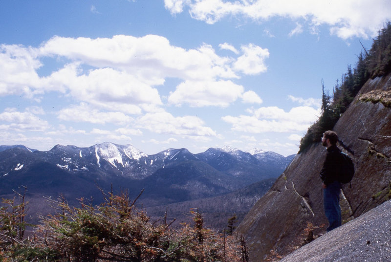
 This was my second mountain hike experience. We went in on the Ausable Club access road, which is fine
when you go in, but an awfully long walk out when your legs are tired, and there are cars driving by
all the time.
This was my second mountain hike experience. We went in on the Ausable Club access road, which is fine
when you go in, but an awfully long walk out when your legs are tired, and there are cars driving by
all the time.The original hike was supposed to reach Gothics (see Andrew's trip proposal email) but in the end we only did the Sawteeth. At any rate, we started uphill from the road, and got to this very nice lookout only to go all the way down to lake level again! To me this seemed an incredibly frivolous waste of muscle power and I would have balked if I'd paid any attention to Andrew's plans. As it was, I was just walking along not really knowing anything about the landscape.
Anyway, we walked a ways along the northwest shore of the lake, then began a steep switchback ascent to the summit. We went down on the direct trail back to the head of the lake. Pictures.
 What a way to get introduced to hiking in the Adirondacks! Springtime, so it's nice and muddy, and
a nice big mountain and of course start from the Keene Valley level so there's lots of elevation to overcome.
What a way to get introduced to hiking in the Adirondacks! Springtime, so it's nice and muddy, and
a nice big mountain and of course start from the Keene Valley level so there's lots of elevation to overcome.I got interested in hiking really fast when I was at Andrew's place one evening, and he was showing slides from his hike adventures. I saw a picture of some people leaning against a wooden railing looking out over a lake with sheer cliffs on the other side (the Hitch Up Mathildas at Avalanche Lake, as it turned out) and this stirred some deep memories of school trips in my native southern Germany many years earlier.
I was advised that you need boots for a hike like this, not sneakers. So I went to Mark's Work Wearhouse and bought some. Not waterproof, not stiff leather to protect against ankle sprains, not stiff soles, but they sure looked more serious than sneakers. As for the rest, I stuck with my cotton jacket and blue jeans. I did have the foresight to pack an extra set of clothes (and the sneakers too) in the car in case I got dirty. Which, if you've seen the trails in the Adirondacks in May, you can imagine that I did.
The hike was exciting, even if the weather was kind of gloomy. It went up and up, and my quadriceps were on fire, and it went up and up and I was pushing against my thighs with my hands as I was taking steps. And I had yet to experience that what makes you really sore ist the hike down. I was sore for several days afterward and not sure I'd want to do any more hikes this hard. But "Climber's Memory" took care of that, soon all I remembered was the thrill of standing on the summit, and the rest is history. Pictures. Andrew was a seasoned hiker by this time, but everybody has to start somewhere.
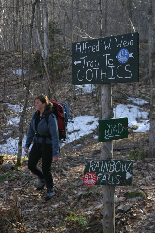
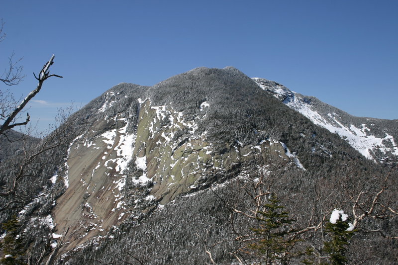
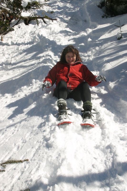
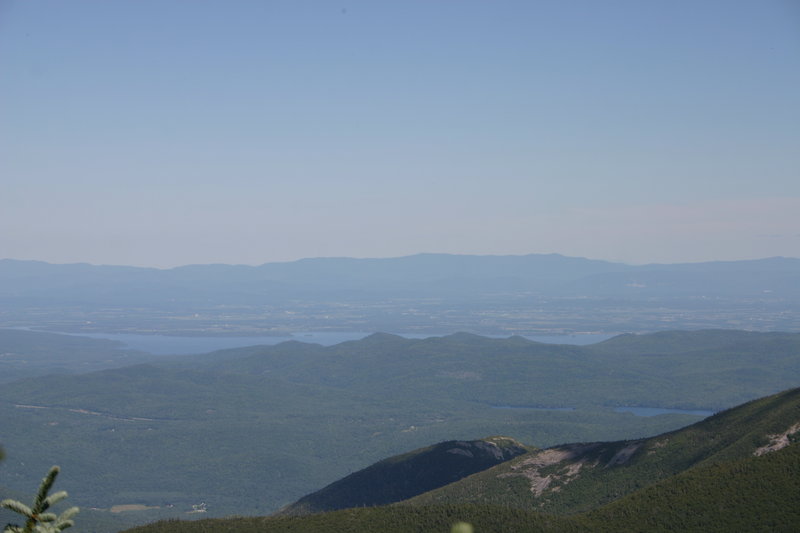
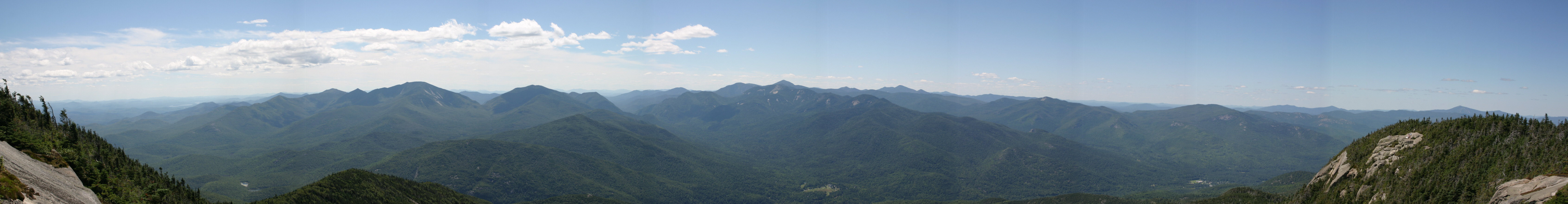
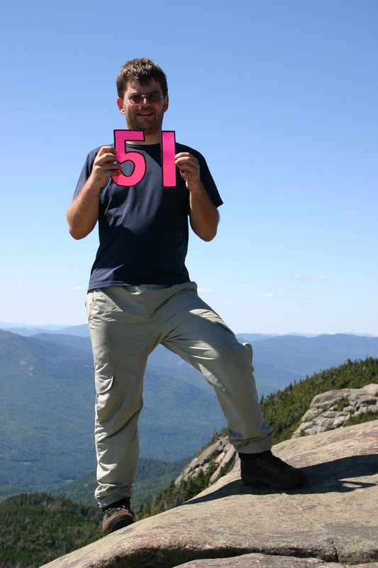
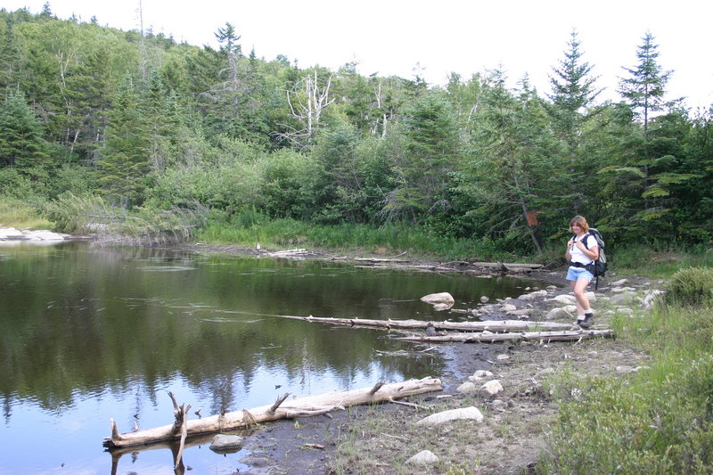
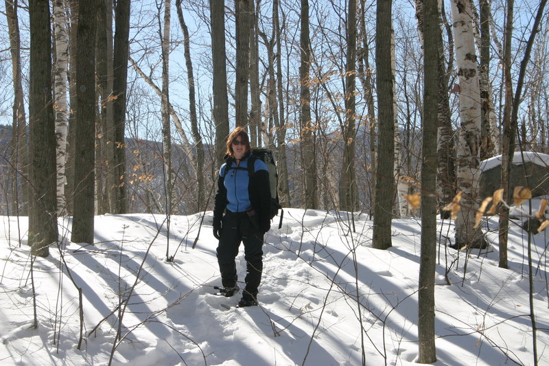
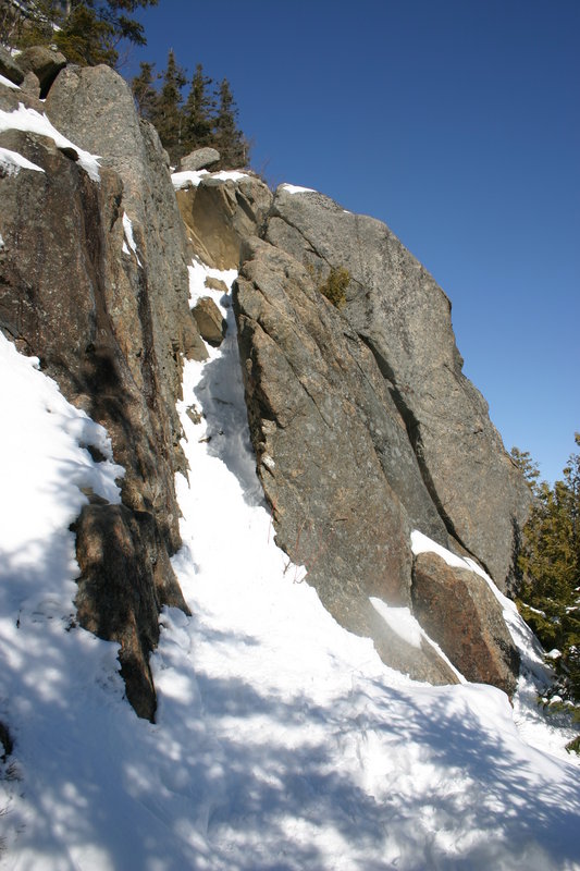
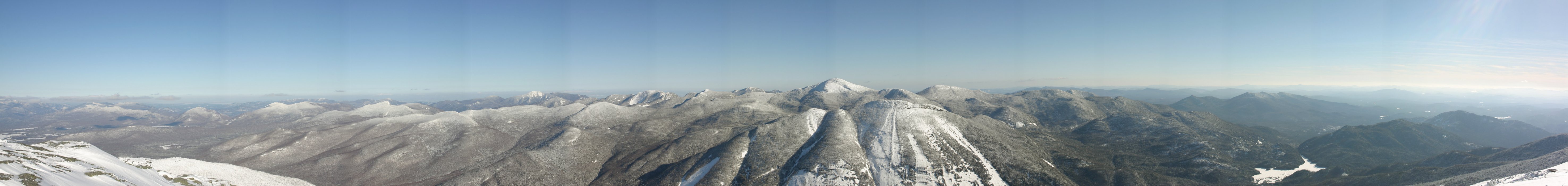
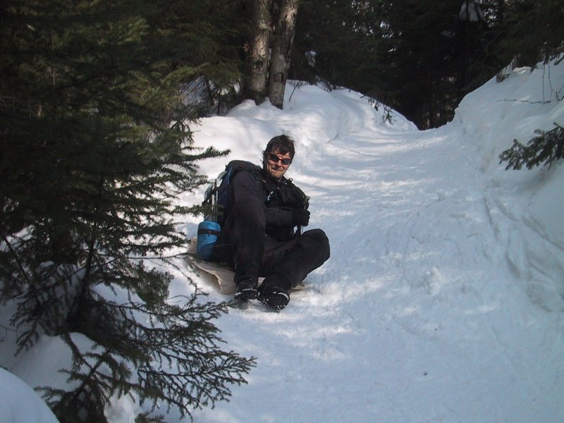
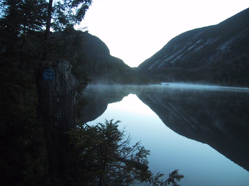
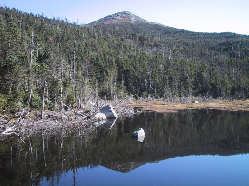
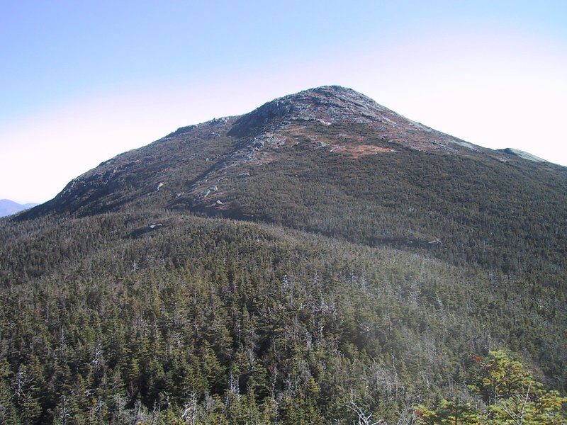
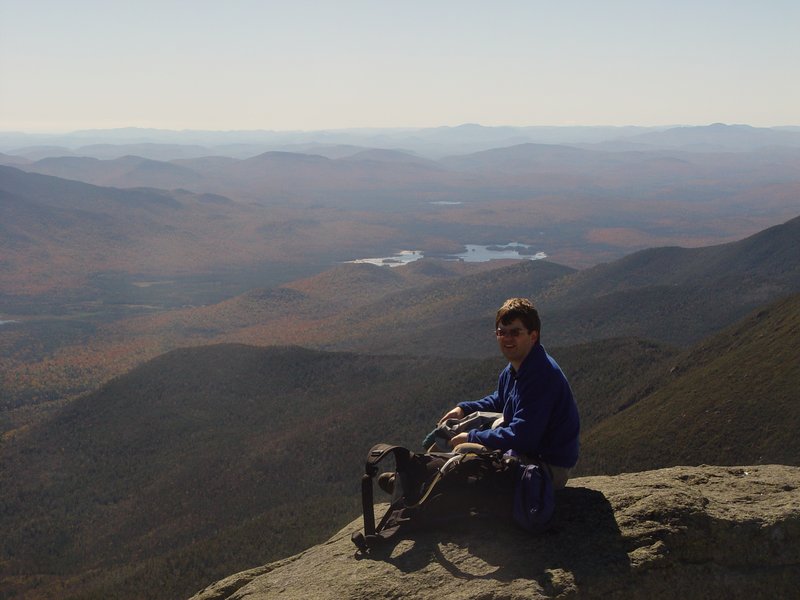
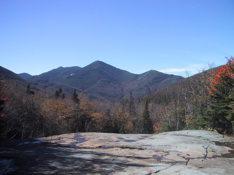
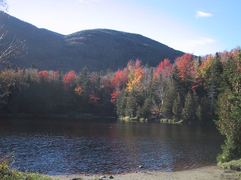
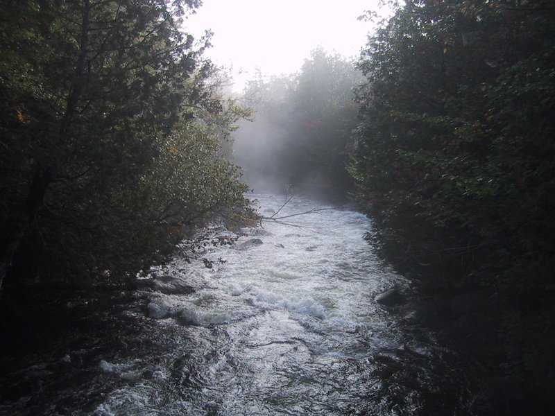
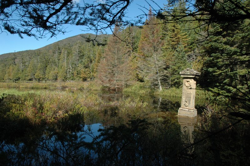
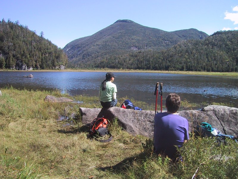
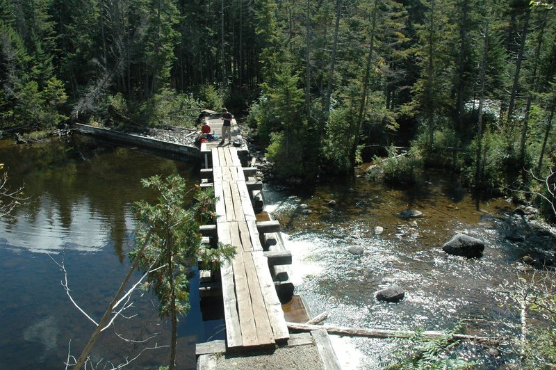
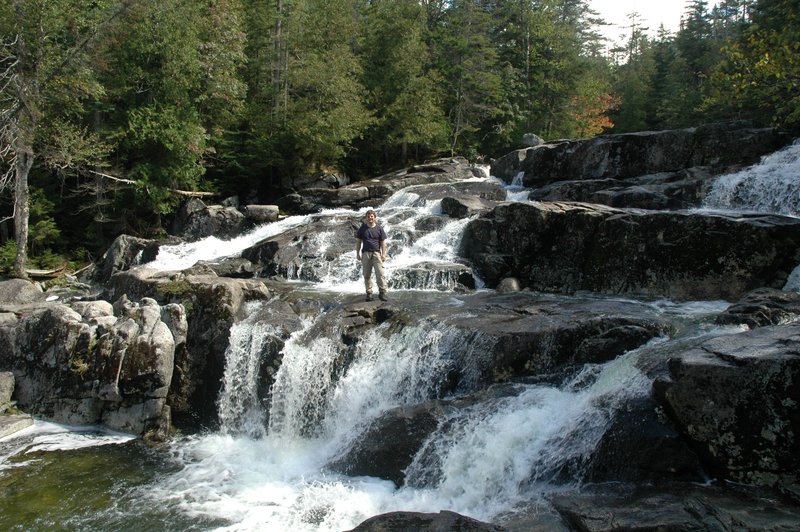
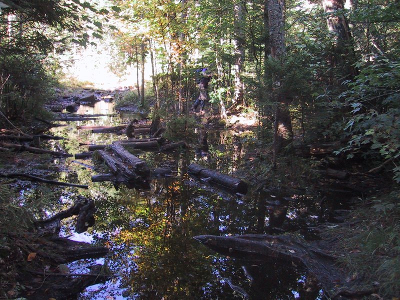
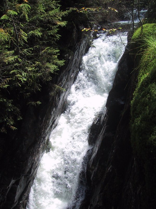
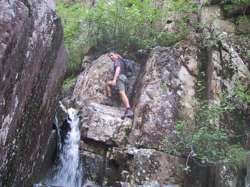
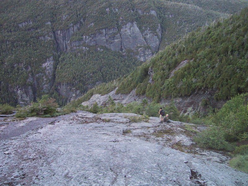
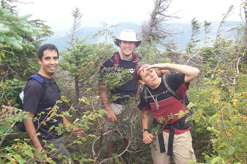
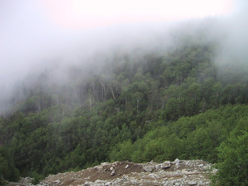
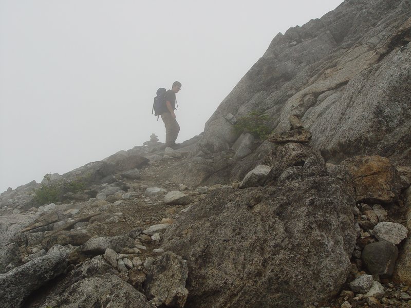
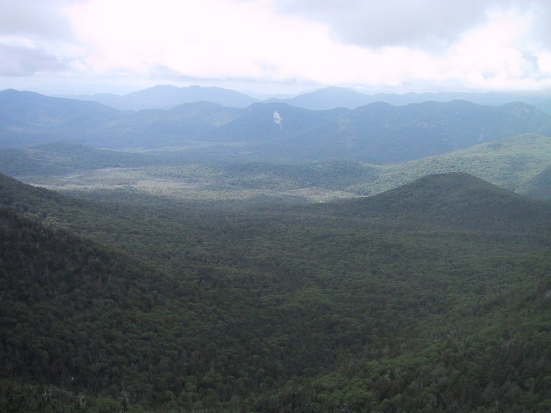
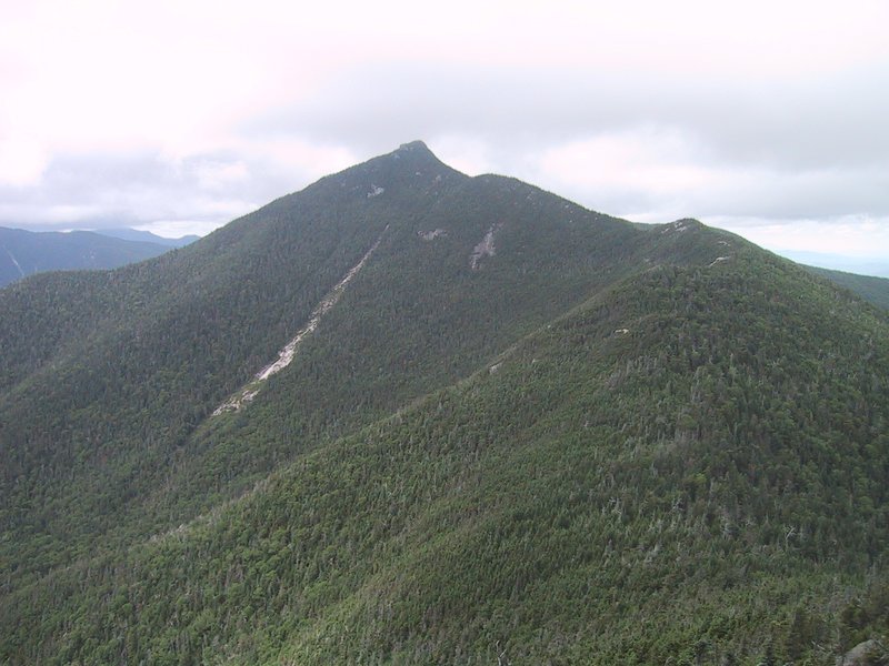
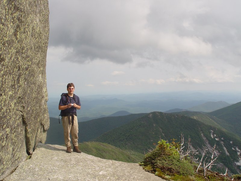
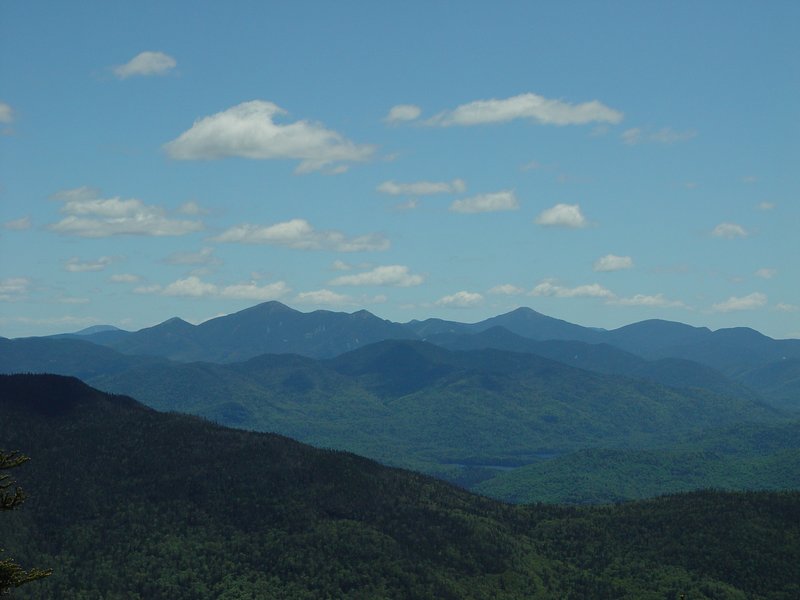
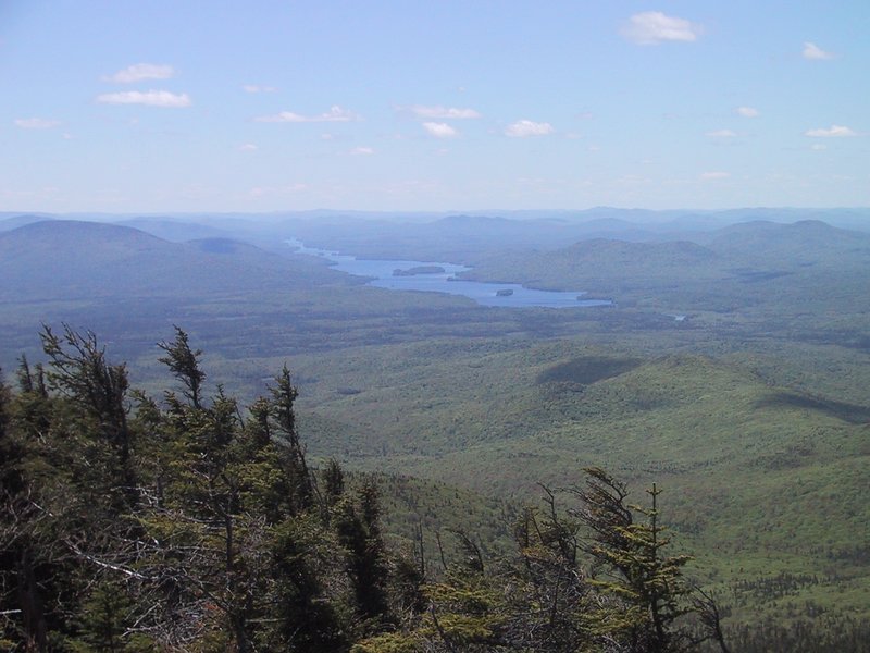
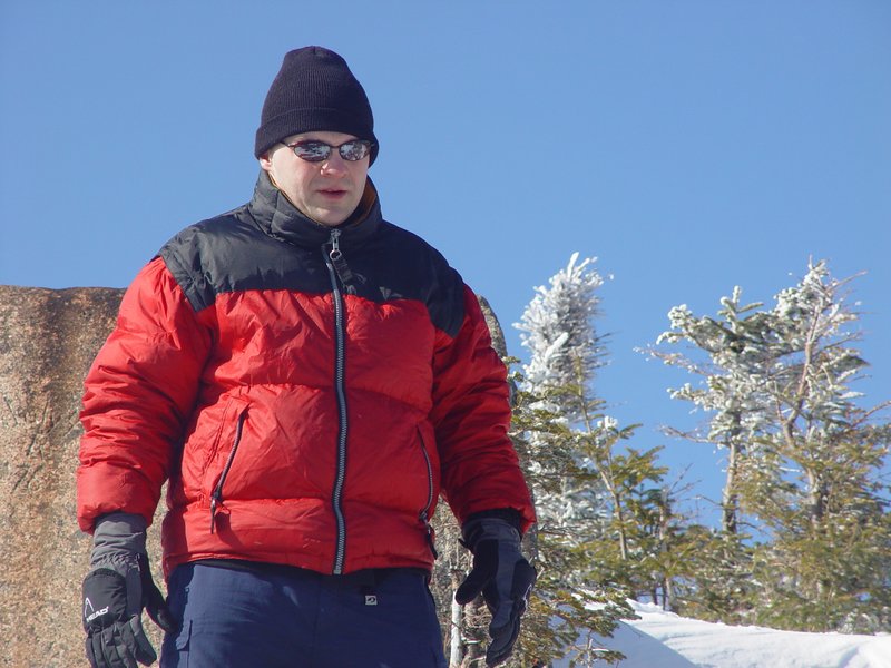
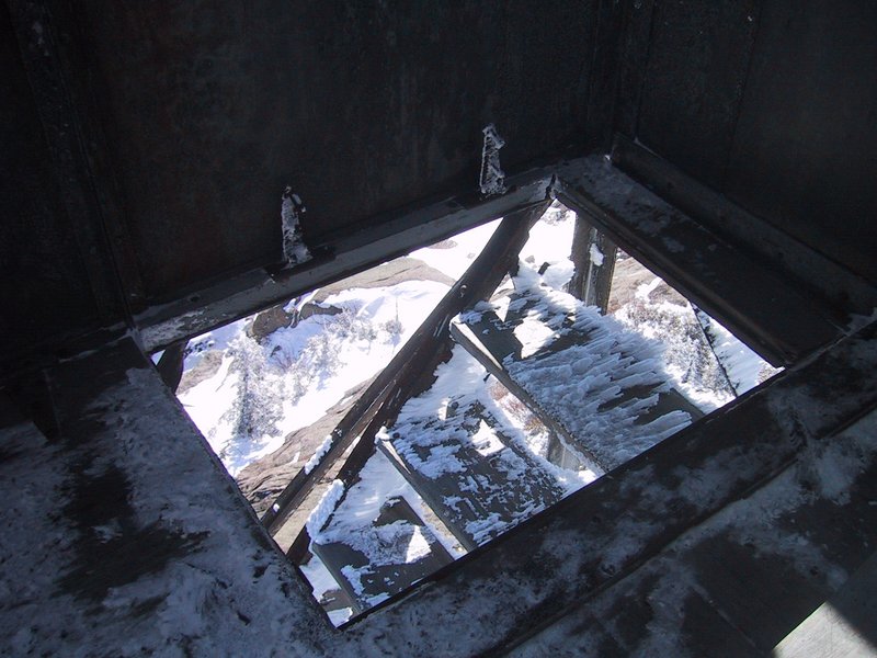
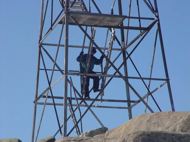
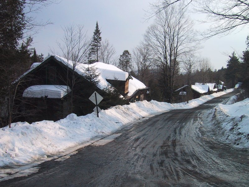
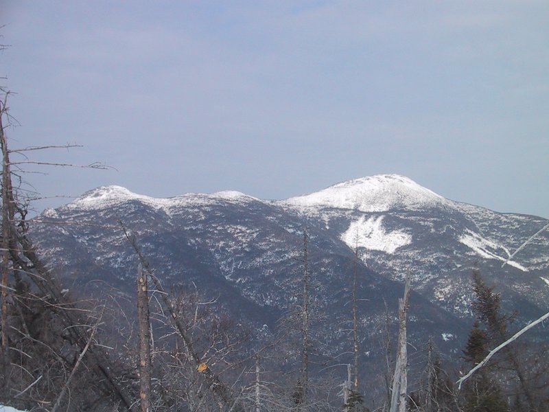
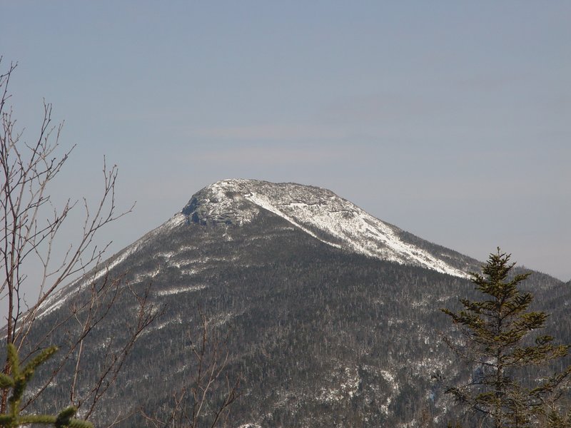
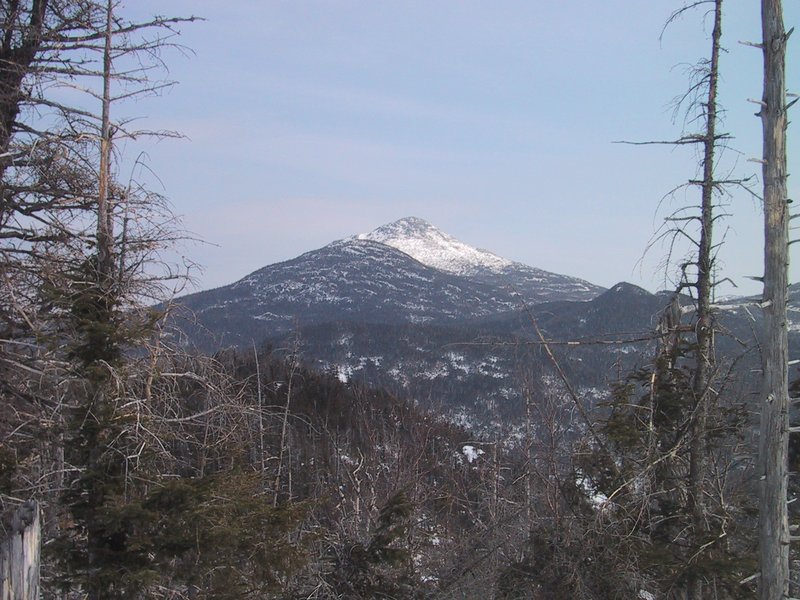
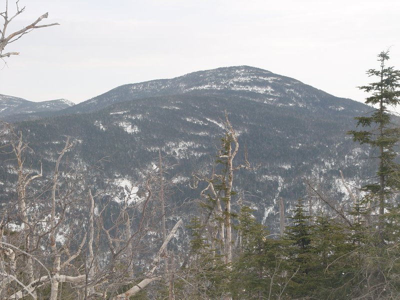
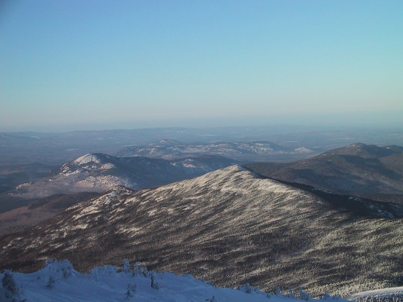
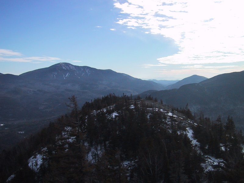
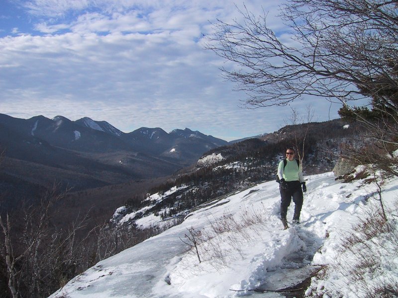
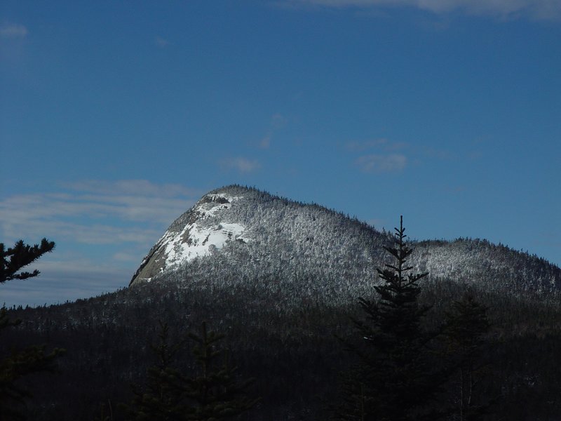
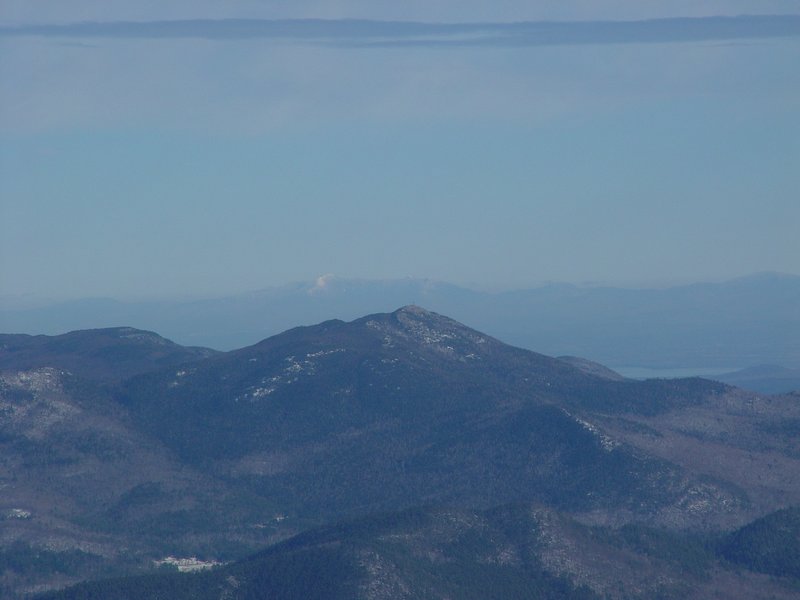
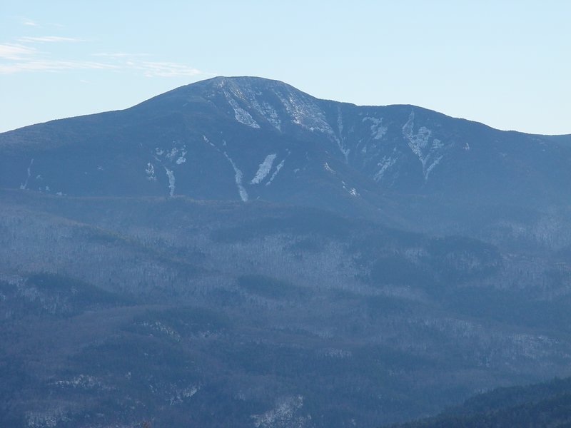
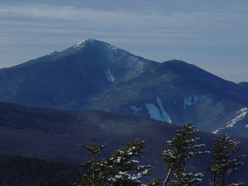
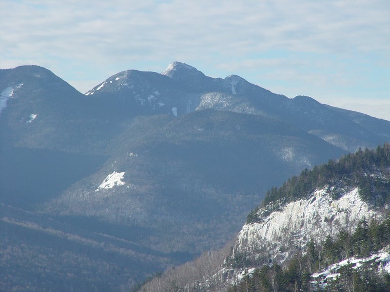
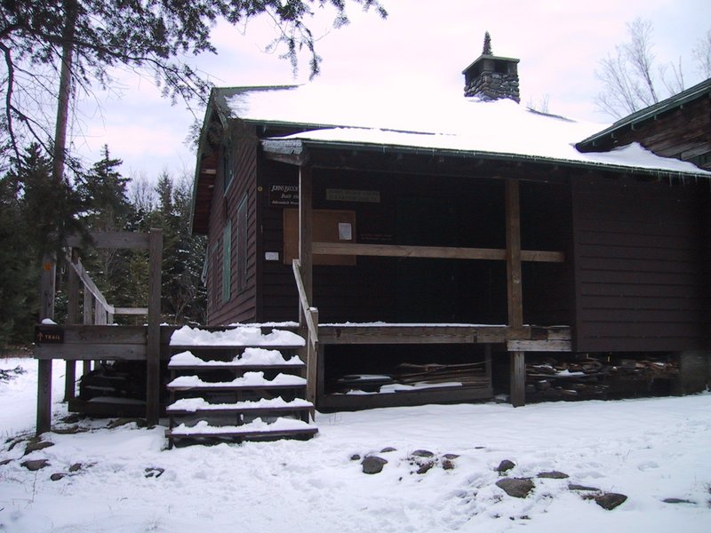
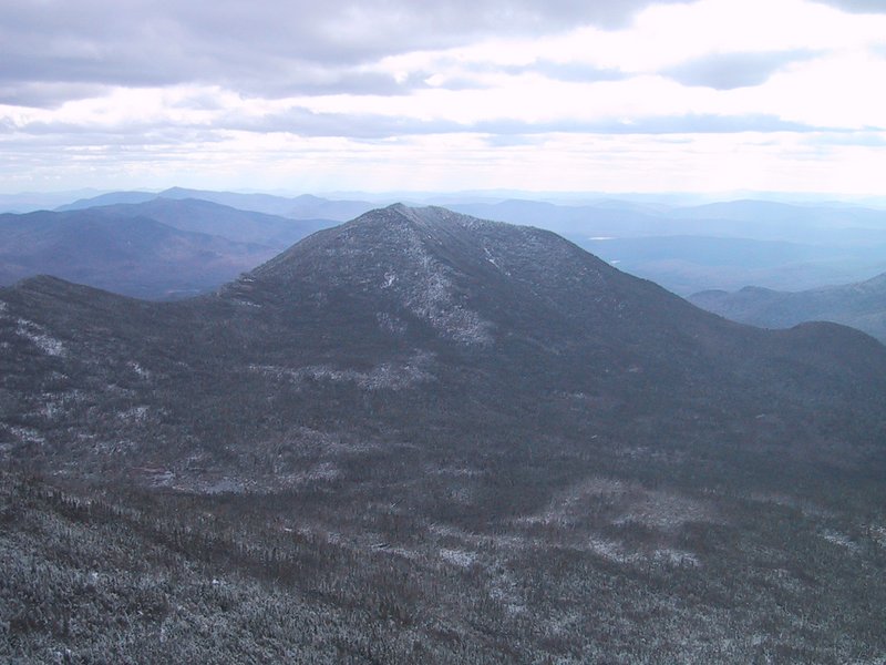
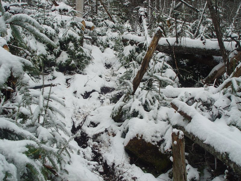
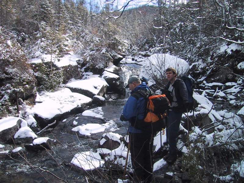
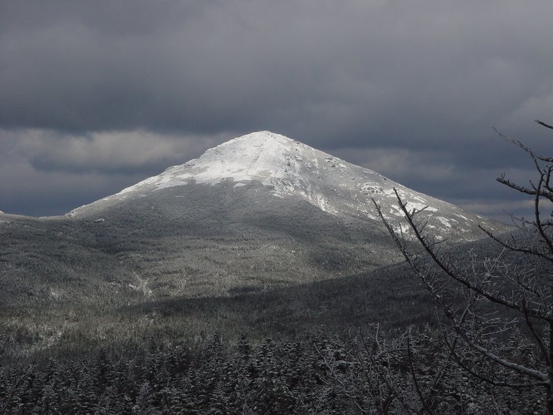
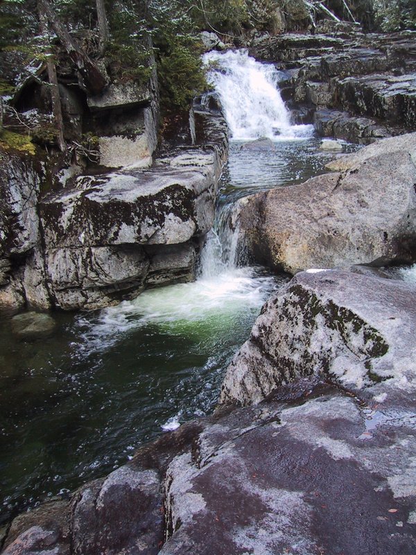
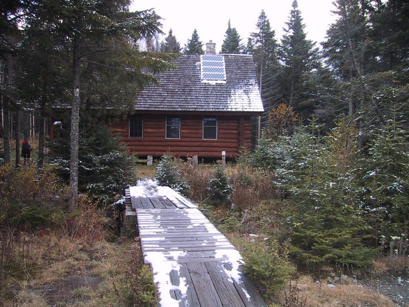
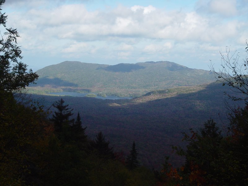
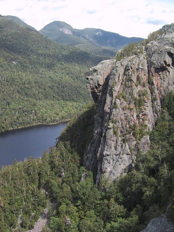
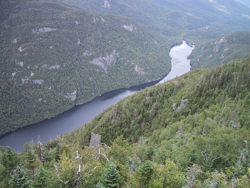
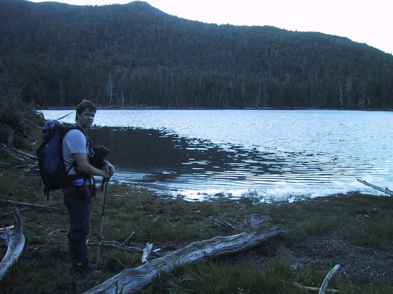
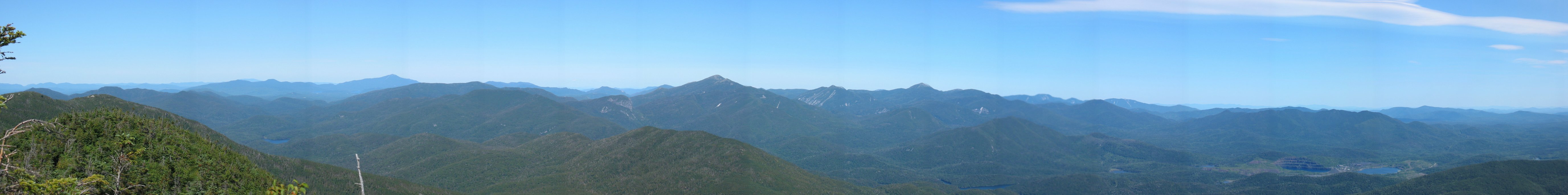
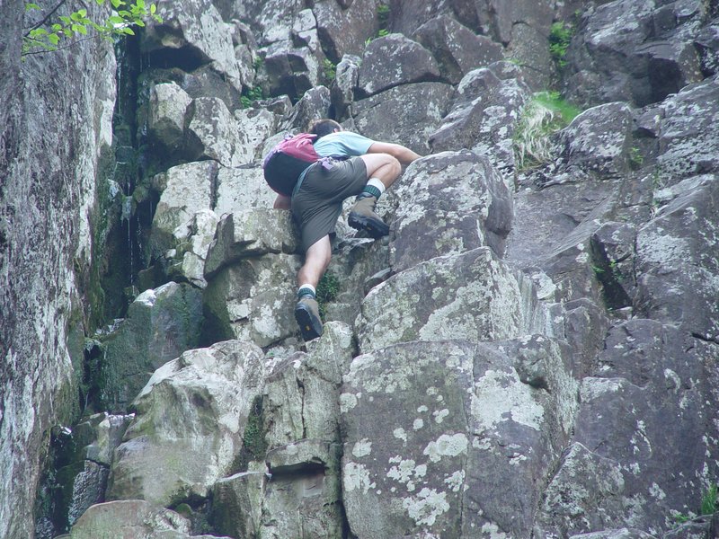
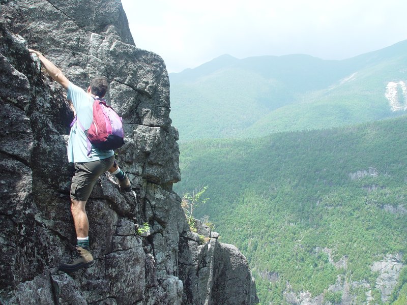
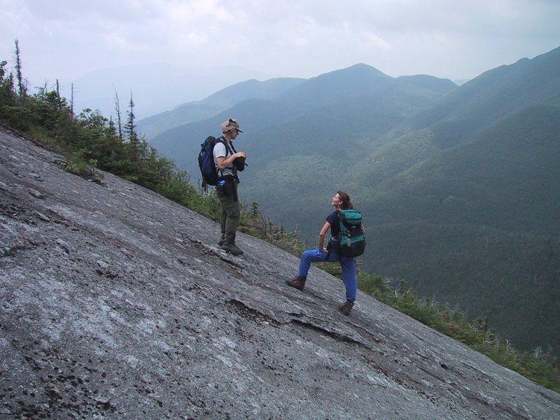
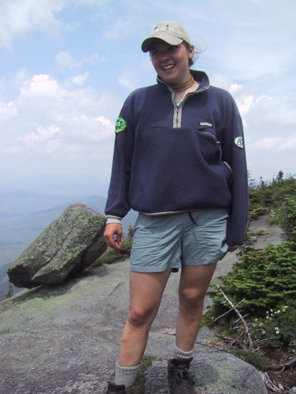
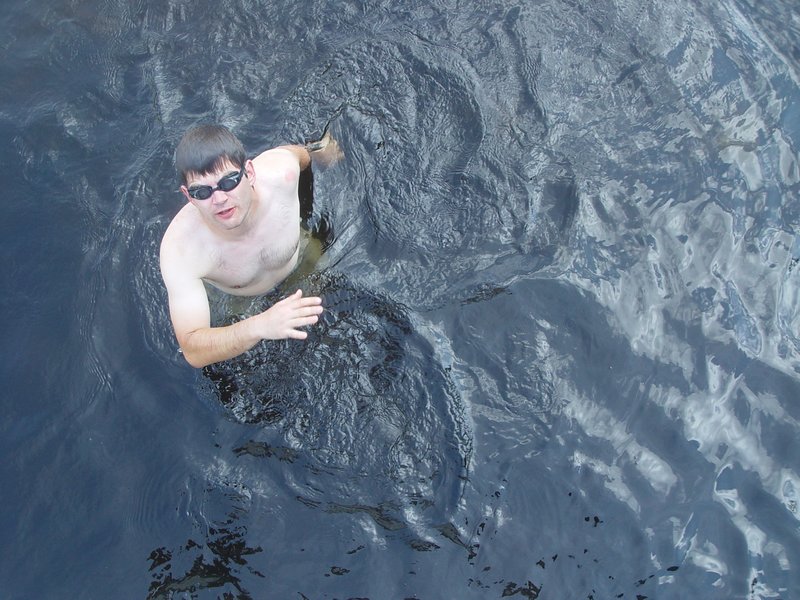
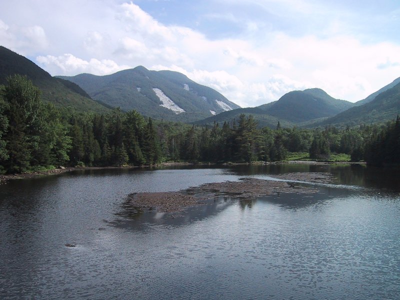
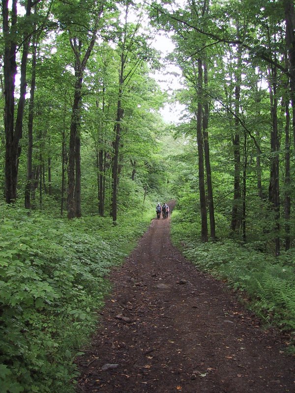
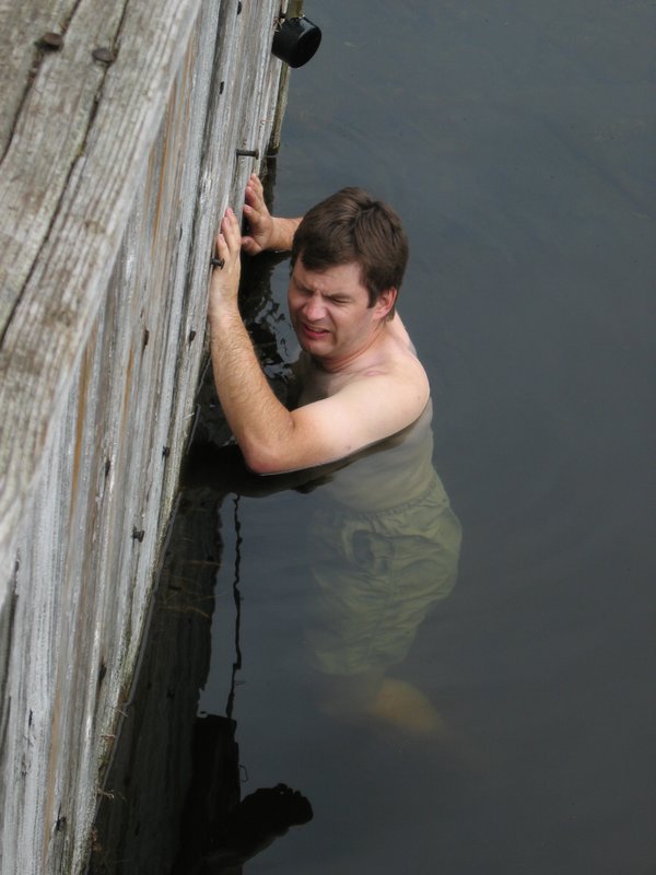
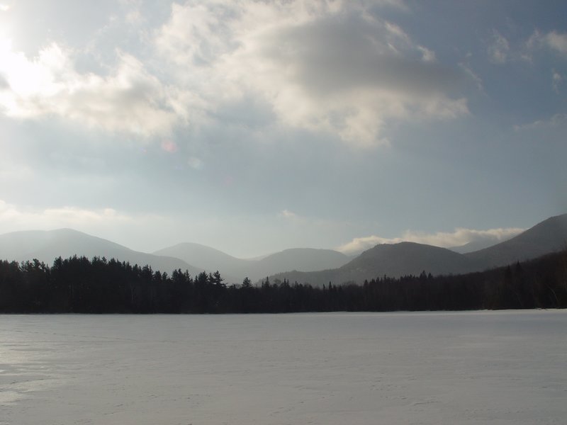
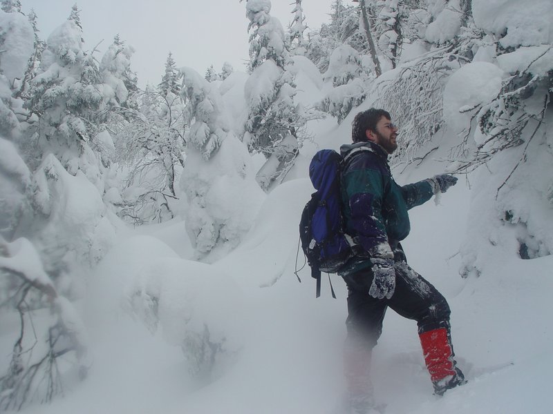
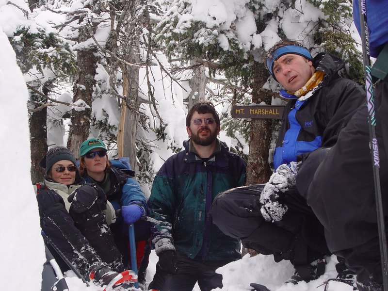
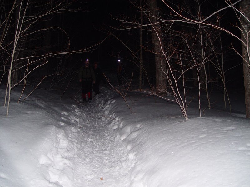
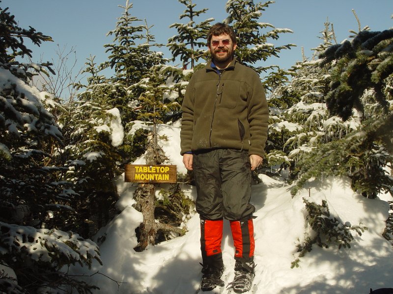
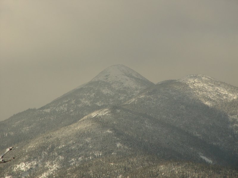
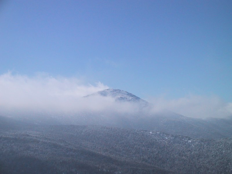
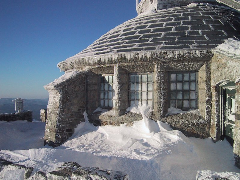
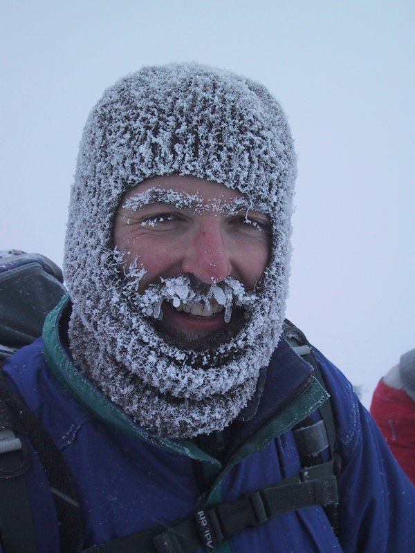
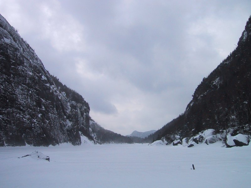
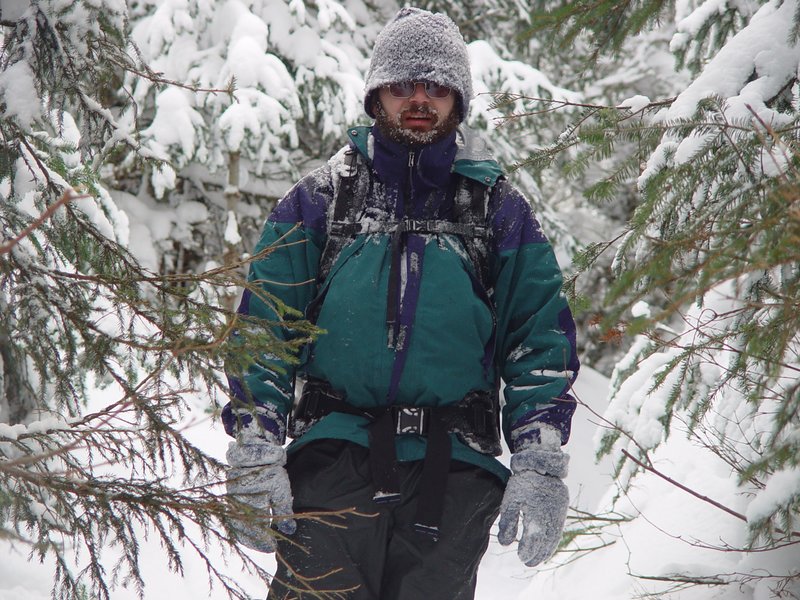
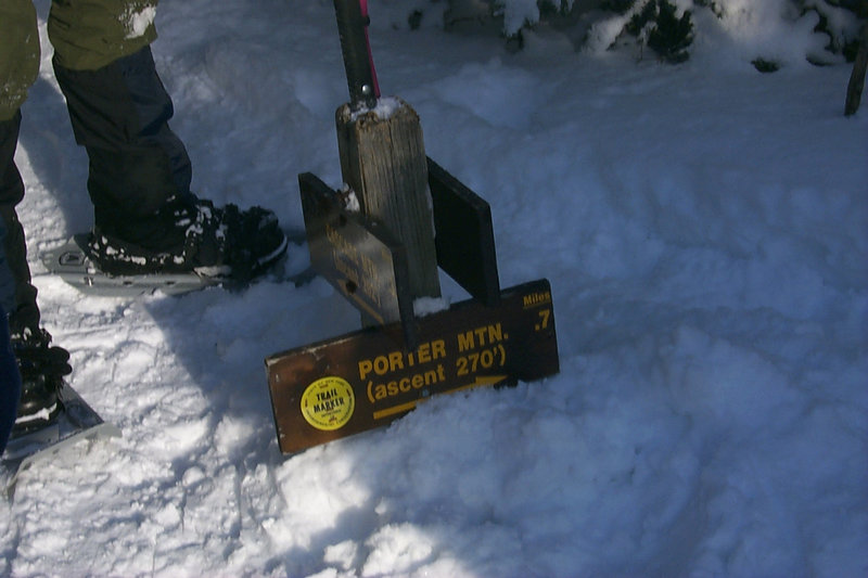
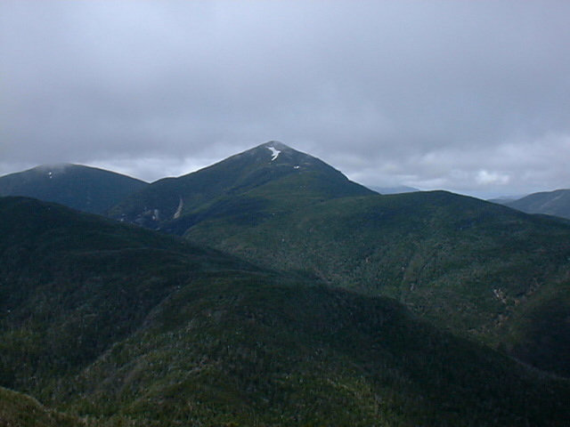
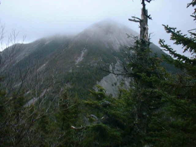
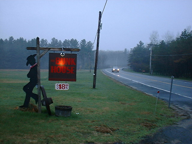
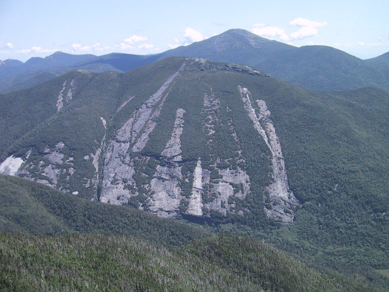